It seems this has become the place for trip reports. So hang in there as I speak of three days of paddling the St Johns River. Often paddlers find camp sites fewer and far between on the lower (northern) St Johns so as on this trip they base camp and/or drive from home. It is also better to hear about what you can do with the kayak than about the kayak. So I’m compelled to tell the story…
Kayak Trip Report
St Johns River
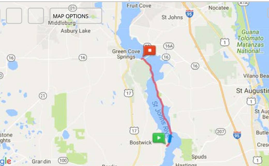
Satsuma to Green Cove Springs Florida
4-12-17 thru 4-14-17
This was originally a four day string of single day paddles by Florida Sea Kayak Association (FSKA) members Carl and Barbra. Carl is completing a segmented paddling of the entire length of the St Johns River, 310 miles. His travels started years ago with another group but injuries prevented him from finishing at that time. So here we were completing some more segments towards his goal. The fourth day was postponed after the weather and the weekend made going home a better idea. More on that later. We expected long distances and weather to be a factor and added the following to the advertisement for the paddle, “To keep the group together and within time limits boats of 14 ft. or longer of touring or sea kayak design are required” The reason for this will be apparent later.
Day One………16 miles……2.5 average mph, 5 hr., 44 min. (includes stopping time)…….
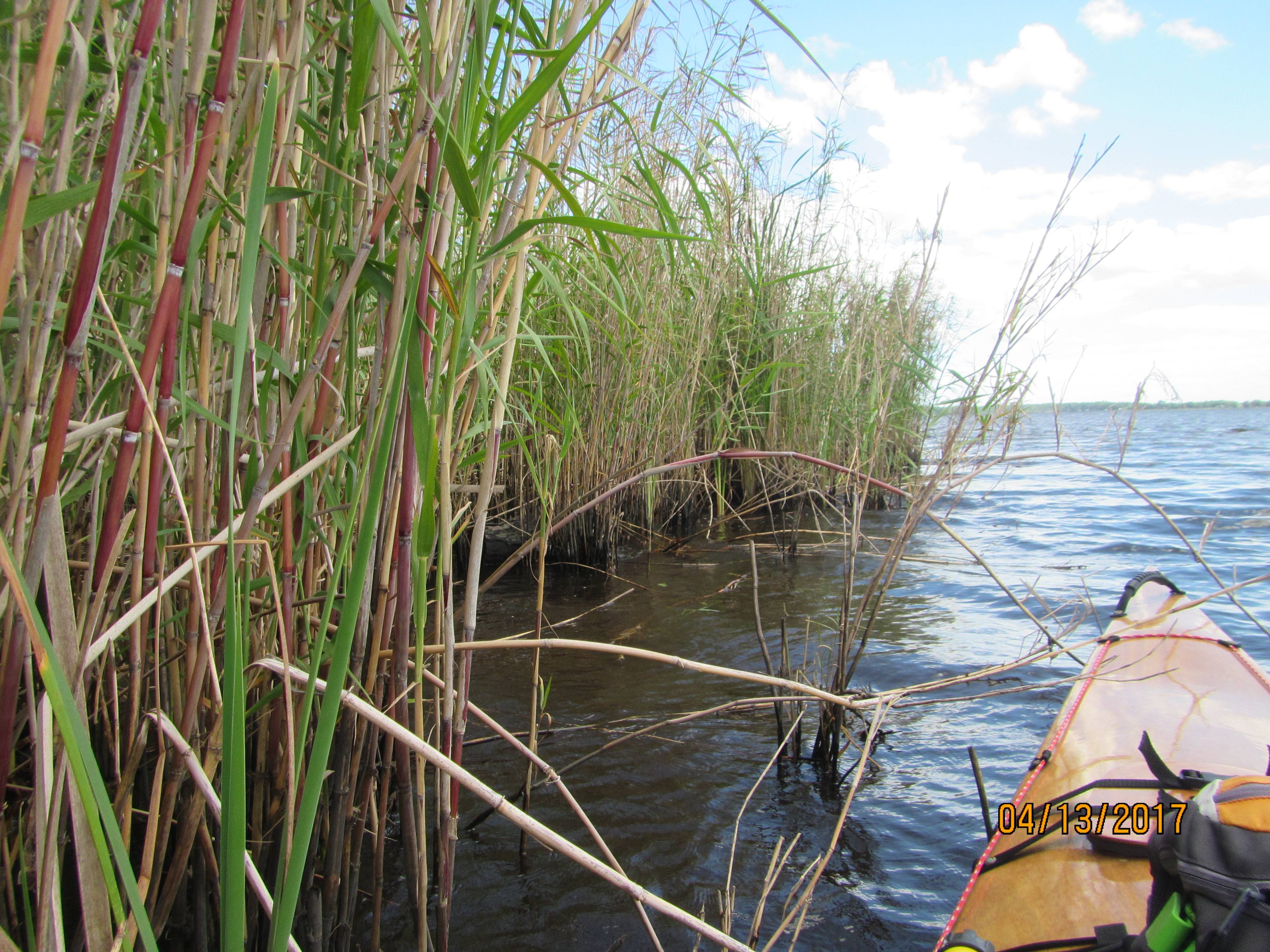
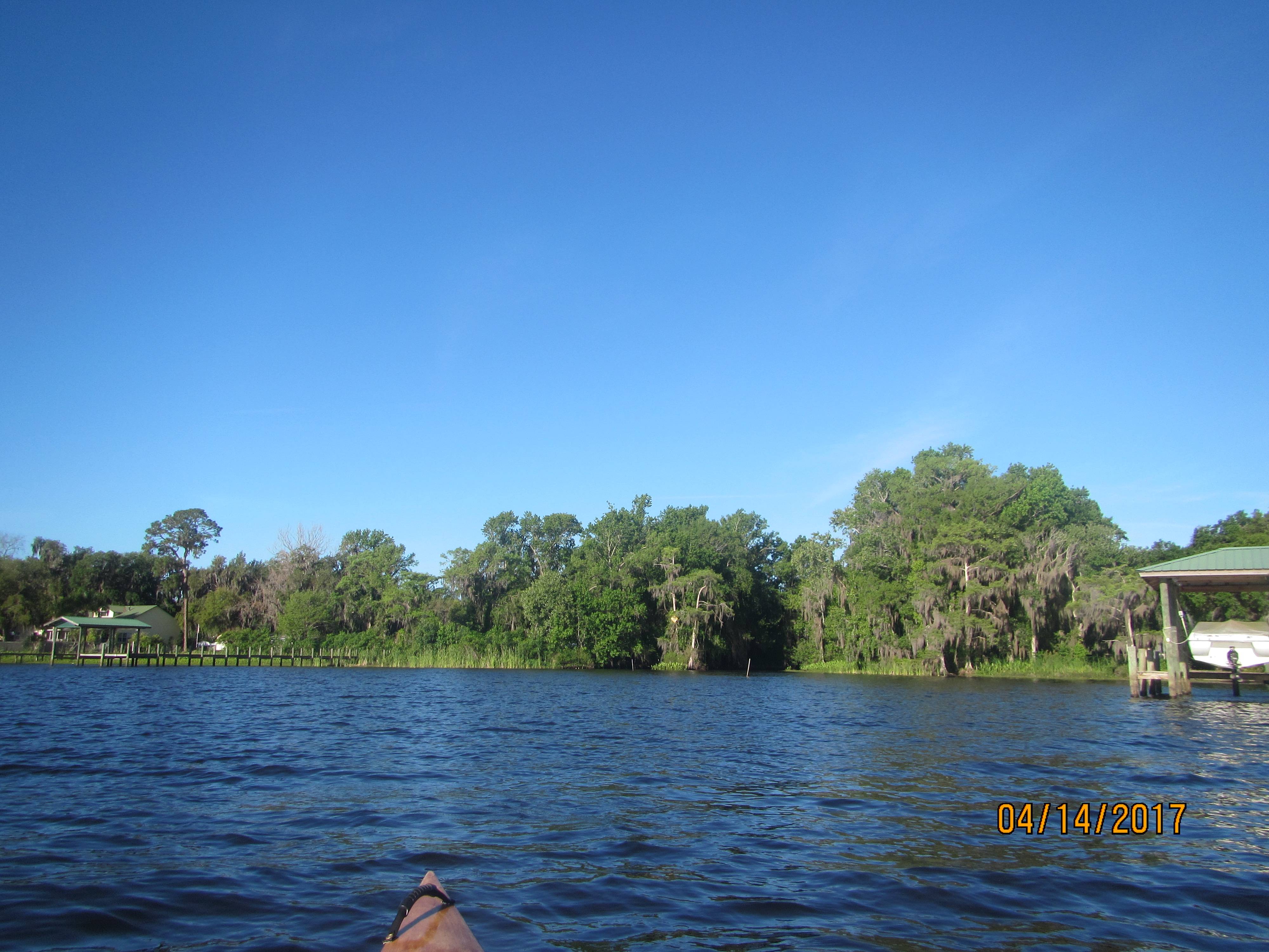
This was the first leg of our string. It started in Satsuma Florida at the Shell Harbor Boat Ramp on 111 Shell Harbor Way, Satsuma. On hwy 309 look for the boat ramp sign. Note “Old” Shell Harbor Road is a driveway. Your Garmin GPS might not pick up the correct information. Use the coordinates, 29.520065, -81.676606 From the paddle advertisement, The paddle is a 16 mile paddle to the Pico Boat Ramp (29.639959,-81.594225) near East Palatka. Along the way the paddle will pass Trout Island, Stokes Island, Seven Sisters Islands, Murphy Island, Polly Island, Rat Island and Buzzard Island. This area of the river was the narrowest of the segments we’d paddle on this trip.
We met at the ramp at 8am and quickly got boats unloaded for the shuttle. Carl and I took the cars to the take out and we left the truck and trailer for the shuttle back to the car at the put in. This set the pattern for the other two days paddles.
This was a club paddle rated as a level 3 for distance. It would later earn the rating for wind and wave, but this day the water and weather was perfect. The sky was clear with a few clouds. The water started out glassy smooth. The ramp was practically empty. Using boat ramps in the middle of the week is always a good thing.
We put in and paddled at an easy 3.5 mph average. The river at this point is about a ¼ mile or less in width. This would change the farther downstream we went. Downstream is north. The St Johns is one of those few rivers in the northern hemisphere that flow north. It starts down near Vero Beach, Florida at Blue Cypress Lake and flows north to Mayport Florida. It really starts somewhere in the swamp near Blue Cypress but the lake gets the credit for the headwaters.
The river here is lightly populated and there are a lot of wild parts. The trees appear to be on solid ground but closer inspection often shows some real low wet land at the forest edge. Landing is often not recommended. Although we only saw a couple of small gators the area looks like prime gator country.
Every once and a while there would be civilization that takes the form of houses or perhaps a ship yard. Near Satsuma is the CSX Retreat. It appears to be a corporate retreat motel with marina, tennis court in some of the really pristine parts of the river. It kind of makes you want to work for CSX until you recall that they are laying off thousands of middle managers.
Soon we started passing islands with names we tried to remember. Of course I left that map in the car. But many of them were well known since our club often does the Seven Sisters Islands paddle. We normally only visit 3 or 4 of the seven sisters. Sooner or later those other sisters will get mad at us, but not today. We easily cruised under the CSX Bridge north of the Sisters and took a break in the shadow of the bridge at a little sandy beach. It is good to get out and stretch the old joints. The normal bugs that would be present at such a landing were also missing. Life is good.
We paddled on and passed such notables as the SS Minnow now grounded on the side of the river shore and now used as a weekend “tiny house”. There was also a pontoon boat turned into on the most “rad” ski jump water slides I’ve ever seen on the river. We stopped at Murphy’s island for a lunch stop.
Murphy’s is an island managed by Putman County. It is part of the Putman Blueways trail. There is a system of signs and historical markers along the river and you can follow them, scan the sign with your phone using their app and learn about that spot. See http://putnambluewaysandtrails.org/page-1847609. There is a privy, picnic table, fire pit and camping on the island. A short distance from the picnic area is some machinery left over from the time the island was logged.
We paddled by Buzzard Island. Despite its name there weren’t any buzzards but it is a rookery for Anhingas, cormorants, and egrets. Many of the trees were covered with nests in the upper areas. The lower leaves were white on green. There were birds roosting above. It smelled like a chicken house.
We paddled on looking for the power transmission lines that would indicate our destination the Pico boat ramp was nearby. It came and we landed and shuttled back to the cars at the take out.
Day two………………….16.1 miles, 3.5 mph avg., 4 hr, 33 min…………
From the paddle advertisement. This is the second of four. It starts at the Pico boat ramp (29.639959,-81.594225) and goes to Palmetto Bluff Ramp (29.766140, -81.563635). Along the way the paddle will pass Palatka, the power plant on one side of the river and houses, woods, swamps, deep creek, farm land and wilderness on the other.
We were joined by John this morning at the put in. John stayed at the put in and unloaded his boat while Carl and I shuttled cars. This will be a factor in an error later. We got back to the put in and launched on time around 9am. The paddle was easy in very calm water. Picture perfect. We paddled on around Corkey Bells and turned toward the east coast of the river in the Palatka river tour area of the blueways maps. See Putman Blueways site, http://putnambluewaysandtrails.org/page-1847630
I made that “how big is your fish” motion with my hands to some fishermen. Usually the fisherman gives the palms up “I don’t know” salute to indicate no fish. But this day the fisherman jumped up and reached into the cooler and pulled out the largest channel cat I’ve seen in a long time. Then he pulled out a second one. Good fishing for those guys.
We continued along the east side of the river. We were looking for a friend’s house on the river. There was a rumor of a picnic basket of goodies on the dock for us. But we never found the house and it was likely for the best because the picnic basket was pure imagination.
The wind began to blow around lunch time and we moved to the Indian shore. There are some mysteries we may never know the answer to. The west shore is called the Indian shore on the Blueways Trails maps. Either way it was in the lee of some trees blocking the NE wind.
Some time ago the paper mill on Rice creek (aka Etonia Creek) got a permit to run a pipe outflow out into the river and discharge their treated water directly into the river. When we often mention kayaking past this area some activist would ask if we saw any difference in the water. The river at this point is 1.25 miles across. The wind was blowing. The water was rippled. No we didn’t see any difference.
Well at this point I find it important to note that the four of us have a lot of experience. We had three Garmin GPS units this day on the paddle. I had a phone app running tracking our route. John had his map out. Carl completed the CT, Circumnavigation Trail around Florida, Barbra has completed 90% of the CT. John is a WaterTribe member. I’ve been paddling since before I shaved regular. Well we should have known better. You remember John and Barbra stayed with the boats at the put in during the shuttle. Carl and I looked for landmarks at the Palmetto Bluff boat ramp during the shuttle. Then John, the fastest paddler, was point man during our approach to the take out. He knew that the boat ramp was in a small canal where you can see the small concrete road bridge across the canal. Well everybody thought the other had the GPS on. So of course none of us did. John saw the canal and bridge but didn’t see any of the boat ramp parking lot, ramp, finger piers, etc. and went on. In the end we paddled three miles extra. We pulled over to the side and while I was turning on the GPS one of the guys talked to a home owner working on his dock. In short they knew we missed the mark because there was “just a small sign”. So Matt and Mike got in their truck and drove our driver to the boat ramp so he could get the truck and trailer. Even experienced kayakers make dumb mistakes.
The next day we would start from Palmetto Bluff ramp and take a look at that sign.
Day three…………………17 miles, 3.9 mph avg, 4 hrs, 23 min………
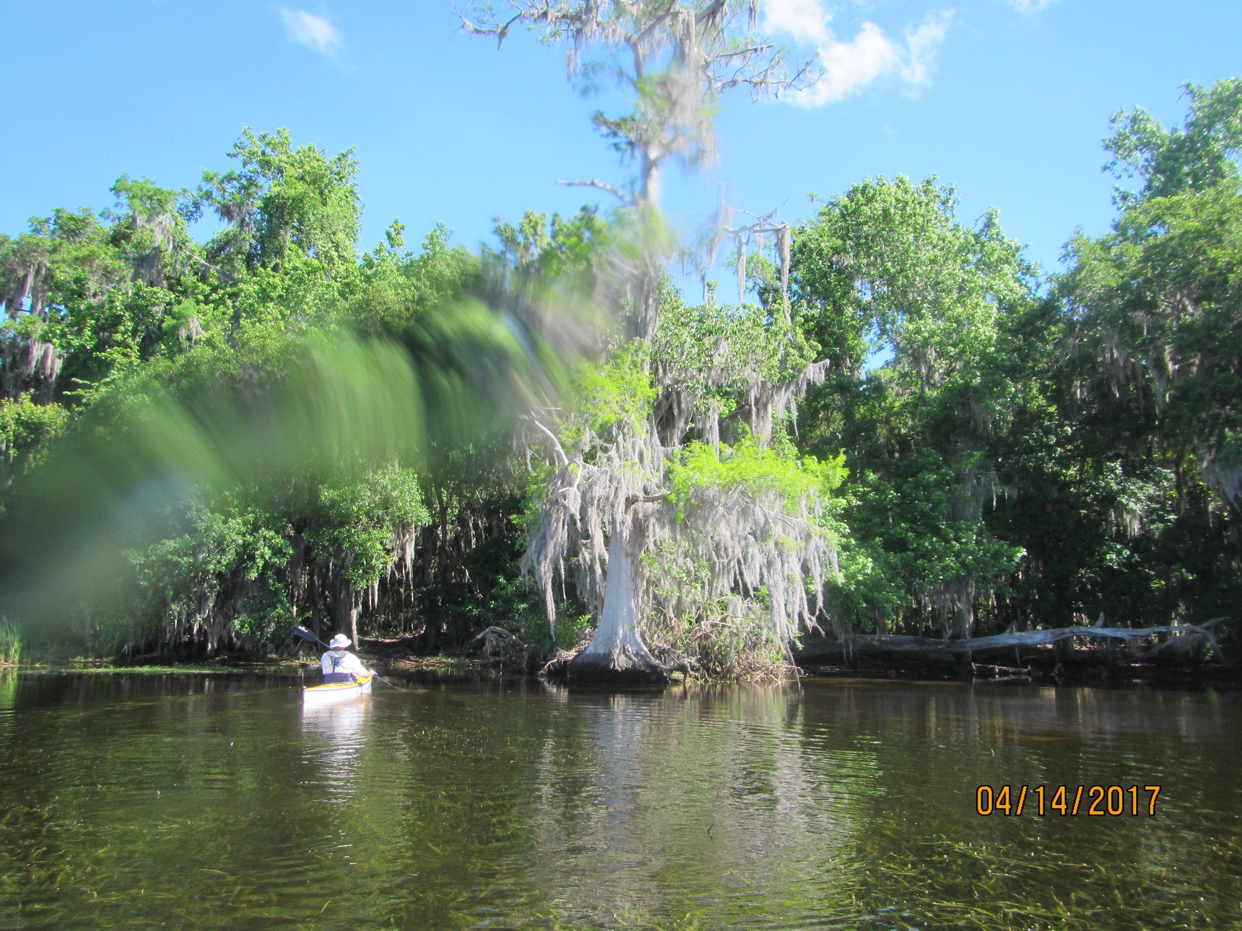
This is the Third of four. It starts at the Palmetto Bluff Ramp (29.766140, -81.563635) to the Old Shands Bridge Boat Launch/Ramp (29.980199, -81.634955). Along the way the paddle will pass lots of trees, farm land, Bay Yard Conservation Area, and the Watson Island State Forest. It also passes West and East Tocoi. There must be a story there for another time. The river is 2 miles wide at the Tocois…it’s getting bigger.
The wind the day before was strong and built up some bothersome waves that often hit on the quarter causing a lot of “round up” motion on the boats. Rudders help that condition but not everything. So we made the decision the day before to meet at Palmetto Bluff ramp at 7 am earlier than the other days. Now Palmetto Bluff boat ramp is accessed from Bostwick. You turn onto Palmetto Bluff road across from the Dollar Store in downtown Bostwick, It is small town very rural America. The ramp is four miles down the road. Go to the Tee, turn left and look for the boat ramp sign. It is on “Boat Ramp Road”.
We launched from the ramp a little after 8am. The wind was calm. We took a look at the canal sign. It was an upside down highway “dead end” sign hung on a little clump of cypress trees in the center of the channel blocking the channel. Very good camouflage. If you go turn on the GPS and load the coordinates for trips from the water.
As usual paddling was easy for the first few miles. We chatted with some home owners working on their docks and some fishermen. People are friendly on the river. Forecasted winds were from the ENE to NE for the day. Varying speeds were forecasted and it depended upon which forecast you wanted to believe how strong the wind would be. In any event we crossed the river to the east side to go up the SR- 13 side of the river. In many places the road on the east side passes real close to the river. There is a boat ramp at Riverdale and later at Trout Creek. But these were not on the schedule for today. Our travel was point to point working for Salano point. This is just north of Tocoi (East Tocoi) the shore line is mostly trees and mud along this part of the east shore. At the north end of Salano cove we stopped at Ferreira point. We put in at a cypress tree that looked like a small beach between the tree and some cat tails. The ground under the shallow water was firm enough to stand on. The shoreline was silty muck too soft to walk on. So we stood in the shallows and had lunch. After sitting a few hours even a wet feet stretch is comfortable. Ferreira Point is at the edge of the Watson Island State Forest. The state forest is 276 acres of woods. It looks mostly like mud. See web site, http://www.freshfromflorida.com/Divisions-Offices/Florida-Forest-Service/Our-Forests/State-Forests/Watson-Island-State-Forest
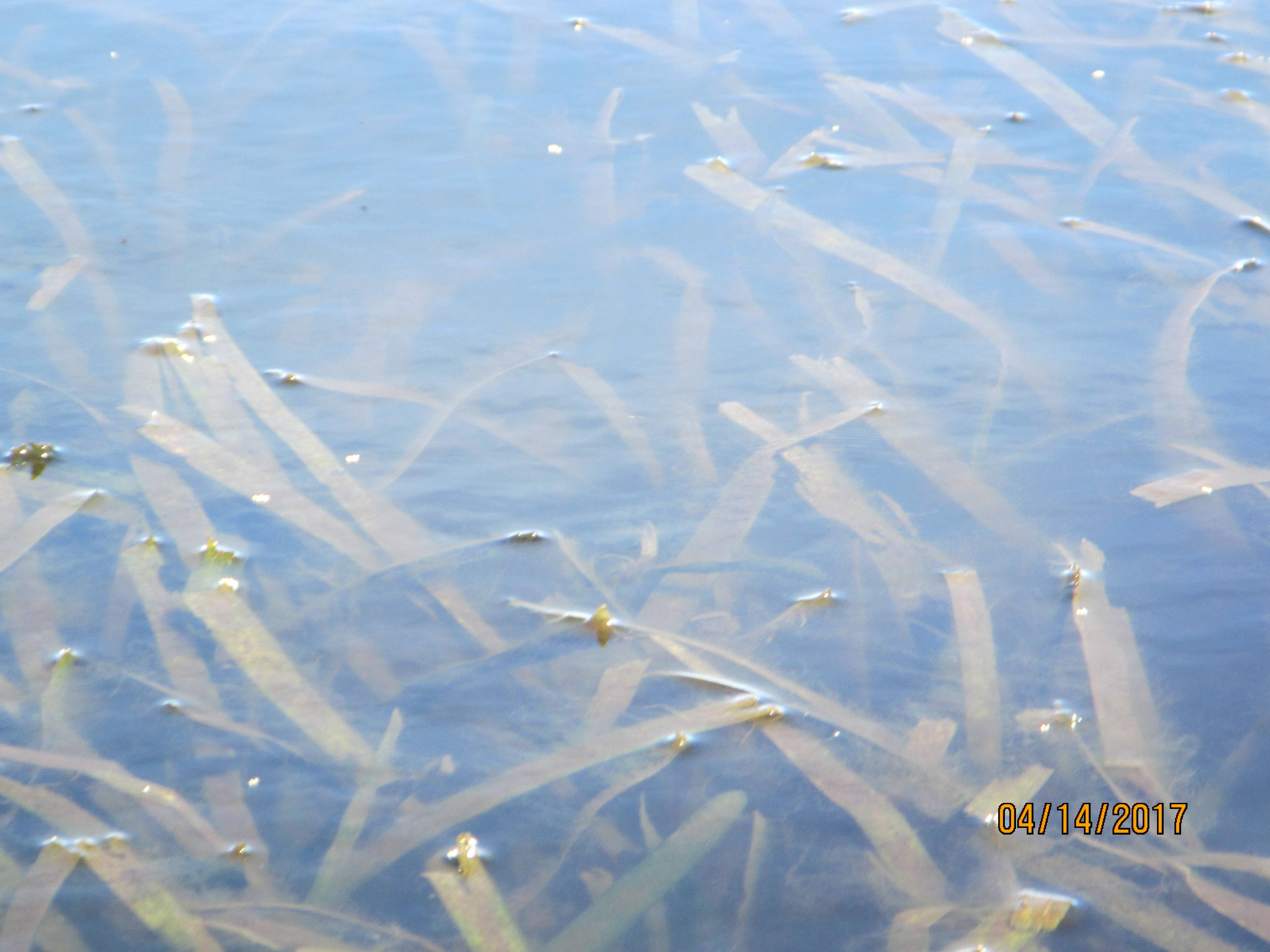
We saw egrets and blue herons working the shallows around the cattails. A few years ago when the Tocoi Fish camp was operating they caught an 800# gator off the boat ramp. We didn’t see any gators but it looked like they should be there. As we ate lunch we started playing with the minnows at our feet. Carl threw a piece of sausage to them and they tore it apart. I tossed a piece of McDonald’s biscuit to them and they ignored it. Maybe we shouldn’t eat those things……or they were worried about the crab below it trying to catch them.
So we paddled on. At the south edge of Colee Cove we turned back to the west side. It will/was rough on the lee shore, but the river goes east there into Colee Cove and the east shore was farther away from our destination. The river now is about to be 2 miles wide. The wind was NE to ENE. Plenty of fetch for waves to build and they did. There were scattered white caps that further reinforced our no boat under 14 ft. policy. As it turned out my 17 ft. boat was one of the short ones. We got to the other side and reformed up. A short water break is a good thing. In the shallows, 6”, the waves were reduced and you could relax. We just leap frogged up the coast by the Bayard Conservation Area, see web site, http://www.sjrwmd.com/recreationguide/maps/Bayard_Conservation_Area.pdf
http://www.sjrwmd.com/recreationguide/bayard/index.html
On one rest stop John pulled up and two deer were taking a drink. When they saw John they beat feet back to the woods. That paddle between rest stops was interesting. The waves were often beam waves that caused us to ride in the troughs, up over the crests, and down into the next trough. It required that you be real familiar with your kayak and its characteristics. Once or twice waves broke on my back deck. Interesting paddling. We landed at the old Shands Pier boat ramp. There on the shore was a police officer, kayaker, there to meet us. He stayed and helped us land the boats. Amazingly he knew Gus, another FSKA member. It is a small world. It was a 17 mile paddle in wind and wave. A good day to be sure.
Remember that Palmetto Bluff ramp? Little boat ramp in a residential area in the country. Well when we returned one of the car’s tailgate was open. All of the things inside were just that, still inside. Apparently we left it open and nobody touched anything. Good country people.
It was a good paddle.
DP
AS typical the white cap areas didn’t show up well in the shots requiring hands on the camera, hands on the paddle, at the same time. Hands free pictures is Qurisers specialty.
You paddled some of my old stomping grounds. I lived in Welaka 6 years in the late 70s and early 80s. Paddled the St Johns, Little Lake George and the Oklawaha. Paddled over a hugh gator in crystal clear water on Mud springs run on 2 different occasions. While at UF one of my friends that worked with the fisheries prof. who was responsible for doing the sampling on Rice Creek monitoring the paper mill effluents effects on the bottom critters. I helped him take samples a few times. Thanks for the photos they have me reminiscing.
Cool. Haven’t been on that section of the St. Johns, as my family is mostly around Jax and usually find myself in the waters around there when visiting FL(although I have done a little surf kayaking off St. Augustine.) Appreciate both the detail and pics.