Sure a map can blow away. And a GPS can fall overboard. Both are the result of being careless and unprepared, resulting in the uselessness of each. There are methods for preventing both disasters from happening (a GPS lanyard and a transparent map case/w lanyard too if necessary). I think what most above are saying is the GPS is a very handy and useful tool, but is only an adjunct to good and practiced map and compass navigation skill as the primary base method.
GPS can be a true life saver in deep fog, it is far more unnerving to be within pea soup fog than you expect until the first time. Of course, as the fog comes in you take a heading to know where you are headed before it robs all visibility. But the two times I have pulled out my GPS for confirmation have been in deep fog.
BUT - I have been out with people who really cannot use a chart, because they have not gained the habit of orienting yourself that can only come from using a map or a chart, and that is also dangerous.
I love my GPS and find it much easier to work with, ergonomically, than a map and compass especially in weather. Having said that, if you’re survival depends on knowing where you are, I’d definitely carry a chart as well. If camping, I’ll bring extra batteries but I’ve also had GPS problems due to condensation forming inside the screen such that whatever the GPS was trying to tell me, it could not be read. This has happened with 2 different units by two different manufacturers with “waterproof” GPSs. During one instance, I was navigating back to a ramp in the dark and had to rely mostly on memory and intuition to find my way back. After a couple hours in the dark, I was beginning to think I would have to impromptu camp on a random beach and wait until light, but eventually I did get back to where I needed to be. I didn’t have a chart but in that situation, I’m not sure it would have helped due to the lack (or at least paucity - I don’t recall) of visible landmarks… So I think a GPS, at least a working one, also has an advantage for night navigation (as it does in fog), unless there are visible and unique light signals you can fix on. I also often use my GPS to check speed when trying different paddling styles, or in comparing boats. BTW, never dropped my GPS overboard but I bought a unit that floats and marked it with high vis and reflective tape.
Sure a map can blow away. And a GPS can fall overboard. Both are the result of being careless and unprepared, resulting in the uselessness of each. <<
My example in the desert shows that both can fail. The Lt ignored his compass back at base as useless. He lost the map. The GPS fried… three things that almost killed us. Had even one of these problem NOT happened, we would have been fine.
I bring a water-proof paper map in a dry-case lanyarded to the kayak. I have a smaller laminated map inside my drybag. I give an extra map in drycase to a paddle buddy. I carry a waterproof GPS lanyarded to the kayak and I carry extra batteries. I also mark waypoints on the paper map and mark them in the GPS.
BYW, the new Garmins cannot have manual entries. They can either mark where you are or download a point from a computer which makes them useless for this discussion.
Also, people think that I am paranoid but when the group abandoned Maria because she was having medical problems that they perceived as ‘lazy’, I was there to keep her alive and find our way down an unfamiliar river to an unknown take-out days later. I was paranoid enough to carry extra and different maps and a GPS but my greatest tool was my brain!
I had to look at the map to try to decide how many miles we must paddle to a possible campsite that was marked on the map but may or may not exist. I had to combine this with Maria’s ability and adjust paddle-days accordingly.
I also had to figure out where the take-out was (I had never seen it from the water and forgot to waypoint it when I parked my car) and do so by logic and map.
I carry both but everything is useless if you are too stupid to know how to use them.
I recommend that everyone take a good orientating/mapping/GPS course and renew it yearly. ANd practice NOT using them occasionally.
Maps can be just wrong. For example names are often wrong. You may say a map/chart name and the locals never heard of it
Then specifically the National Geographic map of the south ever glades has the wrong gps coordinate s for many of the waypoints.
@Overstreet
I agree that paper maps and charts can be off. I have had many examples of same on my front deck. That is why I prefer having some amount of topo features on anything I am seriously going to rely on in a new place. I have had to use those features in concert with compass information and some amount of common sense on the water to confirm about where I am. And they add or renumber nav markers at times, like buoy numbers if you have a really old chart.
To me the relevance of all of these tools is not whether one is better than the the other, since in a given environment one may work much better than the other. This so on land or sea. Talk to older forester types about the value of GPS units under a big tree canopy in mountain valleys for example. But being safe and responsible on the water involves being able to use all the tools and properly assess which ones to rely on. My objection is to people who only rely on a GPS and could not punt to a chart if they needed.
Fun discussion! Thanks for the input everyone. Seems like paper is the consensus with careful consideration of the technical alternatives as a possibility for unique situations. Off to find some maps!!
What is the best way to handle these large paper charts?
What I’ve been doing is to buy the large NOAA chart from http://nauticalchartsonline.com, tape the large (30" x 46") chart to a wall then take good quality photos of the areas I’m paddling so I have something like this…
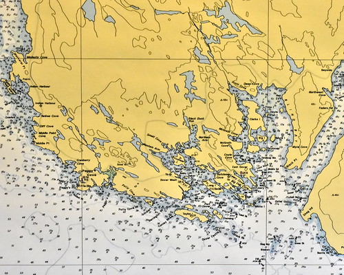
I then print these out on regular printer paper, tape them inside sheet protectors and put them in my deck bag.
Does anyone have a better solution?
I often take pictures of maps from my smartphone and just read them off of there. You can zoom in with plenty of detail and zoom out. Obviously, if your phone battery dies (FWIW, I carry an external battery that is pretty compact and light but gives me multiple re-charges) or is otherwise compromised by water intrusion for instance, and you really need that map to get back home or wherever, you are SOL. For areas with a signal, I’ve also found on-demand satellite imagery very helpful when threading my way through salt marshes and so on. To do what you are already doing somewhat more efficiently, you can probably print your map photo’s out on waterproof printer paper. I sometimes will print out a to-do list (e.g., practice this or that, try some new procedure or whatever) and put it on the deck under the bungees.
1 Like
How do you lose with both?
Maps can be just wrong. For example names are often wrong. You may say a map/chart name and the locals never heard of it>>
So true.
I was with a group on the Colorado (first time that run) and my paddle-buddy did so many pee-stops that we were separated from the group.
My Fish-n-go map said that 4s campground was only a mile downriver. The Calif waterways booklet said the same.
Both were wrong and we could not find that campground even though we fought current up and down that river for an hour searching.
Finally gave up and decided to make a run for another campground a few miles further.
4S was listed in the wrong place by every map I checked!!!
Also Google Maps and even their Sat images are often photo-shopped to show towns that do not exist and changing roads.
One road to one Calif lake I often visit has the intersection photo-shopped to erase the actual roads and add a subdivision where there is only wilderness and an entire city across the river that does not exist.
USGS maps are the most accurate but are often old and out-of-date.
I guess that the only solution is to carry both paper and GPS and most importantly, do not trust either if your brain and experience says otherwise!
In some places, an aerial photo works best. When I paddled in the twisty, bushy slough bends at Tybee, everything around was the same elevation, and the vegetation all looked similar. There was an old map based on an aerial photo another paddler showed me, but it was out of print. I sure wished I had one like that. Even the latest charts did not reflect the constant changes to the surrounding features. At one point, I watched which direction a leaf floated in the very slow current and used that to find my way out of the maze of options. It did the trick, but I felt very uneasy about not having something more solid to go on.
GPS would not have helped. A friend told me that in a similarly-flat place he paddled along the Gulf Coast, one companion insisted on following his GPS-based e-nav directions despite the obvious low island in the way. They did not come to an agreement. Two guys went where their eyes and the map told them to go, and Mr, E-nav followed his device’s directions. He had to turn around and catch up to the others.
When we lived on the Olympic Peninsula, researching the nearest big box store (or whatever) was always bound to yield recommendations for some store a solid two hours of driving (plus possible delays for Hood Canal Bridge closures, or plus an expensive ferry crossing) as being closest, based on crow-flies distance. Cars don’t fly or swim. Meanwhile, the listing for a store 40 to 50 miles away (without any bridges or ferries involved) was shown as farther away.
At the very least, INCLUDE a map or chart as a navigation aid. Common sense from seeing the lay of the features will rule out the stupid recommendations, as in the above two examples.
@RikJohnson said:
4S was listed in the wrong place by every map I checked!!!
If all maps are wrong, how does a GPS help?
Or are you saying that the map in the GPS wasn’t wrong?
Just for some additional options, on my Garmin GPSMap78sc, I sometimes download BirdEye satellite imagery ($30 year subscription) to the handheld (to view on the water) and to see in the route planning software (to create extremely accurate routes and waypoints from my PC during planning), for critical areas that change frequently. For example, narrow Florida Bay channels, the shape of inlets and contours of islands off the West Coast of Florida and so on.
Satellite imagery is often difficult to see (too dark) on the handheld, but it can occasionally be very useful for small areas, where you need extreme detail.
The BirdsEye subscription is nice, but not necessary. Waypoints and routes that are created in Garmin’s (free) Homeport or Basecamp software can be viewed in Google Earth to make sure that they are accurate when you are planning a trip.
Other software allows this as well, I’m only mentioning the Garmin options as I am most familiar with them.
I don’t usually do this sort of planning for a casual trip, but for things like Watertribe races I have routes and waypoints to handle many different scenarios. It’s easy to follow a route’s “magenta line” even when you are sleep deprived and brain-dead, although occasionally some people get turned around and go the wrong way!
http://www.gregstamer.com/images/birdseye.jpg
BirdsEye example, showing overlay on standard chart.
Greg
Topo maps have so much more info, even when one is twisting & turning on old cutting roads in search of a specific area for the first time…it’s good exercise for the brain, however GPS or a compass combined with the topo map can bail one out before approaching frustration mode. That’s nice stuff Greg…
Question: Maps. Paper or GPS?
Answer: Yes.
Since 2001 I’ve carried a GPS all over the water and backcountry in New Hampshire, Massachusetts, Wyoming, Colorado, Nebraska, British Columbia, China, Zambia, Zimbabwe, South Africa, England, and other places. And I’ve never ever seen a single one fail. Not mine, not a friend’s, not an acquaintance’s. But I still carry paper maps.
When doing things similar to OP’s expressed use, I combine GPS (a Garmin InReach Explorer+) with paper nautical charts or printed topo maps inland. I also use my phone in a waterproof case (Lifeproof) and combine the Garmin app with either Gaia GPS or the Navionics Boating USA app. GPS is attached my PFD (it’s a satellite communicator/emergency locator so I want it on me) and charts in a deck case under the bungees. Phone is usually in a PFD pocket. Most of the time I am looking at my phone. Probably 99% of the time in fact. But when conditions turn sucky, like rain and windy chop blowing in and there’s a 3-mile crossing back to the launch and it’s getting kinda’ foggy I’m using my GPS to give me a magnetic bearing back to the launch (or using the chart and the compass rose) and relying on my deck compass to get me there. That way my hands stay on the paddles.
Even on my local lake where I’ve paddled dozens of times, I have my GPS and a map. Even if just to show someone who asks me a question which direction the boat launch is.
I’m partial to the Seattle Sports Dry Doc map case lately, mostly because it comes with the attached magnifier. The close-up vision for little depth numbers on charts isn’t what it used to be.