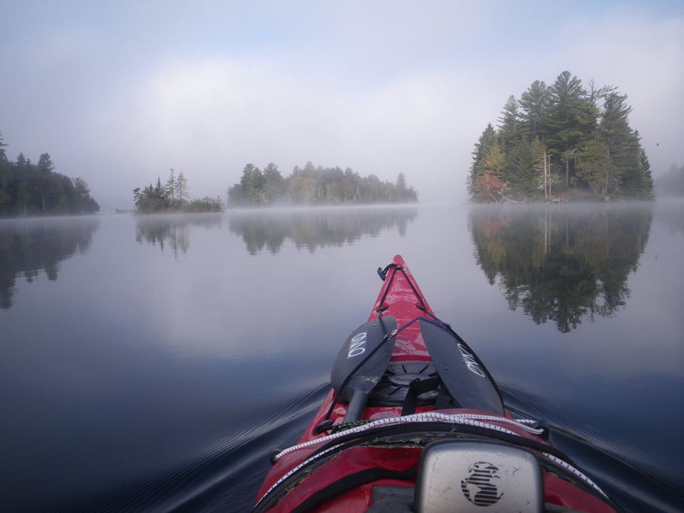
Just beyond these islands was a 4 mile crossing of the lake into very thick fog. I had to reach a river that empties the lake in order to reach my vehicle which was 4 miles down stream. Luckily, I had my GPS and just followed my tracks from the paddle in.
2 Likes
Add a little vertigo and a visual horizon becomes real important.
2 Likes
I made a fog crossing on Lake Superior AI from Cat Island to Rocky in 8-20 foot visibility. Shot the heading and watched the compass and the clock. The best part was the 15-18ft swells when I came out of the lee of Cat Island. The weax radio said they were there I thought the forecast was stale. It wasn’t, but I launched in calm water and paddled into that level of energy. I made really good time in following seas. Focused on keeping the heading straight, I was close to the bulls eye. The swells had intermittent white caps, were actually pretty fun, if it had been clear I would have coasted them all the way to Wisconsin mainland. Would have been a once in lifetime chance.
Peace Jeff
3 Likes
Johnnysmoke brings up a good point, sound. It has some reliability issues in true pea soup fog. The droplets disperse sound so finding the direction it is coming from gets hard. But it can still be a very important clue.
My husband, a friend and I took off in fog that was supposed to lift one morning. Sure… we got most of the way to the island we were headed for but heard a lobster boat motor near where the island had to be. They couldn’t see us, other factors including limited landing points on that island so we had to give it up.
We navigated by compass all the way out and back, but I lost my confidence at one point heading home. The shoreline of the last small island before crossing the river mouth to home looked all wrong to me shrouded in fog and at full low tide. I was reaching to pull the GPS unit out of the day hatch when I heard them - crows. Lots and lots of crows.
There were only two islands in that entire stretch we were doing where crows congregated. We were between them, and in the right place.
2 Likes
Canoeing in the Great Bear Rainforest (Hakai Luxvbelus). A combination of fog, haze from wildfires, which obscured the morning sun, and my ego for not turning on my GPS, led my partner and I on a two-hour paddle through 2 m swells instead of a relaxing 30 min paddle across to a calm channel. Because of the swells, I couldn’t take my paddle out of the water to access my GPS or compass. The full story is here: Foggy Brain
2 Likes
Oh Jeez! So you were headed for Nalau Passage and ended up in the open and blind all the way to Calvert. Harsh toke! It’s been too long since I read that trip report. Guess I’ll do that this morning.
Thank you for posting.
1 Like
Great animation and background illustrations!
Everybody’s circle went clockwise. Could this bias be an ancient holdover related to the fact that the earth still rotates in the same direction it did long ago?
That sounds like motion sickness. I learned at an early age that I cannot read in a moving car, even though riding in one does not make me ill or uncomfortable. I, too, can check a deck-mounted compass, which is several feet in front, but no way would I want to rely on reading a digital device close to me.
1 Like
For me, part of it may be due to wearing monovision prescription contacts but I can change my focal length without getting dizzy and disoriented in bright light. Put me in fog and I really need to spend as much time as possible on a single focal length. So I mostly focus on my deck compass.
Fog is a rarity in CO, but I’ve experienced peasoupers in MA, ME, CA, AK, and WA.
Ideally, you look around and at the chart for clues while there is still some visibility, and memorize bearings then. And the common-sense things like feeling which way any breeze is coming from, or which way any current is going (and when/where change is expected), can help.
The last time heavy fog blew in while I was kayaking, I was in a place I’d paddled hundreds of times, since it was right near my then-home. The fog obliterated sight of everything even though I was less than 1/4 mile from shore. I began wondering if I would get imperceptibly angled off into the middle of a strait I knew could get strong current, and not in a good direction.
I had been paddling overwhelmed by grief over the death of my dogs, and at one point I actually welcomed the prospect of dying and joining them, as I had always thought of them as living “above this world” anyway—spiritually, if not bodily. I stopped paddling and just sat there, crying and making it even harder to see, for a few minutes. In the midst of this dark emotional swirl, the fog suddenly thinned, allowing a hint of pearly almost-sunshine to light up the pier which I knew so well. As if their beings whispered, Not Yet—Go Back This Way. The pier remained discernable just long enough for me to get near, at which point the fog thickened again, hiding even nearby objects. But by now I could hear the sound of the sea rolling into beach and back out, so I knew it was time to land.
3 Likes
Nothing beats a mapping GPS with the proper charts in dense fog. I carry two all the time, mostly just to save the track so I can relive my glory days when I go crippled and senile in a couple of weeks or so. Two because I’ve had a GPS fail on occasion. The tracks are useful when someone has a question about somewhere that I have been.
However, I always have a local chart, either waterproof or in a zip lock bag along with a deck compass and another compact compass in my PFD. All handy without having to open a hatch or anything.
The Chesapeake Bay rarely has a problem with fog, but if you’re doing a long distance day trip in an unfamiliar area, there are an awful lot of areas that are all marsh with few landmarks.
Yup. I was in Core Sound in fog and got an education. I thought I was paddling one way but the GPS was telling me I was paddling another. I trusted the GPS and corrected my course. If I took my eyes off the GPS I’d stray again. I thought “OK, this must be what happened to JFK Junior right before he died.”
Even on a bright clear day, it’s not difficult to be confused as to where you are. Islands blend into their backgrounds, and looking at a map that shows an island and you don’t see it can be confusing. I have been on a large lake on a clear day and trying to determine where the outlet to a river was, was difficult. Low grass lands, mountains, trees, islands blend in so that the river was difficult to find by sight alone.
That’s why I always carry a GPS and spare batteries. The GPS is in the cockpit, so I don’t have to look for it and it’s a mapping GPS. I’ve had the GPS for years and know how long the batteries will last. On a multi day trip, I start off with fresh batteries and keep spares handy.
My favorite fog story: I ran the upper gauley at about 600-800 cfs. My only low water run on that stretch. The fog was really thick and I could only see about a boat length ahead. Much more than the typical morning fog I had encountered videoing commercial raft trips. I couldn’t see the two other guys I was paddling with, just hear them. The first spot I recognized was the pool above Pillow (which I walked). I ran Insignificant without a clue as to what rapid I was even paddling through.
The two guys I was paddling with were both highly skilled, but really wide open, sketchy as far as friends go. They were acting really strange at Pillow. Turns out unbeknownst to me, they had done a hit of acid before putting on. We had done our normal ritual - smoke a joint but that was just considered routine. As if the whole trip wouldn’t be strange enough. I survived (by also carrying Iron Ring) and the fog had started to lift by the time we hit the takeout.
The shuttle driver, still impaired, decided we needed a 4-wheeling adventure in his jeep. So we proceeded to bottom out and and simultaneously hit our heads on the roof of the jeep. I wished I was still wearing my helmet. We were off-roading in the emergency spillway area across from Battlerun campground on our way back to dam (put-in).
I never paddled with those guys again. I never paddled the upper g at low flow again. I never paddled in thick fog again. I never did do a hit of acid. It all made for a great memory though.
4 Likes
People who paddle often in mangrove country must be skilled with using nav tools of all kinds,
Nothing higher around than mangrove isles. No mountains or tall buildings visible from kayak height. Complex tidal flows in some areas. No firm places to land and stand up for a better look.
I got lost in a mangrove labyrinth near Tybee and sat there waiting for clues from water movement. When a small stick slowly but surely moved in a consistent direction, I followed it, hazarding that I was probably heading toward the open water. It led me to where I finally figured out where I was, but it wasn’t something I had felt sure of.
A local told me the best thing to have out there was the most recent aerial photo, and a sharp memory of all twists and meanderings taken.
Everything looks the same.
2 Likes
Had a pilot friend who experienced upside down flight. His brief case kept “falling” on the ceiling and he repeatedly pulled it back down. Finally he took a better look at his instrument panel and discovered the problem.
1 Like
When I paddled the Yukon River 1000 mile races (and the 440), I planned my route using Google Earth images. It was much more up to date and accurate than any other available map, topo or otherwise. I selected GPS waypoints around every bend and island in the river making the shortest/fastest route I could come up with. Then during winter months before the race I played the route on GE video, “fllying” down the river to familiarize myself with the route while training on my paddling machine and watching the route on a large screen monitor in front of me. I memorized every turn and island and what direction to take at each one. It all paid off on the actual race. After each time on the river (5 races) I updated the route for an improved more effective next time track.
2 Likes
I don’t paddle on the ocean, or on huge lakes; I’m a canoeing, river paddler.
If the fog gets to thick, I simply pull over and chill out until the fog burns off. No need to risk running into strainers, log jams, low hanging limbs, rock gardens, or sudden drop offs.
I don’t much care for unnecessary surprises, and an unnecessary dunking.
It helps that when I paddle I am not in a race, or on a schedule. I don’t need a map, compass, or GPS to sit on the shore or gravel bar.
If the fog doesn’t lift; I may put up my rainfly, get my chair, and make a cup of coffee. A lot more fun than getting out of a strainer…
Also a good “photo op” time.
No hurry, no worry; I’ll get where I’m going eventually.
BOB


7 Likes
I will add one more thing to this important post. Sometimes people get this idea that “they have to get home.” It is Sunday and they have work the next day. Sometimes people will paddle into fog, a storm or other hazards because this urge is so strong. Don’t do it.
Pull over and wait. Paddle when it is safe. If you have a decent company to work for they will understand.
4 Likes
A band of close packed Tstorms came thru one time, no it was not forecast to happen then, Jim and I spent 3 and a half hours hunkered down on an island waiting for a window. Directly across from a bunch from the Audubon camp who had hunkered down on an adjacent island for exactly the same reason.
It gave us a lot of time to assemble a list of the gear that we should have had.
1 Like