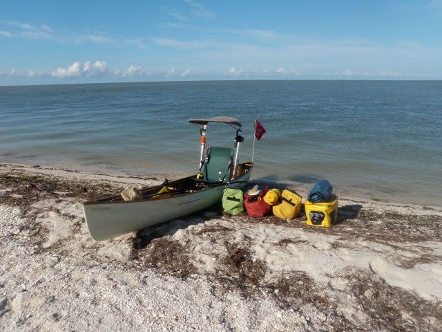
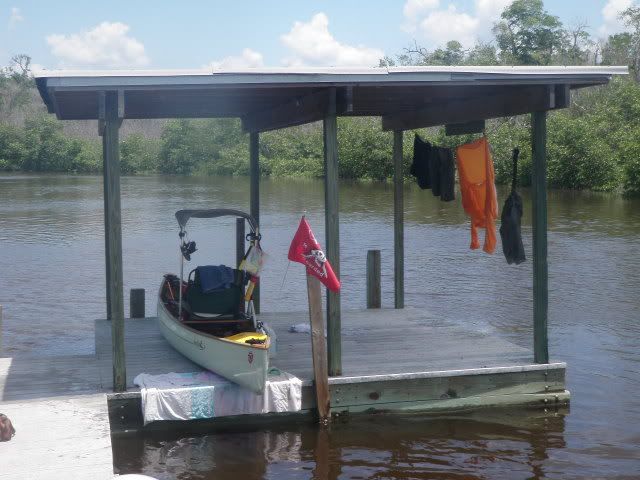
Before the BP oil spill potentially ruins Everglades National Park for years to come, I decided to take a 10-day, 129-mile solo paddle in my new Swift Shearwater. I attached a Bimini top to my canoe to get a respite from the hot midday Florida sun, plus I placed a folding reclining chair over the canoe seat so I'd have back support while paddling, plus a chair to sit on at campsites. Five of the campsites were land-based, and the last four were on chickees (free-standing docks). I paddled from Flamingo along Florida Bay to East Cape Sable, then moved north up the Gulf coast to Middle Cape Sable, Northwest Cape Sable, Shark Point, and Highland Beach. From there I paddled south to the Harney River chickee, then on to chickees in the Shark River and Joe River. From the South Joe River chickee it was just 8.6 miles back to Flamingo.
Here are pics:
http://i241.photobucket.com/albums/ff233/Kaskazi/10-7.jpg
Packing up on East Cape at the beginning of Day Two.
http://i241.photobucket.com/albums/ff233/Kaskazi/10-9.jpg
Middle Cape Sable.
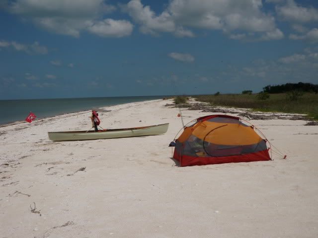
http://i241.photobucket.com/albums/ff233/Kaskazi/10-12.jpg
Campsite at Middle Cape. My tent is a Marmot Aeolos.
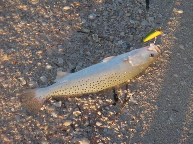
http://i241.photobucket.com/albums/ff233/Kaskazi/SeatroutMiddleCape.jpg
Spotted seatrout for dinner and lunch for the next two days.
http://i241.photobucket.com/albums/ff233/Kaskazi/CrocTracks.jpg
American crocodile tracks at Middle Cape. There was a freshly-dug nest at the other end.
http://i241.photobucket.com/albums/ff233/Kaskazi/TernsMiddleSableCreek.jpg
Royal terns hanging out on a sandbar at Middle Sable Creek.
http://i241.photobucket.com/albums/ff233/Kaskazi/NWCape.jpg
Northwest Cape Sable, the calmest of the three capes.
http://i241.photobucket.com/albums/ff233/Kaskazi/dolphin1.jpg
Frigatebirds following a pod of dolphin (porpoise) offshore.
http://i241.photobucket.com/albums/ff233/Kaskazi/RobberFlyBeachSharkPoint.jpg
Shark Point, Day Four
http://i241.photobucket.com/albums/ff233/Kaskazi/BroadCreek.jpg
And osprey along the edge of the Gulf.
http://i241.photobucket.com/albums/ff233/Kaskazi/HighlandBeach.jpg
Highland Beach, Day Five, about sixty miles from where I launched.
http://i241.photobucket.com/albums/ff233/Kaskazi/PastaHighlandBeach.jpg
Pasta dinner.
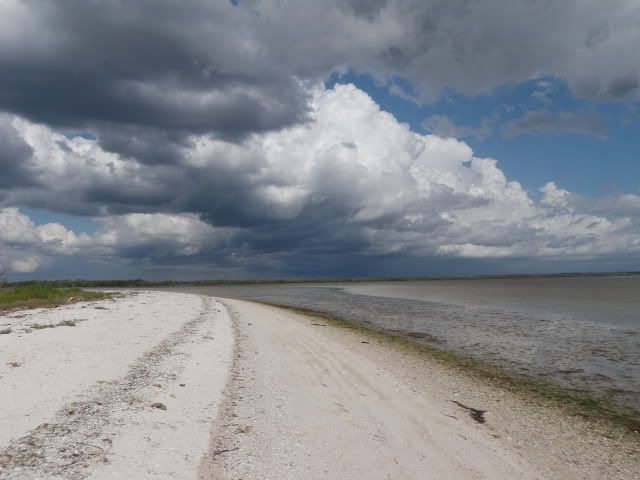
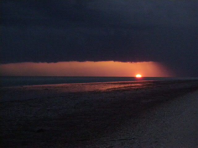
http://i241.photobucket.com/albums/ff233/Kaskazi/HighlandBeachStorm.jpg
A storm over the Gulf at sundown. Pelting rain, lightning, booming thunder, screaming wind. I thought it was Armageddon!
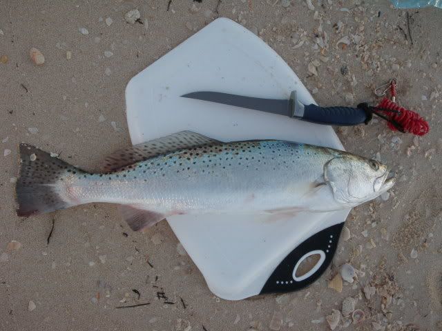
http://i241.photobucket.com/albums/ff233/Kaskazi/SeatroutMiddleCape2.jpg
Another fat seatrout for dinner, caught on the morning of Day Six off Highland Beach.
http://i241.photobucket.com/albums/ff233/Kaskazi/HarneyRiverNorthMouth.jpg
A shell mound at the mouth of the Harney River where I stopped to wash off and take a break. The pause that refreshes.
http://i241.photobucket.com/albums/ff233/Kaskazi/HarneyRiverChickee.jpg
Harney River chickee.
http://i241.photobucket.com/albums/ff233/Kaskazi/HomeSweetHomeHarneyRiverChickee.jpg
Home Sweet Home on the Harney River chickee.
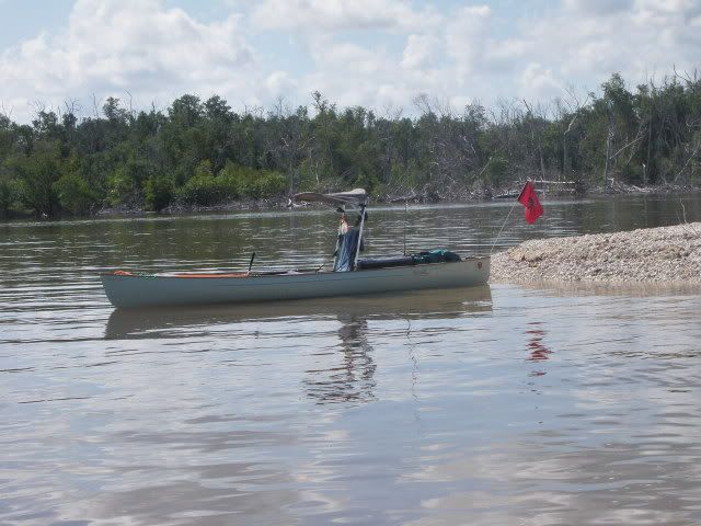
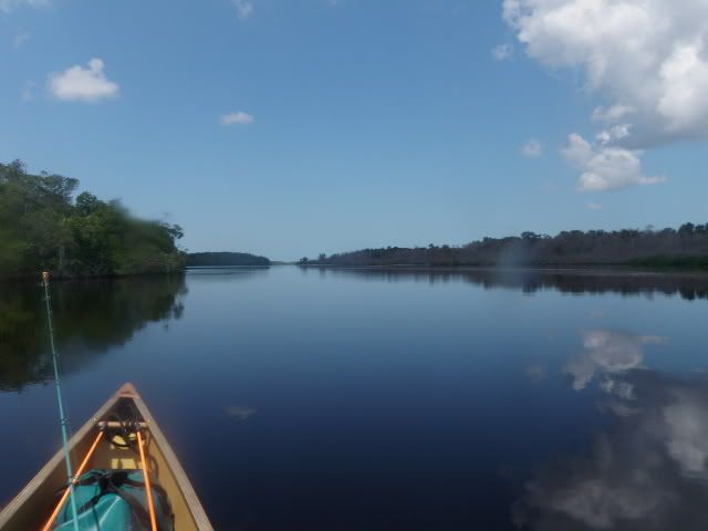
http://i241.photobucket.com/albums/ff233/Kaskazi/SharkRiver.jpg
On the way to the Shark River chickee.
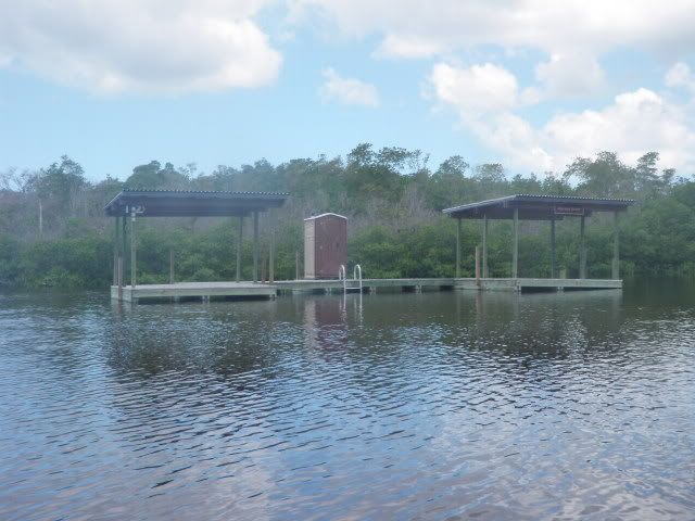
http://i241.photobucket.com/albums/ff233/Kaskazi/SouthJoeRiverChickee.jpg
Approaching the South Joe River chickee, Day Nine.
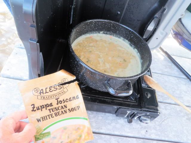
http://i241.photobucket.com/albums/ff233/Kaskazi/TuscanBeanSoup.jpg
The Last Supper. These Alessi products are super good and great for camping.
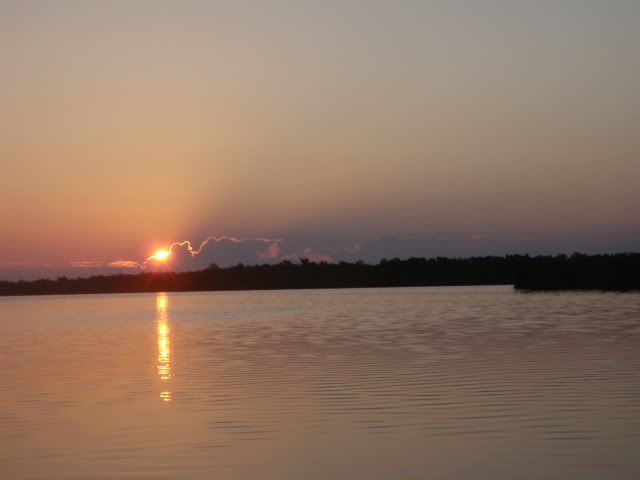
http://i241.photobucket.com/albums/ff233/Kaskazi/SunriseJoeRiver.jpg
Sunrise on Day Ten.
http://i241.photobucket.com/albums/ff233/Kaskazi/WhitewaterBay.jpg
Whitewater Bay...NOT living up to its name, thankfully.
http://i241.photobucket.com/albums/ff233/Kaskazi/BackFlamingo.jpg
Buttonwood Canal where my fiancee was waiting to greet me on the dock back at Flamingo.
http://i241.photobucket.com/albums/ff233/Kaskazi/TheDerelictReturns.jpg
The end of a great trip!
Nice Trip
Wonderful Photos. You look like my friend Roger H. Peace Joel
Wonderful Trip Report and Photographs
Encourage you to write this trip up for p-net "Places To Paddle".
Deadhead, you be the man!
Mike
terrific pics…
Great pics from a great area Deadhead, terrific stuff…certainly brings mixed emotions. Just shows how few congressional people…that determined amount of inspection/engineering/location…ie planning, are paddlers…$.01
I did similar paddles
when I was a kid (early 70s). Everglages city was a favorite put in. Sad to think it will likely be lost for such pursuits into the next millenium.
Corrected a typo.
I just realized I made a typo in the original post, so I corrected it. I said it was a 12-mile paddle, but I left a number out…it was a 129-mile paddle.
I’m not certain how you go about posting pics that will show in a thread without having to click on a link. I used PhotoBucket like on other forums. What am I doing wrong?
I love paddling out there, although some of my experiences have been hellish, like getting caught in a wicked thunderstorm in Florida Bay on my way back to Flamingo from Cape Sable, and having to paddle across Whitewater Bay when it was living up to its name. But, if it was easy it wouldn’t be as much fun. This recent trip was a blessing…great weather, good timing with the tides, no mosquitoes whatsoever, and no tar (yet).
One good tern deserves another.