This year I did a rookie thing and bought my family pelican trailblazer kayaks. Over Memorial Day weekend we went to the river to kayak at white haven. About 10 seconds in we realized it was a bad idea and it became a rescue mission. Thank god no one was hurt! Can these kayaks ever go down the Lehigh? How can I find out the the river is flowing slow enough for the boats we have? Will the river flow slow enough for the kayaks we have?Or are we just going to have to stick to lakes like the dam or beltsville? Thanks for you advice.
I have paddled the Lehigh Gorge from White Haven to Glen Onoko many times. I used to live about 40 minutes away from White Haven.
The Lehigh will sometimes be high enough to run from natural flow during the winter or periods of high rainfall. During much of the year, the river will be too low to run unless water is being released from the Francis Walter Dam, which is operated by the Army Corps of Engineers. That dam is about 6 3/4 miles upstream of White Haven and ordinarily will impound much or all of the flow of the river upstream of it.
There are scheduled releases from the dam for recreational purposes periodically during the year. This year there were releases scheduled on May 26 and 27. The river is typically heavily used during release days and is a popular whitewater rafting river attracting people from New York and New Jersey as well as Pennsylvania.
I would not recommend paddling the Lehigh Gorge in recreational kayaks. The stretch from Francis Walter Dam down to White Haven, and the stretch below Jim Thorpe are considerably less challenging, but may still not be appropriate for rec boats unless you have considerable experience. You might possibly be able to paddle the upper or lower gorge during times of low natural flow, but this could also make for a very long day. Be aware that access points you can drive to are pretty much limited to White Haven, Tannery bridge on route 534, Rockport, and Glen Onoko, although there is a rail trail running along the river the whole length of the gorge. This is open to bicycles and can be used for emergency vehicles, but is closed to regular motor traffic.
You might consider trying the Susquehanna River. The stretch between Towanda and Laceyville is nice. There are also sections of the Delaware River that would be suitable for recreational kayaks.
@pblanc said:
I have paddled the Lehigh Gorge from White Haven to Glen Onoko many times. I used to live about 40 minutes away from White Haven.The Lehigh will sometimes be high enough to run from natural flow during the winter or periods of high rainfall. During much of the year, the river will be too low to run unless water is being released from the Francis Walter Dam, which is operated by the Army Corps of Engineers. That dam is about 6 3/4 miles upstream of White Haven and ordinarily will impound much or all of the flow of the river upstream of it.
There are scheduled releases from the dam for recreational purposes periodically during the year. This year there were releases scheduled on May 26 and 27. The river is typically heavily used during release days and is a popular whitewater rafting river attracting people from New York and New Jersey as well as Pennsylvania.
I would not recommend paddling the Lehigh Gorge in recreational kayaks. The stretch from Francis Walter Dam down to White Haven, and the stretch below Jim Thorpe are considerably less challenging, but may still not be appropriate for rec boats unless you have considerable experience. You might possibly be able to paddle the upper or lower gorge during times of low natural flow, but this could also make for a very long day. Be aware that access points you can drive to are pretty much limited to White Haven, Tannery bridge on route 534, Rockport, and Glen Onoko, although there is a rail trail running along the river the whole length of the gorge. This is open to bicycles and can be used for emergency vehicles, but is closed to regular motor traffic.
You might consider trying the Susquehanna River. The stretch between Towanda and Laceyville is nice. There are also sections of the Delaware River that would be suitable for recreational kayaks.
Thanks for the reply. We are just looking for some river trips that we can get in a paddle down stream with some nice scenery changes, not too many rapids, and very low technical ability. We are also planning to go up to the Francis E Walter dam lake for some kayaking.
I would suggest the upper Delaware between Hancock and Narrowsburg. There are numerous access points to allow day trips of just about any desired length. This section of the Delaware is quite scenic, but can draw a lot of traffic on nice summer weekends. This part of the Delaware consists primarily of straightforward Class I riffles alternating with pools. The one exception is Class II Skinner’s Falls near Milanville, about 5 miles upstream of Narrowsburg. This is really a pretty straightforward class II, but it is about100 yards long dropping over a number of ledges which create a few holes, and there are rocks to avoid. Skinner’s Falls can be portaged:
http://www.delawareriverscenicbyway.org/uploads/3/7/0/4/37043509/river_trail_map.pdf
Another possibility of course is the Delaware Water Gap National Recreation Area.
Harvey’s Lake in Luzerne County is the largest natural lake in PA but you can paddle around the perimeter in a couple of hours. It is quite developed but it is sort of interesting to check out all the boathouses and piers. There is a public access at the tip of the northwestern limb of the lake.
Another pleasant lake in eastern PA is Brady’s Lake near Tobyhanna. Andy S. has posted some nice photos of the lake on these threads:
http://forums.paddling.com/discussion/2937437/bradys-lake-pa#latest
http://forums.paddling.com/discussion/2937439/bradys-lake-pa-again#latest
Pick yourself up a copy of the book “Paddling Pennsylvania”. It’s a guide to waterways and lakes around the state and has maps and information on access launch points and a description of conditions. You should learn about USGS river gauges and how the levels affect the flow and conditions on rivers. The guidebook tells you what levels make a river safe and navigable.
Also, if you are going to stick to recreational style kayaks, stick with flatwater and nothing over Class 1 rapids. You can get in real trouble even in Class 2 in boats that are not designed for whitewater. Your kayaks lack bulkheads (walls that keep the spaces under the deck from flooding) so if they are swamped, which often happens in rapids, they will sink and you will have difficulty getting them to shore to drain them. The cockpits are too large to support a sprayskirt to prevent water from entering the cockpit and the flat hulls. designed to be “stable” in calm water mean that they can more easily be capsized by a wave.
I hope you also picked up PFD’s with your kayaks and always wear them. Also be aware that you are required in PA to have a state issued launch permit to use any launch areas that are under state or Game Commission control. There is a fine for not having one and rangers can even prevent you from launching, You can get the permit stickers on line at the PA DCNR website. It is $10 for one year and $19 for two years. Perhaps you already know all this but I am aware that the salespeople at some of the big box stores that sell the cheap kayaks often don’t inform buyers on safety and regulations. YOu also need to be aware of low head dams on many PA rivers and streams, which can be deadly. Don’t enter any waterway unless you’ve checked out what to expect on it in the way of high or low water levels, high water flow rates, rapids, dams and potential strainers. Strainers are trees that may have fallen into a river after storms. Especially in periods of high flow, your boats can become trapped in those branches and are a drowning hazard.
A little knowledge and prep can assure safe and fun paddling. You lucked out the first time – it could have been a tragedy. It certainly was last year here in Western PA when two young women did the same thing you did, bought some cheap kayaks at Dick’s and launched into a river they knew nothing about, in this case the Ohio downstream from Pittsburgh. They ignored signs for the Dashield’s dam (you can’t see low head dams from upstream – they are like the edge of “infinity pools”) and were swept over into the powerful whirlpools of trash and junk at the bottom of the drop and killed. In fact, one out of 6 people killed in low head dam drownings in the whole country occur in Pennsylvania – we have the highest rate in the entire US because we have such a large number of streams and rivers in steep terrain.
FYI: Here is a guide to the Lehigh showing the dams and where the gauges are located. The USGS has a website where you can check real time gauge levels on line (they spell it “gage”).
http://www.fishandboat.com/Fish/Fisheries/LehighRiver/Documents/5_lehigh_plan_figures.pdf
Here is one example of a Lehigh gage link:
There are many stories of the uninformed and unprepared needlessly perishing on whitewater streams they had no business being on, but this one might be of some interest to the OP since it resulted in the death of two young girls on the exact same stretch of the exact same river upon which the OP experienced his or her "Oh sh*t " moment. And I happened to be on the river that day, which was March 14, 1995.
That was pretty warm for a mid-March day in NE Pennsylvania with an air temperature around 50 degrees F, but the river was running high and the water temperature was about 34-35 degrees from a lot of snow melt. A friend and I set up to paddle open canoes from White Haven to Rockport. After leaving my truck at Rockport access, we drove my friend’s old truck with our gear and boats to White Haven. When we got to the parking area behind the grocery store we saw no other paddlers, but we did see a small, black sedan with the passenger side window smashed out. We feared that local miscreants might be breaking into vehicles, but my friend’s truck was an old beater containing nothing of value and he was willing to chance it. We left his doors unlocked and windows rolled down and put on.
As we paddled through that first rapid, variously called Entrance or Initiation, the water was high and it was running a solid Class III+ or perhaps even IV-. We immediately saw the aftermath of some type of carnage, with a raft, pool toy really, pulled up on the right bank, and some orange horse collar PFDs and other flotsam scattered further down toward the end of the rapid. But we saw no people. A short time later, we saw emergency vehicles driving along the bike rail trail on river right with lights flashing. We paddled slowly along, eddying out frequently, and looking for stranded paddlers but saw no one on shore and no other paddlers.
We decided to pull over at 'Lunch Rock" below Tannery, Triple Drop, and Z rapids, about 2.5 miles into the run. We saw more vehicles driving up and down the rail trail, and then a helicopter came flying low up the river. The pilot saw us on the big rock, and landed the copter on the train tracks that run along river left behind the big rock we were sitting on. An officer got out, and told us the story and questioned us. He told us a party had had a mishap and two young girls of Southeast Asian descent were missing. We told him what we had seen in Initiation, that we had seen no survivors, and that we would paddle very slowly the rest of the way to Rockport keeping a sharp eye out. We later learned that by that point we were already downstream of where the two girls bodies were recovered the following day.
These unfortunate individuals did just about everything wrong that could be done wrong. The rafts were totally inadequate and doubtless folded in the first hole. The PFDs were inadequate, even if they were worn, which is not clear. They had put on a whitewater river running high without adequate prior experience (one or two had been a commercial rafting client on guided trips during warm weather and much lower water). The water was very cold and they had no protective clothing. And what is really staggering is that one of the kids who survived was only 2 years old. It was an outing doomed from the outset.
After the two girls fell out and disappeared, a brother had swum to shore to summon emergency help. He had lost his car keys so he had to smash out the window of his car to retrieve his cell phone. That was the vehicle we had seen at the put-in. We must have put on within a half hour of the accident.
More details about this tragedy can be had here on the American Whitewater site:
http://www.americanwhitewater.org/content/Accident/detail/accidentid/367/
I paddle the Francis Walter Dam impoundment and Brady’s Lake quite often. Primarily because I live in NJ, but have a house in the Poconos and both areas are Army Corp of Engineers areas, And none of my boats are registered in PA, so I restrict my paddling to those two areas. The area near the dam is quite deep, depending on the pool. When the pool is high, you can paddle quite a distance upstream, but when it’s low the distance is limited. Brady’s lake is relatively shallow and a pretty scenic place to explore. The northern end of Brady’s is the most interesting, it’s quite shallow and has an active beaver population that each year has dammed up more and more of the stream that feeds the lake. Years ago, I could paddle nearly half a mile up the narrow stream. This year the beaver have reached the lake and dammed up the mouth of the stream.
Your Pelicans would be fine in either area,
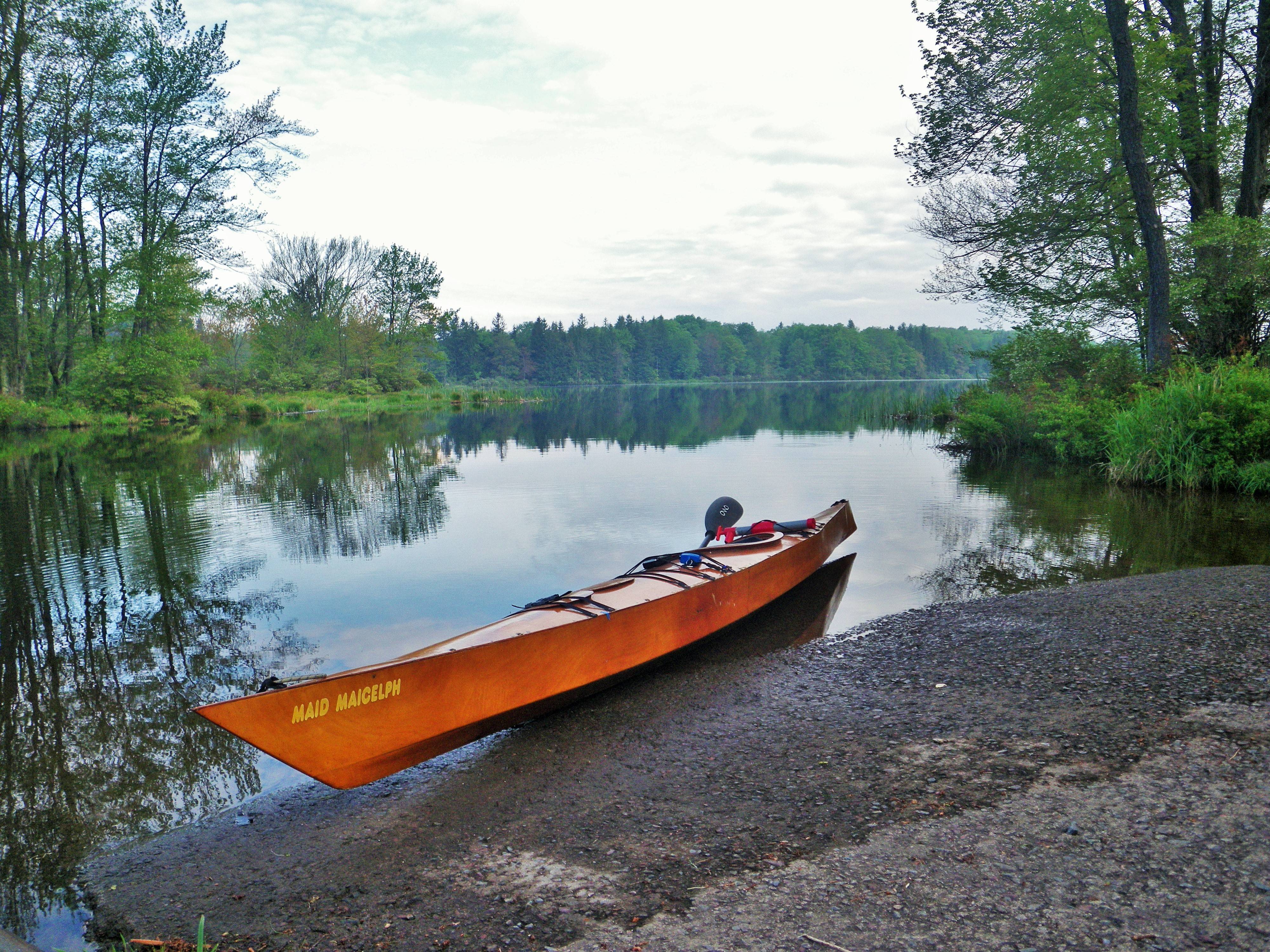
This is the put in at Brady’s.
In addition to the info that willowleaf told you, in PA you must also have a whistle with you. Mine is attached to my PFD. The “pealess” ones are best for this use.
Yes, thanks for the reminder about the whistles (i tend to forget those since I just have one tethered in each of my PFD’s). I believe the state mandates the “pea-less” type because the ones with peas (like sports coach whistles) don’t work well when wet. We are also required to have a non-flashing white light if out after sunset.
Also, if you are going to venture out on rivers that have commercial traffic, it’s best to familiarize yourself with the rules of the waterway and safety around large boats and powered craft. They usually can’t see you and you DON’T have “:right of way” for practical purposes. Also be aware of docks and eddy currents around bridge piers. You can get sucked under structures or capsized by high currents at obstacles in the river
Thank you for all the tips. Being new, this a great place to start. My son goes on a boy scout trip every year on the Delaware up by equinunk. I went with one year and had a blast. I am still beating myself up over the “lehigh incident “ and never want to make that mistake again. We do have PFDs and since have attached whistles to them. We also came up with a family communication using them. Next was to figure out the limitations of the boats. From what everyone says they are limited to lakes,class 1and very short class 2 sections. I need to figure out the gages and where to find them and how to read them. I also will be reading up on any river I plan to paddle. Any other suggestions would be appreciated. Thanks for all your help.
You should try some calm waters first in order to get familiar with your boats.


Looks like everyone is having fun. Just for fun, on a nice day this summer, go swimming with the PFDs on. You may want to make a few adjustments.