My husband and I are planning a mini-vacation around driving our daughter to Dubuque in July, as it's near the Mississippi (which we've never seen or kayaked). I'm just beginning to search for info, but I'd welcome any suggestions about how to best enjoy the area. We're just recreational kayakers, and I'm into outdoor photography too.
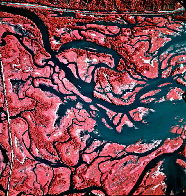
The infrared aerial photos are the most useful, but that feature isn't working right now (I haven't used this site in a few years, so I can't verify that that feature works at all right now). If you find a time when the infrared photos are available again, you'll have no trouble finding places to padde that look something like this:
If you don't mind driving a little ways north, you will find many places along the Mississippi having a maze of backwater channels. The area I'm familiar with is near Lansing Iowa, where there might be 80 or more miles of backwater channels alongside 10 miles of the main channel. It's a whole other world that few people know about.
Okay, I thought the infrared-photo feature was working again, but now I see that most of them are still malfunctioning. Anyway, on any kind of aerial photo, if it only shows up in one corner of your screen, click the photo and it should show up full-size.
Grew up I grew up there and spent a ton of time on the river. You should definitely check out Mud Lake if the wind is blowing and you should go through the lock and dam. It’s fun to paddle into the area by the old Star Brewery. Check out the shore by Mines of Spain and catfish creek if it isn’t blocked by trees.
USGS Photos are Back On-Line! I emailed the guys who maintain the website that I listed in my first post, and told them that it sure would be nice if the links to infrared photos were still working. A day later I got a note saying they had been fixed.
Check out this photo as an example of the kinds of places you can find:
Wisconsin / Mississippi confluence About an hour upstream is the confluence of the Miss and the Wisc. Wyalusing (sp?) state park. The Wisconsin in mostly undeveloped. Great paddling. The Miss is a little crowded with power boaters in July.