Today I paddled DOWN a river flowing out of a lake. After paddling for about 45 minutes, I looked up ahead and noticed a distinct current flowing TOWARD me. It was stong enough that I had to turn around and head back. After paddling for about 10 minutes back toward the lake I again encountered a current flowing TOWARD me out of the lake.
How do you account for this???
Could it have something to do with winter drawdown?
It’s caused by the wind
– Last Updated: Oct-21-09 11:20 PM EST –
I am pretty sure that you witnessed something called a "seche". You know how if you fill up your bathtub and disturb the water, it sloshes back and forth? Lakes do the same thing.
I first noticed this kind of thing when I was in 6th grade, while fishing on a river about a mile upstream from where it empties into a large lake. The current would often reverse, and I seem to remember that the interval was about 20 to 30 minutes, with a slightly longer and stronger flow each time in the "proper" direction. There's a USGS gauge there now, and due to the character of the site, the gauge is equipped with sensors which measure current speed and direction, and it usually shows some evidence of cyclic flow, though often it is just a periodic speeding-up and slowing-down of the current, rather than an actual reversal.
A very strong wind across the lake toward the mouth of that river will sometimes create an exceptionally strong current in the wrong direction for a while, but any time the wind blows, it will pile-up water (a tiny, but measurable amount) on the downwind side of the lake, and once displaced, the water will tend to rock back and forth. In very large lakes, the rocking motion can be a lot more complex, with several "peaks and valleys" from one side of the lake to the other. Each "peak", when it encounters the mouth of the river, will cause the flow into the lake to either slow down or reverse direction, while each "valley" in contact with the river's mouth will cause the river's current to go faster in the "proper" direction.
Oh, I see you were paddling DOWNSTREAM out of the lake. If you really were on the outlet of the lake (and not on the inlet side, believing an initially seen reverse flow to be "proper"), and if the dam was between you and the lake, then I can only guess that the outflow from the dam would periodically pile-up and fall back in a section of the river below, in a resonant fashion. This should be "possible" in a low-gradient area with deep with some obstruction downstream (such as partial damming by rocky shallows). However, if the dam was downstream of you (which is possible in natural lakes which have been raised higher by dams), then I'm sure the flow reversal was caused by a seche.
Watershed
Guideboatguy is probably right,it’s a seche tide but another possibility is that you are crossing a watershed. Our cottage in northern Ontario is on the height of land bordering the Artic and Great Lakes watersheds. Most rivers flow north to James Bay but if I launch into Dushene river which flows into the Arctic water shed and paddle south for a day into Overflow Creek which is a tributary, the flow reverses and starts to go south into the Onaping lake,river system.The first time I experienced it many years ago it was quite confusing until I understood what was happening.
I think you’re right: wind
I indentified this river on Google Earth and according to Wikipedia it is an INLET of this very large lake. I just assumed it was an outlet because the current flowed away from the lake.
In fact there was a strong wind yesterday, pushing large waves to the southern end of the lake. At that end there is a huge sandbar, with a water depth of about 12" over a large area. I guess that sandbar plus the wind was causing the pressure to build up in that area? And it was all possibly aggravated by the drawdown, as the water seemed unusually shallow.
The current flowed away from the lake for about a quarter to half a mile, then became stagnant until I encountered the current flowing into the lake.
So I think wind is the answer. Very interesting!
Graphic Ilustration:
– Last Updated: Oct-22-09 2:18 PM EST –
Here's the link to the USGS gauge at the location I mentioned in my first post.
http://waterdata.usgs.gov/wi/nwis/uv/?site_no=05427850&PARAmeter_cd=00065,00060
Note that changes in rate of flow, associated with changes in water level of a few hundreths of a foot, happen in cycles of such short duration that they are compressed to simple vertical bars on the graph. You can see that the velocity changes very frequently, and when the changes are large enough, the periods of slow-down are magnified into periods of current reversal. Currently, the dates of Oct 18, 19, and 21 show greater fluctuations than other recent dates showing on the graph. In other cases I've seen, the fluctation wildly shifts from "forward to reverse" in very short periods of time, but that isn't the case on the current graph. There are ways to search out data according to date, and it would be fun to show what the graph looks like when teh current is flowing extremely fast in reverse, or when the direction shifts a couple of times per hour all day long, but I've not had the best luck when figuring out how so I didn't try it this time. Anyway, it's pretty interesting how due to rocking motion of the lake a mile downstream, this river is NEVER moving at a constant rate, and often it reverses direction.
How can a river flow two directions?
The Hudson River does. The indigineous people’s name for the river translates as “river that flows both ways.”
The Hudson flows in two directions because it is tidal up to the Federal dam/lock in Troy (approx 160 miles from the mouth). Aside from times of notable run-off the incoming tide is stronger than the outgoing river current.
it’s either tidal or wind driven effect
– Last Updated: Oct-22-09 9:05 PM EST –
...... originally you lead me believe you were paddling an out-flow from the lake , so I posted and asked if the out-flow was tidal . While I was posting you had posted again and explained you found out this was not an out-flow but an in-flow , so I deleated immediately .
Since you were not in tidal waters but feeder waters (the in-flow), the wind must be the cause of your experience .
The water piles up on the leeward side and can over power an incoming feeder for a noticable distance "up-stream" , making it appear you are paddling on an out-flow .
Consider this same effect on bays and estuaries when there is an offshore low of signifigence such as the noreaster the east coast was under early this week ... it's winds blew the waters inland and piled them up against the outgoing tides , causing coastal flood warnings , extra high high tides and rip current advisories .
On a "true outflow" that may be under a tidal influence , the same thing can appear to be happening but actually is reversed . The true current direction is out , down and away from the lake which would be below a spillway or dam of sorts . Then you run into a reversing current that is caused by a tidal effect . The water is still pilling up but on the tidal side as opposed to the lake side .
There are other things that could cause a similar effect such as a continental divide line as I believe another has mentioned . Or perhaps a water export system removing water from an outflow , the back-flow of a lowhead dam , or an eddy all cause the river water to flow opposite , but these are localized areas .
Paddling into a tributary
I have paddled downstream in the outlet of a lake and then noticed I was paddling upstream.
What happened was that I took a fork in the river that turned out to be a tributary stream. I was fooled for two reasons. First, the mouth of the tributary was wider than the main stream. Second, the current of the main stream caused caused a back flow (like an incoming tide) on the tributary, so for a while it appeared as if I was still going downstream. 50 yards later, when the back flow effect faded, I was definitely going upstream.
This was quite confusing to me until I figured it out.
I have seen current reversal when a
watersource is shut off upstream from a dam. But the section of river where this occured, the Nantahala below Worser Wesser, can become a lake when Fontana is quite full.
When Fontana is full, that section of the Nantahala flows downstream as long as the Nantahala dam is generating. But after the dam shuts off, there is a temporary reversal of flow as the lake pushes back into the river channel.
Hudson not a true river fron Abany
– Last Updated: Oct-24-09 5:28 AM EST –
From Albany to New York the Hudson is an estuary (tidal river).
Mushrooms
flooded hairpin
Another way it can happen is when hairpin bends in a river flood, and the water level rises over the banks. Then, instead of following the twisty course of the river bed, the water simply moves across the plain in a straight line downhill.
On my local river, there is one segement where this effect is especially notieable. The trees along the bank are fairy thick and tall, so the river’s underlying course is distinct, and the canoe trail is distinctly marked with signs. When following the trail at high water, paddling is tricky because sometimes the current comes from behind, sometimes from ahead, and most often at some angle across the river.
reversing waterfall
And of course the most extreme tidal effect is the famous “reversing waterfall” in the Bay of Fundy. Actually, it’s not much of a classical-looking waterfall when reversed, but there is whitewater in the reverse direction, so it does more than just fill up.
http://www.mytripjournal.com/travel-391648-saint-john-low-tide-slack-tide-river-bay-fundy-high
True
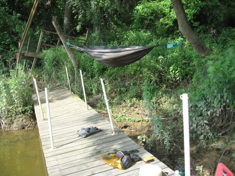
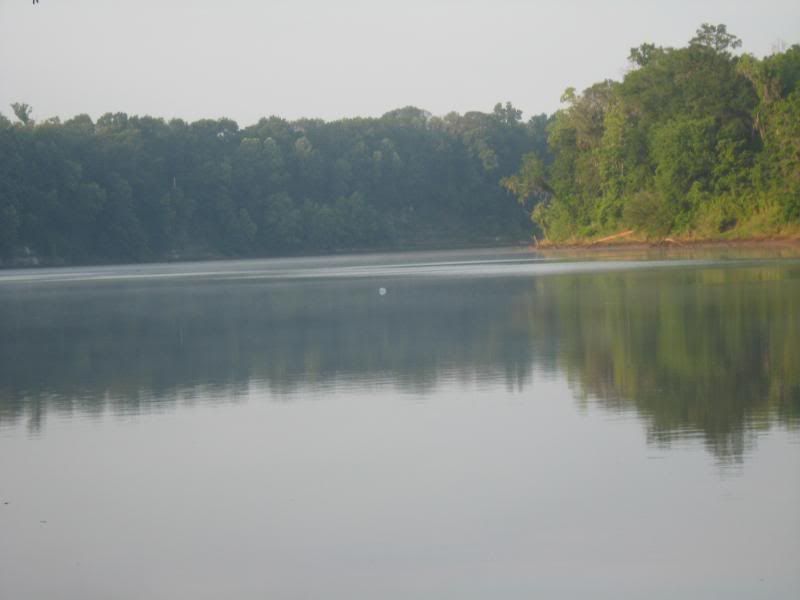
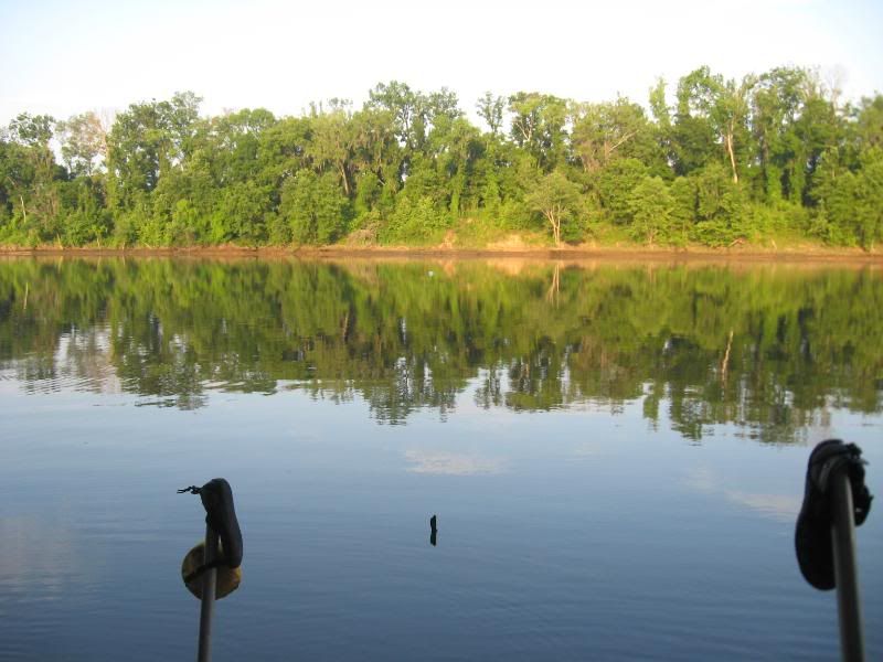
While on the Alabama River last summer, I cleared the Robert F. Henry Lock and Dam and continued down river. I had a tough time finding a suitable place to camp that night and ended up on a floating dock that was at a severe angle due to the lack of water.
As the afternoon turned into night, the water came out and the dock leveled out. A storm appeared to be coming so I reorganized everything back into the kayak before I went to sleep except for my collapsible water job.
Of course, when the water went down over night, it rolled off into the water and I was irritated at myself when I discovered it the next morning.
As I ate breakfast, I thought I spotted it way down the river. OK - I can catch it later in the day. As I got ready to depart, it kept coming back towards me such that when I was finally ready to leave, I had to paddle back up the river to grab it.
Yep - they had shut down the dam overnight and for awhile, the river was running backwards to backfill itself.
That campsite - thank goodness for the hammock:
http://img.photobucket.com/albums/v239/k7lro/Kayaks/AL%20River%202008/Picture074.jpg
You can just make it out here:
http://img.photobucket.com/albums/v239/k7lro/Kayaks/AL%20River%202008/Picture086.jpg
…and even with my site:
http://img.photobucket.com/albums/v239/k7lro/Kayaks/AL%20River%202008/Picture087.jpg
I know of such a stream.
There is a stream that flows in two directions. Its source is on the continental divide. the stream splits and one leg ends up in the Atlantic, and the other in the Pacific. Quite an anomoly. Crossed it on a horse. It’s on Two Ocean Pass in Wyoming, south of Yellowstone Park.
15 beers does that to me too…
“Hudson not a true river”
– Last Updated: Oct-25-09 1:20 AM EST –
Tell that to Henry ;-)
Yes the Hudson is an estuary, but it seems the consensus of most that it is still a river.
Currently celebrating the 400th anniversary of Henry Hudson's journey up said river...