Marks on Your Charts

There are places that are just waypoints marked on your charts and logged into your GPS. Aspirations or maybe just stepping stones. There are some other places that actually matter to you, though, for whatever reason. Crux moves? Places with lots of moving parts? Maybe a place that you approached but nature told you that you would not pass. A place you view as a test of your abilities. A place where you were tested and failed, but now want to retake that test? Places that are marked only on your charts because they are personal?

I would like to hear your stories about those waypoints. What was it about them that tested you? What turned you away? Have you “retaken” that test? Did you pass?

I rarely use a GPS or waypoints, but figuratively speaking there have been lots of them over the years.

Best technical white water in a canoe Trinity River, CA.
Best salmon runs swimming under the boat Sacramento River, CA
Best history Upper Missouri R, MT and the Green River, UT
Most difficult canoeing on a river in flood John Day River, OR
Best wildlife Klamath R, CA and un named river in OR.
Best winter canoe trip Colorado R, AZ/CA border
Best Northwoods Trip, Boundary Waters, MN

We passed all the tests, but some were on the edge of the crew’s ability.

1 Like

And you have always passed. Wish I could say the same. I’m still working on passing some of my “classes”.

Prior to my first 440 mile Yukon River Quest (YRQ) canoe race in 2008, I spent months studying available maps and descriptions of the river. I plotted hundreds of waypoints, calculating best and fastest travel time for a successful winning race. I learned a great deal about big river currents and navigation, and the hope for possible shortcuts outside of the 100 year old accepted published “safe” main channel deep water paddlewheeler routes. During the race I learned which were correct shortcut decisions and which were not good choices as time and distance wasters.

In 2009, for the first ever Yukon 1000 mile race (Y1K), I spent more months modifying the first half of the route, based on my 2008 YRQ experience, plus rational guesses on the second half beyond Dawson for which there is little or no published route data. For the second half of the 1000 miles below Dawson, I chose waypoints and possible out of main channel shortcuts based on a combination of best guess and what seemed to work in 2008, as there was not any reliable documentation or guides on best route below Dawson. I chose a primary “safe” main channel route as well as several possible optional short cuts where they made sense in reasonable water levels, many of which proved useful, some others not so much in low water years. I would choose whether to take the shortcut option or not in real-time, upon inspection of the entry point at arrival.

For the Y1K I plotted 738 GPS waypoints ( less than one per mile) to get me up to into fastest current and/or shortest distance around major turn points and islands, mainly from Google Earth imagery. I used the “fly route” video option in G.E. many times during training while on a paddling machine to memorize what each of the waypoints looked like, which proved to be remembered when actually on the river.

Based on 2009 experiences, I refined the entire route again for another Y1K in 2011, and my team did better still. Additional YRQ races in 2013 and 2017 benefitted from further experience and route modifications.

With route, waypoints, and notes plotted, I printed on computer paper (95 pages for the Y1k), and treated them with waterproof spray to take with me on the races. Placed in protective sleaves in a binder, the pages survived getting wet multiple times at my paddling seat.

I can’t wait to go again with yet another improved route.

2 Likes

That’s awesome!

Well, I have a couple. I’ve paddled the Lower Missinaibi from Mattice twice and haven’t made it to Moosonee by water. Both times the water levels have been low. The first time we had a Kevlar boat alng that was having issues. It had been wrapped some in a rapid on the first day & by the time we got to the Moose it had some problems. Strong winds that day & when a gust would hit the boat would heel over but not push itself back up. We cut a couple of poles and tandemed our two canoes together which worked fine for a while but then we started to run out of water. Camped on a gravel bar (Gilligan’s Island) then bushwhacked by compass bearing for 3/4 mile or so to the tracks and waited for the train. The second time two years ago we were running a couple of days behind the plan and 18 years older. Running a bit low on food and time we took out at Moose River Crossing & took the train back to Cochran to our cars. Talked to some young folk on the train who had made it into Moosonee & they had waded with their canoes for a long ways (maybe 10K?). Lots of ice damage & erosion that had loaded the river with gravel plus its very wide & the flow was low. I’m not sure if I’ll take the retest. I’ll hit 70 in a couple of months.

Some people have aimed much higher and run into some serious challenges. The Rivers of the North in particular are remote, cold, not well known and plenty difficult. We have not taken the hardest classes, but that is because I have had some inexperienced on my crews consistently. I feel fortunate that we did not lose anyone on the John Day R in flood. It was an important lesson to learn.

The other experience on the edge of what we could handle was Basswood Lake in the Boundary Waters, the largest lake around. The wind was a steady 25-30 knots with a lot of fetch. Large rolling white caps were a challenge in loaded canoes.

I will now sit back and read more exciting adventures from this excellent group.

1 Like

Love it… We had a similar experience in 1996. We had just about run out of water when arriving at Moose River X ing. The river was so low that we must have added another fifty miles zigzagging across the boulder field and then the sand bars that formed the Missinaibi then the Moose. Hubby kept saying I hate this fing river. We had a Royalex Dumoine so damage was not an issue… We camped at Portage island looking upstream at a totally waterless Mattagami RIver where the the Miss meets it.

We knew nothing would go well from that point on and exited at Moose River Xing. The train of the day was going to Moosonee so that is where we went . We resumed a journey of sorts paddling around that area for the next few days after getting off the train. Luckily we managed to not get our gear peed on. A dog that had been crated for nine hours from Cochrane jumped out of his crate and promptly peed on a pile of groceries that a Moosonee resident had bought in Cochrane.

We met a couple when we got on at Moose RIver X ing and they were going from there to Moosonee with their folding boat.

Its about 70 km between the two points. We saw them four days later covered in mud their folder boat bottom destroyed. They dragged the craft most of the way.

Never used a tracker. They did not exist in 1996 and even now I just use a GPS for confounding mangrove islands in the Everglades.

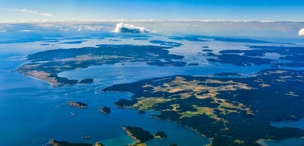
In 2005 I took my first kayak trip to British Columbia. On that trip we camped at Wolf Beach on Calvert Island. Just beyond the westernmost tip on the island the shoreline turns southeast, out of sight, exposed to the open Pacific. I was afraid of everything during that trip and while I wanted to know what was around that corner, I wasn’t about to go find out.

I started using “real” charts after that trip and the corner of Calvert was where I placed one of my first aspirational waypoints. I placed a few more along that shoreline to include “3-Mile Beach”, “Blackney Beach” and “Grief Bay”. Someday I would return.

In 2007 I did return to the coast but our route didn’t take us that far south. It was just as well because I wasn’t prepared for that level of commitment but I didn’t know it at the time.

In 2009 I paddled the Outside Passage from Prince Rupert to Port Hardy with friends. I had plans for incorporating those aspirational waypoints into that trip and had been talking the outer coast of Calvert up to them for 4 years. At that time, I was unable to find out any information about that stretch of coast. If anyone paddled there, they weren’t talking about it. I poured through every book and article I could find to no avail. I posted requests online and only one person provided any information at all and that was only for Grief Bay. Other folks who responded told me that it was a bad idea but they hadn’t done it or knew anyone who had. Google Earth only provides so much info but I was feeling confident and insisted that we do that stretch.

After 214 NM we were camped just inside that westernmost waypoint and up before dawn for an early start. Weather report was good with light winds in the morning rising to 15-20 knots in the afternoon. When I looked at the water, though, I was terrified. It looked really rough to me.

My partner Dave is a more skilled paddler than I am. He spent a lot of time training while I had spent a lot of time just paddling around. He was comfortable with the conditions and I was scared to death. We have always had an agreement that either one of us can veto a route for any reason or for no reason at all.

I played that card because I was afraid, hadn’t done the work and didn’t have the skills. Through my insistence I had talked Dave into the route, put us at this very spot on the planet and now was backing out because I wasn’t prepared. I felt horrible. I had failed. I spent the next three years training in uncomfortable conditions so that I wouldn’t disappoint Dave, myself or anybody else when and if I could return.

In 2012 I was on a solo trip from Klemtu to Port Hardy and camped at Wolf Beach. In the morning I rounded that first waypoint into conditions identical to those that had frightened me so thee years prior. For two days I paddled in utter isolation on moderate seas, greenwater up to my elbows and under brilliant blue skies.

It took me 7 years to turn those aspirational waypoints into reality.

2 Likes

I have done only one sea kayak trip in salt water in the San Juan Islands of Washington. I had two strong paddlers for companions. We left from Anacortes and it became obvious in the first hour how different the trip was going to be. We paddled past some ocean going ships in the harbor and then ran into the wake from the Washington State Ferry which was 4-5 feet.

The tidal range in the Islands is much lower than up by Ketchikan, but because of all of the bays and islands and inlets the rips can be 8-12 knots in Deception Pass nearby. Reading the tide table takes a lot of interpretation. It is like a chess game with Mother Nature. Out in the main channels rips can appear from out of nowhere to 3-4 foot waves.

In August the water temp was 55 degrees so we wore wet suits. We circumnavigated Guemes Island and a few smaller islands. There was an overlook about 1,200 feet on the Island which allowed a good look at Haro Strait which is exposed to the Straits of Jan de Fuca. Haro Strait has ocean going traffic and notably barges pulled by tugs on long cables. We stared at Haro Strait several times but decided not to make 4 mile crossing.

Lots of salmon and sea lions swimming under the boat. A great place to camp. We had some serious rain and some guys from Alaska showed up that had just finished working the salmon boats for the summer. They built the tallest lincoln log fire I have ever seen and we could feel the heat through our wet rain gear.

The return leg into Anacortes had confused seas and lots of large power boat traffic. After paddling for a week everyone had good bracing skills and the waves washing over the deck seemed like no big deal. I would still be leary about making long crossings in the fog with ocean going ships. I will probably never take that class.

1 Like

The San Juans are probably the most well known kayaking destination in Washington State. Consequently they receive a lot of visitors, many who are not prepared from a skills, equipment or knowledge standpoint. The waters there are everything you said but, still, you find folks out under dressed in rec boats not understanding the dynamics of the situations that surround them.

It sounds like the week long trip you took was a good introduction with talented partners. It’s a lovely area, easily accessible and far from deserted. Lots of people, boat traffic and private property.

The area is an incredible location with dynamic waters, marine wildlife and stunning vistas for “prepared” for folks like your group who came prepared. None of my charts have waypoints marked in the San Juans.

3,
The area gets high visitor use in July and August when all the PNW people are looking for the sun. I have spent a lot of time on big power boats and sailboats in the Islands, often flying into Roche Harbor on San Juan Island.

Other times of the year it is pretty quiet. Even months like May and September and relaxed and do not require reservations. Our trip was in September. All of the camp grounds had plenty of room. There were empty buoys around on DNR locations.

I have spent time in the winter on Orcas Island in my uncle’s cabin that he built. Then the whole area is really quiet. Deserted even.

I like the daytrip option of paddling from Anacortes to Friday Harbor and ferrying back

1 Like

I like your enthusiasm. It is about 27 miles one way. That means you would be against the tide part of the time. Sounds more like 2 days to me.

I think it works out to ~25 miles but is reasonable due to currents. Leave Anacortes on an ebb to the south end of Lopez and wait for the turn to flood then travel north-ish through Cattle Pass and San Juan Channel to Friday Harbor.

A few moving parts and at some point you will probably have some wind against current. The tide race at Cattle Pass can get big on a large exchange. Note the flow through Cattle Pass.

If you say so. This is why you are the King of the Coast 3.