I’d like to paddle the coast of NC and have been talking with local paddlers for local info. One said “you know you’ll be paddling around three capes on your journey”. which kind of threw me. I’ve paddled and played about Cape Hatteras a bunch on good days, and have sat in the truck with the windshield wipers on on bad days and seen stuff on the water that I would only do with a bunch of other fairly experienced paddlers, so the judgement issue is sort of covered. And I’m also looking at Cape Lookout and Cape Fear. Heck, the placenames alone give me the heebyjeeby’s. So far, from talking with a very experienced paddler in NC, I was told to paddle the Capes at high tide and watch out for the shoals- simple enough. My question to the group is if anyone has additional insight about paddling about Cape Hatteras, Cape Lookout, and Cape Fear. Obsessive local information is welcomed. Thank you and cheers---------------------Kevin
Cape Lookout
I've paddled in the vicinity of Cape Lookout quite a few times. It's very nice. The next inlet down... be careful. Beaufort Inlet. I'd definitely try to do Beaufort Inlet at high tide. Very strong current and lots of traffic.
I've never paddled at Cape Fear but I recently had a conversation with a guy who piloted a small boat in that area. He said the water got pretty wild and the traffic was pretty thick where the Cape Fear River meets the Atlantic. Probably good to travel there at high tide.
If anyone can handle the capes you can!
Come on, Kevin, I know you can handle it. Just keep an eye out for the weather and round the capes at high tide. The shoals of Cape Lookout go out quite a ways, but there are a couple of spots fairly close to shore where you can slip through.
The waves at Cape Lookout NP north of the cape dump pretty hard right on the beach. Once you round the cape it isn’t very far to the bight. There is great camping right there and it has protected waters. If you get scared rounding the cape you can always paddle down the soundside of Shackleford Banks ;-).
If you plan on stopping at Ocracoke (which is a good idea since it is the last place for water for a few days) you can paddle across the soundside of the inlet to Portsmouth. Technically not a cape, but it can get kinda rough.
When are you going and can I come along to play?
Cape NC
watch out you don’t get too near the inlet when y0oouVe got tide running one way and a stiff wind the other, but the abandoned village of Portsmouth is a neat place to go, http://photos.imageevent.com/dgb8363/ncsounds/ghosttown/websize/Phshed.jpg its maybe 3 miles across the inlet from Ocracoke, you can launch behind the ferry terminal. Anothe 10 or 12 miles past Portsmouth will put you at the Cedar Is. ferry terminal where you can catch a ferry back to Ocracoke. You need to stay well off from Core Bank, the water gets unbelievably shallow near the bank. There is a boat landing on the east side of the Ferry dock, but it would be closer to land on the west side near the terminal.
On the way south eat at Cox’s family restaurant in Moorehead City, on the ocean side of the main road through town.
Never been outside at Cape Lookout other than paddling around Shakleford Bank which is a neat place unless its tourist season, you can launch in Beaufort at the landing on the north side of town.
Cape Fear>? They don’t call it Cape Fear for nothing. http://photos.imageevent.com/dgb8363/capefear/62102/websize/CFearNlet.jpg Again, check your tide table before making plans and evaluate conditions. The bar next to Bald Head Is at the inlet is a good place to play when things aren’t too rough. (I have never paddled there, but spent some time there on the old Hobie Cat)
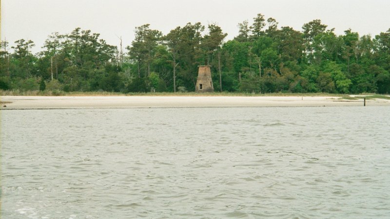
Cape Fear River is an interesting place - pic is of an old lighthouse on the river.
http://photos.imageevent.com/dgb8363/capefear/cfearmar/large/014_14.jpg
You can put in at the ferry terminals at Ft Fisher or Southport, downtown Southport, or Carolina Beach state park. Old Brunswick town and fort Anderson are directly across the river from the State Park. there is a good sand beach launch spot at the edge of the parking lot, ;you don’t have to use the ramp. tide tables ar a way of life in these p[arts, you can paddle like crazy and go nowhere if you time it wrong. Check conditions carefully and enjoy.
I wrote a response on the other forum
where you posted, but I’ll post it here too.
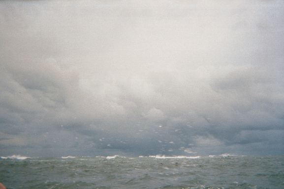
On Cape Fear: there can be very strong currents, (between 3 and 6 mph) depending on the tides and wind.
Also the crossing from Bald head Island to Oak Island is the main shipping channel for NC with large freighters entering the Cape Fear River.
With that said: if you are an experienced paddler you should not have any problem.
Cheers,
JackL