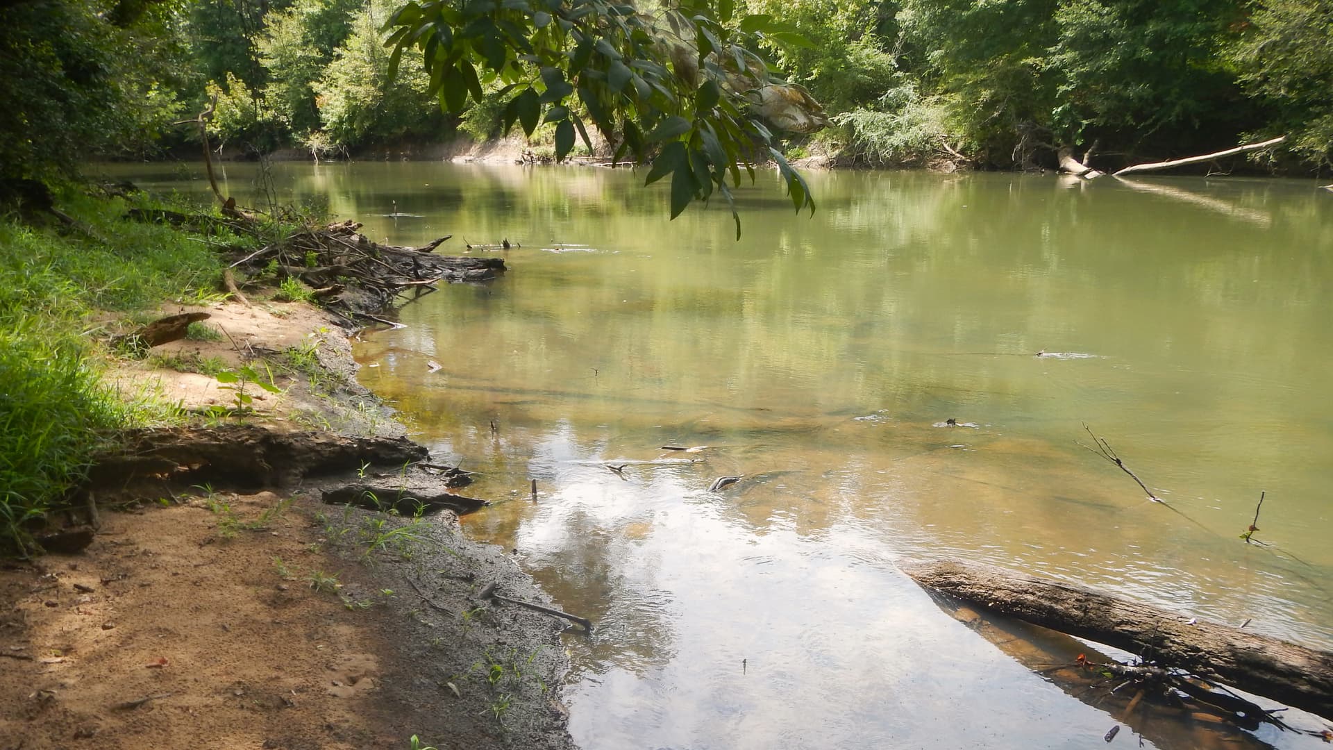
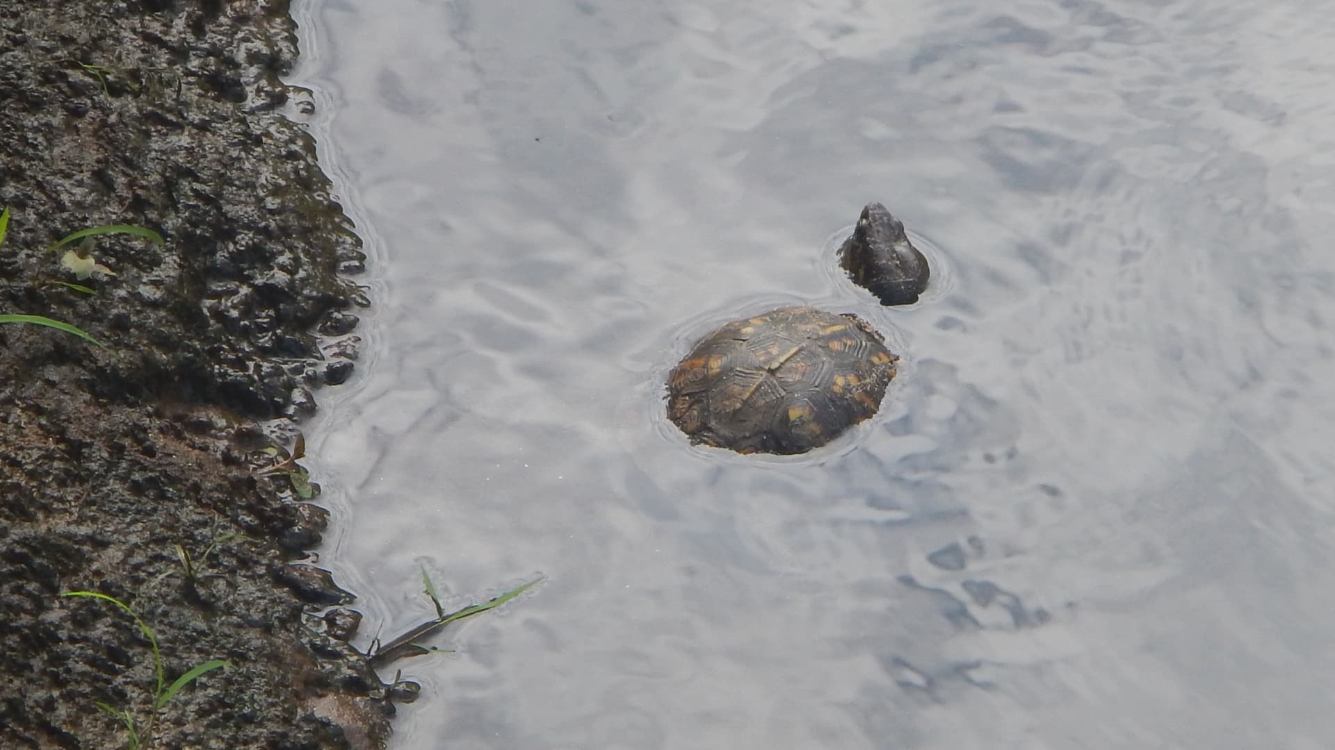
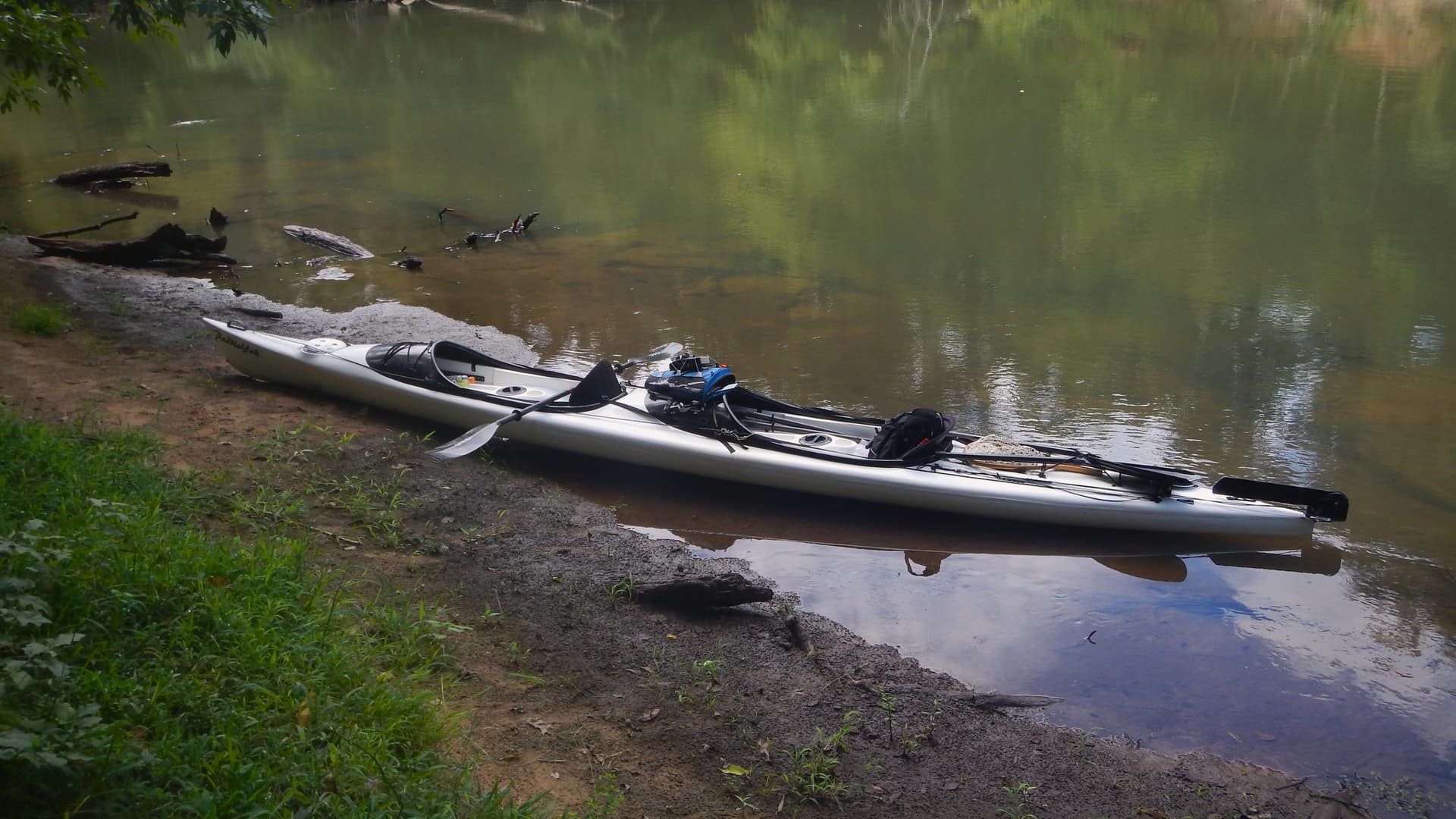
Frank quit the ranks of the retired and went back to work about a year ago. As a result, we don’t paddle and fly fish as often. It was good to get together last Friday and paddle the tandem kayak. We put in at Chappel’s boat ramp and paddle up stream. I knew we would have multiple shoals to paddle against. We paddled up a couple shoals before stopping for lunch. Commenting on the serenity that can take hold of the mind by simply watching the water flow and observing (now the cliche) “wonders of nature”, but it’s true. As proof of our assertion one such wonder was a box turtle enjoying a soak in the water at the river’s edge. It seemed unperturbed by our presence and had a most serene countenance on its beaked face as it watched the river flow.
After lunch the uphill paddling began as the shoals became more frequent and drops a bit steeper with the relatively flat-water sections shorter between the drops. We finally turned around after just barely making headway against the last shoal we would paddle up that day. On the way back it took one hour to cover the distance which took 3 hours to cover paddling up hill.
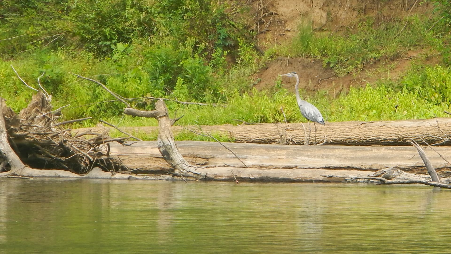
We saw a Bald Eagle not long after Frank said he would like to see one. Sometimes the stars line up, or perhaps it was the clouds lining up this day instead. We saw the ever-present vultures circling on the up drafts above us. I’m sure they are thinking we look close to the finish line. Kingfishers would do their rattling call as they flew across the river. The Great Blue Herons did their classic fly before we get too close.
The high was 84 and partly cloudy, the humidity was in the 80s dropping to the high 50s and the breeze was a pleasant constant. The day was a good workout and a balm for the soul spent with a good friend.
Sounds like you had a great day paddling with your friend. I try and explain to friends and family the positive mental aspect of a day like that and non paddlers don’t always understand the feeling.
As to padding up hill the good part is whatever goes up must come down. It is always a good idea when paddling from point A to point A to do the hard direction first up hill or into the wind.
Yesterday I paddled with some friends around Capers Island, I believe an area you are familiar with. We took some wrong turns through the salt marsh side, but even the backtracking was pleasant. Eventually we found our way to Price Inlet, had a nice lunch, and paddled through the ocean back to the other side. Then back through some creeks to our launch point.
It was a beautiful day for it, and timed very well with the tidal currents. A great blue heron actually allowed us to get fairly close before flying off as we paddled past.
One thing I found disturbing is a single dolphin which surfaced 3 times next to me not more than 8 feet away. The disturbing part was this big tracking device attached to its dorsal fin. A big ole box like a large remote control, and then a wire antenna extending off from it. I noticed this on a dolphin last weekend. I’ve never paid much attention to these tracking devices, but seeing these up close in nature, I cannot see how they would not have a significant detrimental impact on the dolphin. I can imagine it being something like an unbreakable dinner plate being attached to my ankle so that every step I took it was dragging against the ground, tugging and jarring at my ankle, and altering my balance. And I can imagine other people keeping their distance as they observed me approaching with this conky thing dragging from my sore ankle.
I can promise you that this dolphin is not ok with this situation. It was clearly far too significant to not have an effect. Is this practice really ok?
Yes, Capers Island and the surrounding marsh is one of our coastal paddling/camping spots. There are two put ins that can put you in the area. The one we use when we camp on the island is the Isle of Palms Marina. Sounds like you came from there. The other is the GadsdenvillePublic Boat Landing at the end of Gadsdenville Rd. This one is a free dirt landing at the end of a small marsh creek. Be aware it can be dry at low tide so time a trip accordingly. This is about a 3-mile paddle out to Capers Inlet. We haven’t left our vehicles there overnight preferring the safer marina parking for that. We prefer Camping at the Price Inlet end of the Island but have done a mid-winter camp at the Dewees Island end before. Otherwise, it can be crowded. You need a permit to camp on the island and they limit the number.
We used to launch to camp at Price Inlet from Garris (Moores) landing where the Bull Island ferry takes people over to the island for day trips. Overnight parking is prohibited they lock the gate at 9. However, we could park at a local house for $20 bucks. that is no longer available. We do use Garris for day trips out to and around Bulls Island. Working the tides is the way to do it. Those marsh creeks especially between Capers and Garris Landing can be confusing at water level.
A paddle around Bull Island is another favorite. We have done that from our camp on Capers at Price Inlet and from Garris Landing and back.
I haven’t seen those tags. I feel sure you are right about the animal having some impact from it. I know some tags are meant to record environmental data etc. and release from the animal at some point in time. There was an unexpected die off of Bottle Nose Dolphins a few years back We saw a couple washed up on oyster bars and creek banks. The head was removed from one, I assume to look for ear parasites or other possible causes of death. I wonder if the tag you saw was research in regard to that.
I band birds, not dolphins. I can say that the issue of what effect the band or other device may have on the bird is an important one, and researchers that I know take a lot of time considering that and waiting until they have that sorted before trying the bands (or whatever), and observing to verify the device is not have a negative impact on the birds behavior for the experimental first few birds.
Don’t forget that if the device changes the behavior, it probably results in poor data if the objective was understanding the animals behavior. I cannot comment on the dolphins you saw with devices, but hopefully, this had been sorted out correctly. You could, if concerned, try calling the Marine Mammal Stranding Center for your area, and ask them about it. While they are probably not doing the research, they may know of it and have some insight that could help you understand. they are usually good people to talk to, in my experience.
Thanks for the information! We launched from Gadsdenville Public Boat Landing. One of my friends there said on a spring tide day (which yesterday was - new moon) and probably with some help from onshore winds, she came back at high tide to saltwater just about halfway up her car wheels. High was < 6’ yesterday, with light winds, so it didn’t rise onto the road/parking area.
Dewees Island is just to the SW of Capers Island, and Bull Island is just to the NE of Capers Island. Capers Inlet separates Dewees Island and Capers Island on the SW end of Capers Island. Price Inlet separates Capers Island and Bull Island on the NE end of Capers Island. We paddled from The Gadsdenville launch towards Capers Inlet, which is about 3 miles away, but then followed creeks to the NE end of Capers Island to Price Inlet. We paddled out of Price Inlet, paddled through the ocean SW along Capers Island, and back into Capers Inlet on the SW side of Capers Island. Then we paddled the creeks back to the landing.
There were only a few boats on the NE end of the island between Capers and Bull. There were a good number on the SW end between Dewees and Capers, but definitely nothing close to crowded. Only a couple of tents given the beautiful August camping weather. I was wishing we had called in for a permit and brought tents.
I look forward to exploring north along Bull Island and going up around Cape Romain!
I grew up visiting the Cape Romain, Bull Island area. My Dad was a USFWS warden out of Charleston and he patrolled that area frequently. I still have a little pluff mud in my blood.
Yes, that is correct on all counts about Capers Island.
There is now a $100 annual ramp fee to launch, and no guaranty of parking at the McClellandville ramp. I have always found parking on the weekdays. This is where I put in for overnight camping. We have paddled just about every marsh creek in the area. The only islands you are allowed to camp on are Cedar Island dividing the mouth of the North and South Santee Rivers and Little Murphy Island. There is a ramp to the east of Hwy 17 to put in on the South Santee that is public. I haven’t left a car there overnight yet.
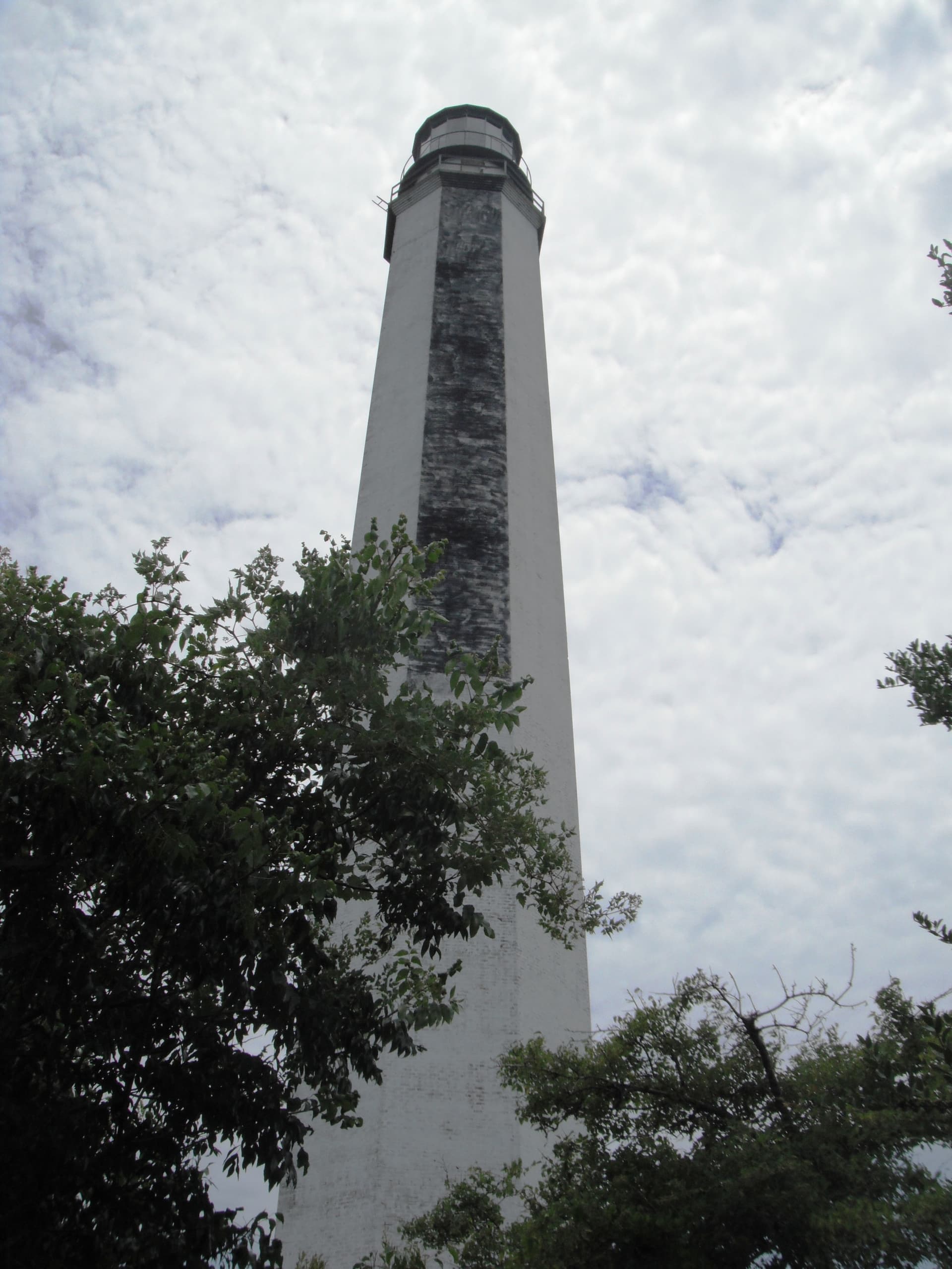
There are two abandoned Light Houses on Lighthouse Island. It is best to be near high tide if you want to walk up to the lighthouses. At Low tide there is an extensive mud flat.
On the tip of cape island Skimmers and Least Terns nest, and about 30% of all loggerhead turtle nests in SC are found on Cape and Lighthouse Islands.
Buck Hall campground on the ICW has a ramp with fee for launching. you have access to Bulls Bay and Awendaw creek has a free canoe and kayak put in of a long ramp with rails and a 90-degree turn and ramp down to a dock to put in from. I have seen gators in this area and even in Alligator Creek out near where we camp.
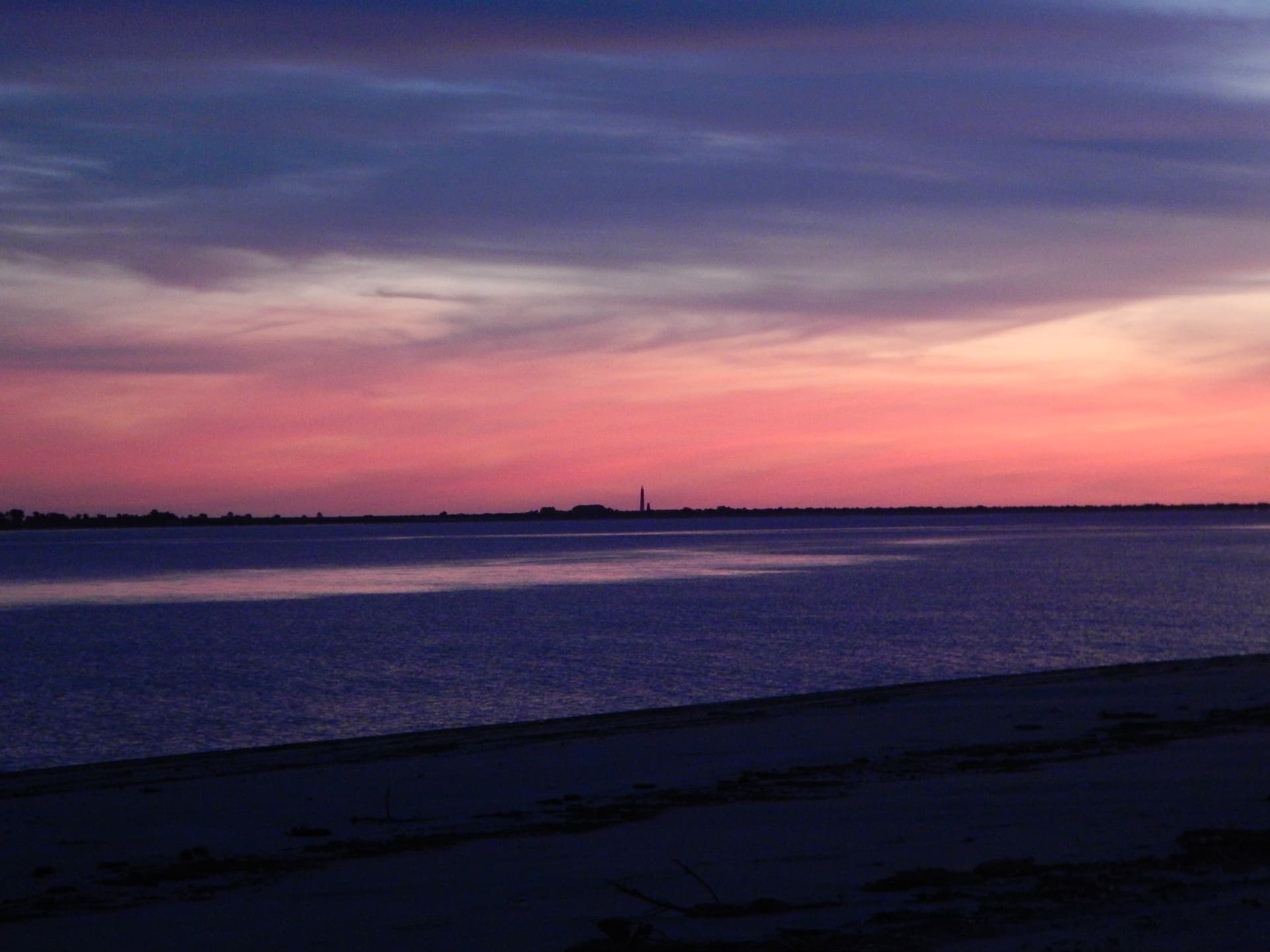
This is undeveloped wild coastline. A few Photos of the area.
Drone shot of Little Murphy Island’s Atlantic facing beach looking toward the mouth of the South Santee River and Cedar Island. The wetlands behind the island are the remains of the vast rice paddies that were destroyed by the damming of the Santee River preventing spring flooding to fill them with fresh water.