Cross-posted on alexsidles.com
Point Roberts is an American exclave, surrounded on three sides by water and on the fourth side by the border with Canada. In normal times, the drive from Point Roberts to any other part of Washington State requires crossing the border twice: once into BC at Tsawwassen and thence back into Washington at Blaine.
In pandemic times, this route is not available due to the border closure. The people of Point Roberts are cut off!
Boats can still reach Point Roberts by crossing Boundary Bay. As further enticement for a visit, Point Roberts is home to the northernmost campground on the Cascadia Marine Trail, and also the most isolated: the Point Roberts Lighthouse Marine Park.
The people of Point Roberts hadn’t seen a tourist since April. I thought they might appreciate seeing a kayaker in November.
I launched from the public beach at the tip of Semiahoo Spit, the closest land access to Point Roberts. From Semiahoo, the distance to Point Roberts is a little over eleven miles (18 km), or fourteen miles (22 km) to the campground at Lighthouse Park.
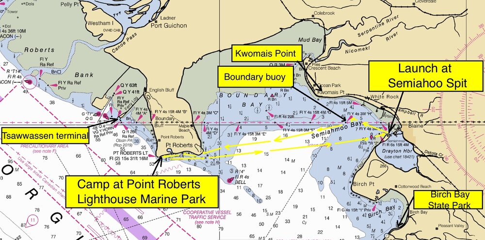
Route map. Boundary Bay is wide but very shallow.
To get an early start on Saturday, I drove up Friday night after work to camp at Birch Bay State Park, one of the most attractive car-campsites in Washington.
Birch Bay is home to a black color morph of the eastern gray squirrel. No doubt these individuals dispersed south from the famous black squirrel population of Stanley Park, introduced from the east coast in 1911. Black squirrels may be pests in BC, but they are still a novelty in Washington. Birch Bay is the southernmost extent of their range.
A dawn stroll through the park yielded only two squirrels, both ordinary gray color morphs, not black squirrels. Still, the walk was not wasted. The forest at Birch Bay is one of the most diverse in western Washington, both in terms of species composition and age class: a late-successional, second-growth forest, characterized by Douglas-fir, western hemlock, and grand fir, with abundant, mature red alder, big-leaf maple, and black cottonwood, and even a handful of old Sitka spruce. Leaves were falling like rain in the November wind, carpeting the road in the portions of the campground that were closed to cars for the season.
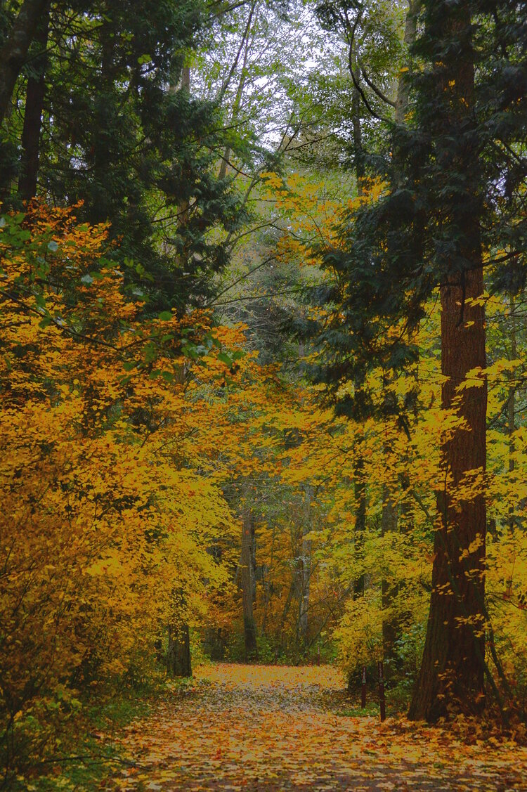
Birch Bay forest walk. Colors of the black cottonwood, vine maple, red elderberry.
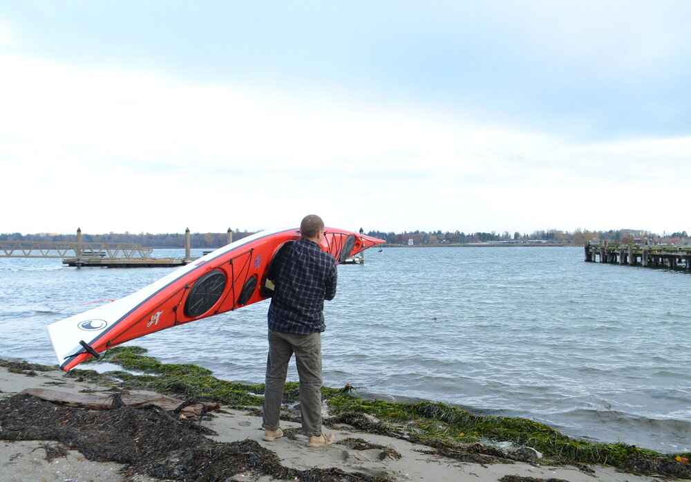
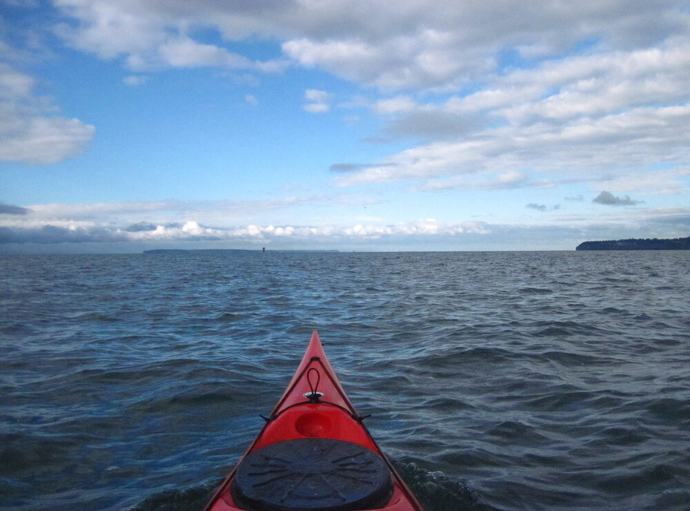
Launching kayak at Semiahoo Spit. At the very north end of the spit is a tiny public beach adjacent to a free, overnight gravel parking lot.
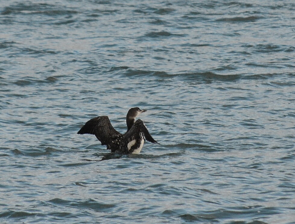
Common loon, Semiahoo Bay. Loons, grebes, and sea ducks were the most common seabirds in the bay, with smaller numbers of alcids and gulls.
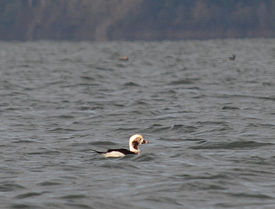
Long-tailed duck, Semiahoo Bay. Unusually for Washington, long-tailed ducks were the most numerous sea duck species after scoters on this trip.
Crossing a large bay should not pose a navigational challenge, but I still managed to wander off-course when I mistook nearby Kwomais Point, BC for distant Point Roberts.
From the water, the peninsula connecting Point Roberts to the mainland was below the horizon, so Point Roberts looked like an island. I mistook it for one of the San Juans. Operating under the misapprehension that Point Roberts was an island, I figured Kwomais, an obvious peninsula, had to be Point Roberts.
I didn’t realize my mistake until a fishing boat that had been poking around the BC shoreline suddenly started dropping nets right next to me. “Well, either he’s on the wrong side of the border, or I am,” I thought.
A short distance ahead, a boundary beacon confirmed the truth. I had crossed the border and had been paddling ever deeper into Canada. What had seemed like a distant island on the horizon to my left was actually my destination.
Paddling toward Kwomais Point. The near landmass on the right is Kwomais; the distant landmass that looks like an island is actually Point Roberts.
Boundary Bay boundary beacon. According to the official nautical charts, the “H” stands for, “Hey, you’re on the wrong side of the border.”
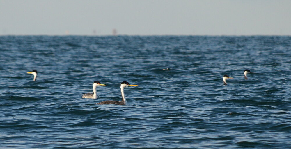
Western grebes, Boundary Bay. These were foraging in flocks hundreds strong throughout the central reaches of the bay.
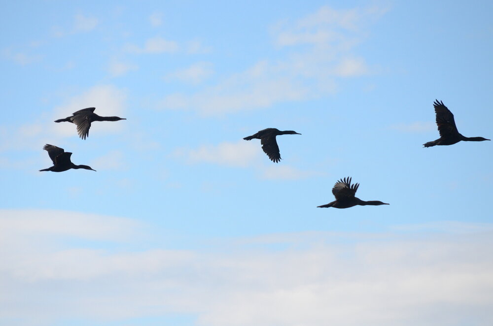
Cormorants over Boundary Bay. Brandt’s were the most numerous species, followed by pelagic. I saw no double-crested.
The search for squirrels delayed my start long enough that the strengthening Fraser outflow caught me still on the water in the afternoon. Wind kicked up to fifteen knots. Whitecaps and small breakers pocked the surface of Boundary Bay and the Strait of Georgia. I had forgotten my drysuit at home, but my new British sea kayak was so well behaved in the chop that my shirt didn’t even get wet.
A long cobblestone beach marked the landing at Lighthouse Park. The uplands consisted of grassy fields and Nootka rose bushes: perfect habitat for a northern shrike. I spent the waning afternoon hours birding on land.
Even though Lighthouse Park enjoys Cascadia Marine Trail status, signs at the park said the campground was closed for the season. When I knocked on the door of the ranger’s house to ask about a special dispensation for a stranded kayaker, there was no answer, nor when I called the ranger’s number on my cell phone. There wasn’t even a pay box where I could have deposited a fee.
I assumed the good people of Point Roberts would be less keen to welcome their exotic guest if they saw him camping illegally in their park, so I waited until dark to set up my tent, not in the campground where a patrolling ranger might catch me but right on the beach, like a real kayaker.
To make up for my bad behavior as a guest—and to spare myself cooking a pathetic dinner, huddled over a campstove in the merciless northerly wind—I walked a mile up the road to Kiniski’s Reef Tavern for burgers and beer. I was the only non-local in the bar.
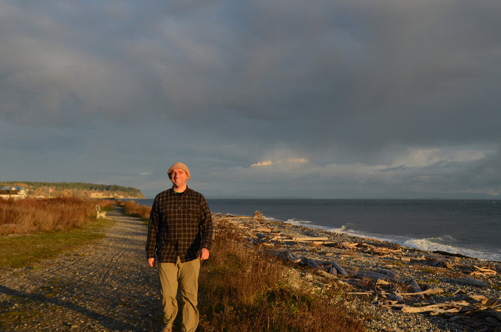
Hiking at Point Roberts Lighthouse Marine Park. Even in the afternoon, there were only a handful of other visitors.
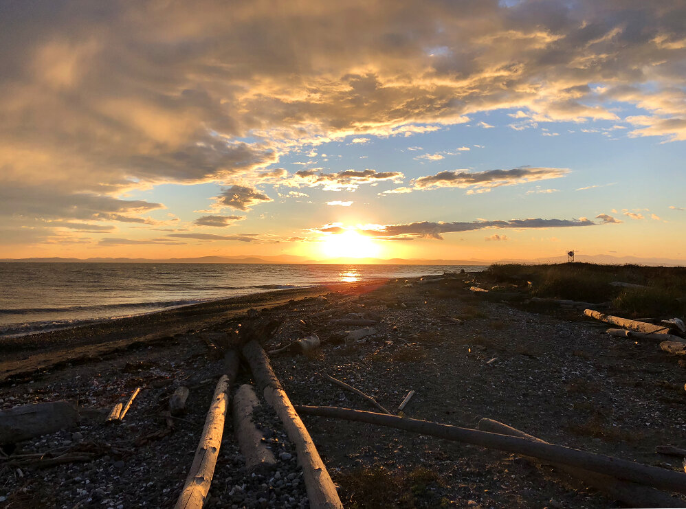
Sunset at Point Roberts. The view across the Strait of Georgia made me want to keep paddling right on to the Gulf Islands.

Dawn at Point Roberts. Light from the lighthouse flashed on my tent walls all night, but I was too tired to notice.
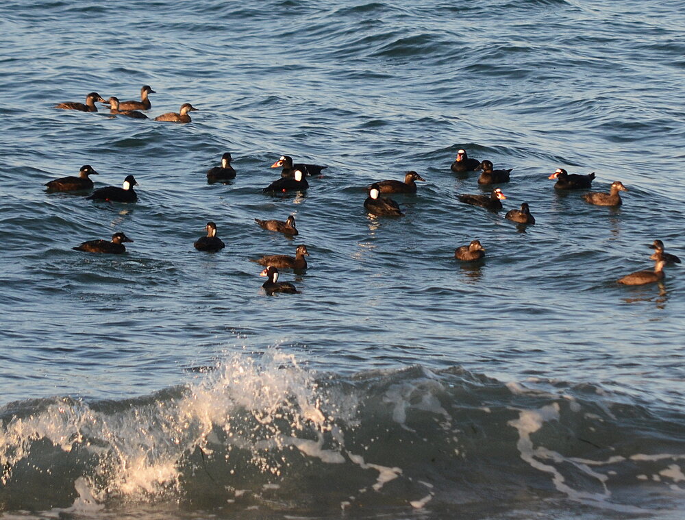
Twenty surf scoters and five black scoters. Thanks to its position far out in the Strait of Georgia, Point Roberts is a magnet for seabirds and marine mammals.
In the morning, the fifteen-knot northwest wind had diminished to a five-knot northeast wind, a fortuitous shift that spared me from breaking, following seas. Unfortunately, I caught the tides in the worst possible configuration: an adverse westerly flood in the western half of Boundary Bay, followed by an adverse westerly ebb in the eastern half of Boundary Bay.
Even in the face of such gentle wind, the fourteen-mile return trip took five and a half hours against the current. Pages 6, 7, 8, 38, and 39 in the Current Atlas would have illustrated the problem of the shifting current directions, but I had no more thought to bring my Current Atlas than I had to check my GPS before proceeding blindly across the international border.
The only thing to do during a long crossing against a merciless current is accept your fate and enjoy your surroundings. The ancient murrelets were even more numerous today than yesterday, and the mountains came out from behind the clouds on all sides. Few boats or planes were abroad so close to the border, so I was alone with the waves and the birds—just where I like to be.
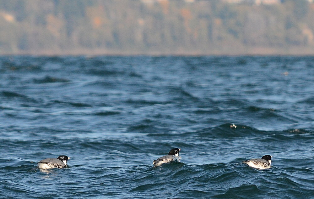
Ancient murrelets, Boundary Bay. These winter visitors are less shy than the marbled murrelet and even more handsome.
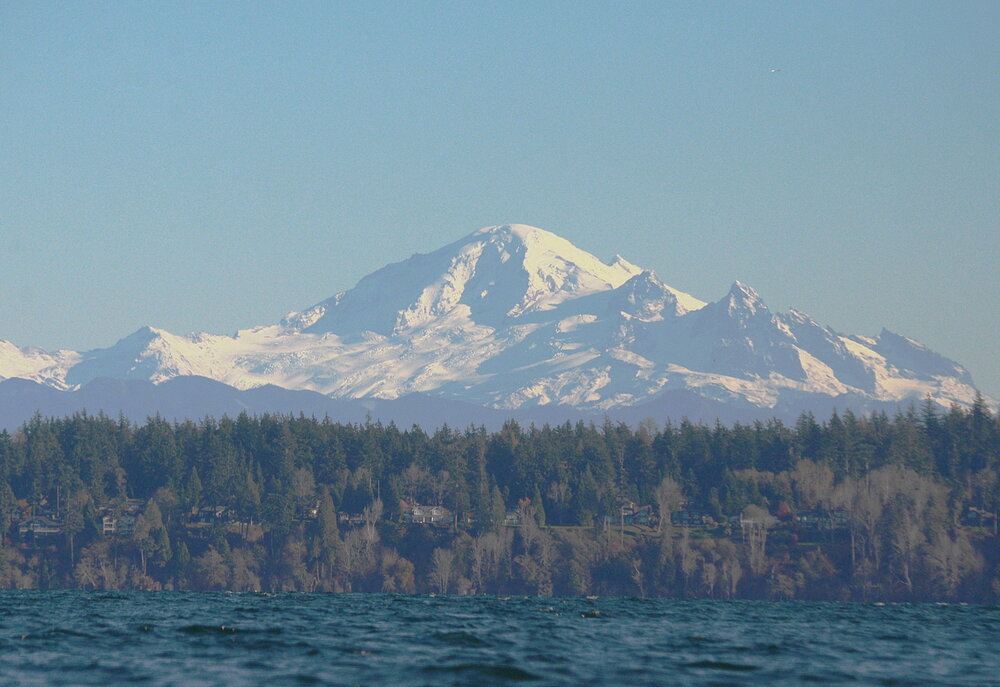
Mount Baker from Boundary Bay. Volcanoes and sea kayaks are a happy combination.

Return to Semiahoo Spit. Old buildings on rotting pilings are a hallmark of the Pacific Northwest.
Just before I departed Point Roberts on Sunday morning, a local stopped me on the beach to ask me about my trip. He seemed to think I might be a day visitor out for a little paddle around the point. When he learned I was going all the way to the mainland, he was flabbergasted. He had been out in his motor skiff the day before in the strong breeze and chop, which had convinced him it would be an act of insanity ever to venture far from shore.
I left this incredulous bystander on the beach and headed out among the seabirds and sea lions, proud to have become one of the few kayakers to reach Point Roberts.
—Alex Sidles