Hopefully the pros don’t hit as many balls into the Paw Paw River.
So we have 2 kinds of tourists this weekend, golf tourists plus the regulars from Indiana and Illinois headed to Silver Beach for the weekend. Temps hitting 90, no clouds, and Lake Michigan water temps for swimming near 70…unusually warm for this time of year due to lots of sun and no wind. You still need a lot of enthusiasm to submerge in 70 degree water.
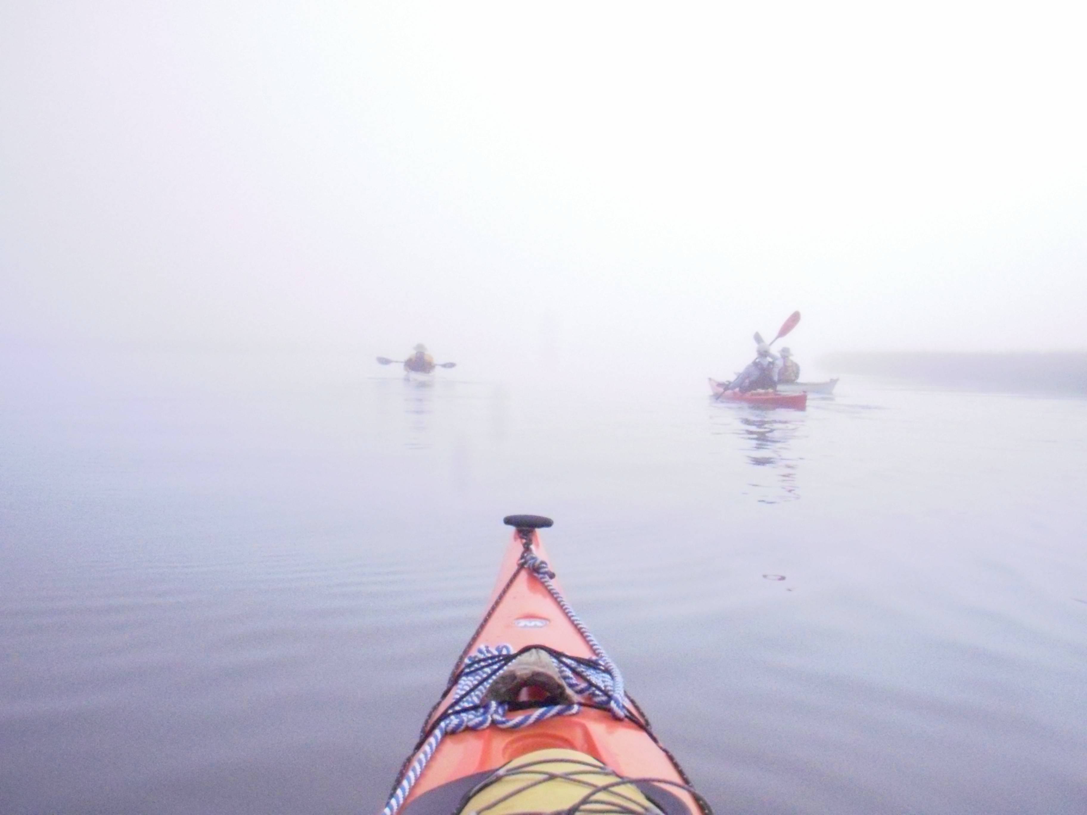
And at the other end of the lake, the buoy report where I planned to paddle read 46F. When I got there, drysuit donned, the air temp was 61F and as I was getting ready to unload my boat I saw a white mist out of the corner of my eye, across the bay. Within minutes thick fog enveloped the entire bay and harbor. It was still there and even along the highway making visibility tough as I headed for an inland lake.
Happy I wasn’t on the water then as it would have been a long, shore hugging trip back…presuming I would have known where the shore was.
@Rookie said:
I saw a white mist out of the corner of my eye, across the bay. Within minutes thick fog enveloped the entire bay and harbor.
If you don’t already have a compass, consider purchasing one. Then practice following a bearing as though you can’t see your surroundings. The next time you encounter fog it will be unnerving but navigable. The few times I’ve found myself enveloped, the compass has always steered me true… with the occasional sanity check from the GPS.
Yes a compass and GPS go with me along with other gear and water every time I paddle. I guess paddling the coast put me in this habit. The only time I don’t have the deck compass is on a river, but I have a hand held with me all the time. You never know when you will be walking out through the woods. Surfing is the only time I don’t have gear in or on the kayak, just a paddle, helmet, and PFD
Using the compass to paddle a predetermined bearing plotted before launching on the chart just in case. It was good to hear the sound of surf on the Island tip as we got close.
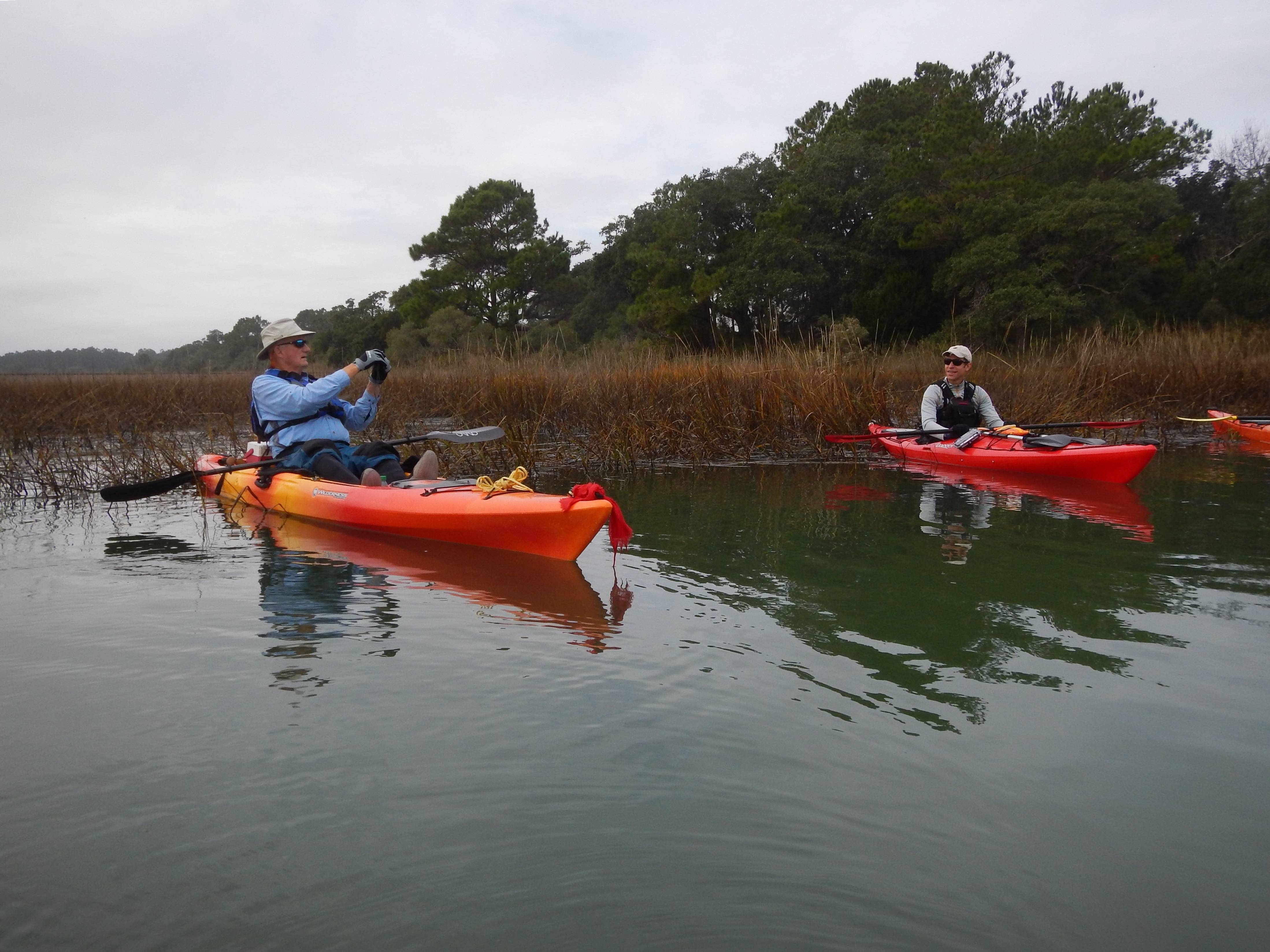
Fog is awesome. Rookie, I think my wife and I could see offshore fog when we went in to town for breakfast on Saturday morning…there was a white band on the distant horizon.
The two mile crossing in fog on a holiday weekend makes me think about the powerboat that went by at 50 mph (twice) when I went down to the river yesterday wondering how crowded it might be. We ended up at a nice safe small local lake.
@TomL said:
Fog is awesome. …crossing in fog on a holiday weekend makes me think about the powerboat that went by at 50 mph (twice)
I was fishing once at the Mayport Jetties. It was foggy. I decided to pull near shore and fish till fog lifted then go out to my spot……. We were 20-25 ft off the beach in 3 ft of water. I heard this outboard coming toward us. A flats boat came out of the fog , on plane, moving fast and passed between us and the beach. We pulled anchor and went back into the marshes.
Using the compass to paddle a predetermined bearing plotted before launching on the chart just in case. It was good to hear the sound of surf on the Island tip as we got close. …………
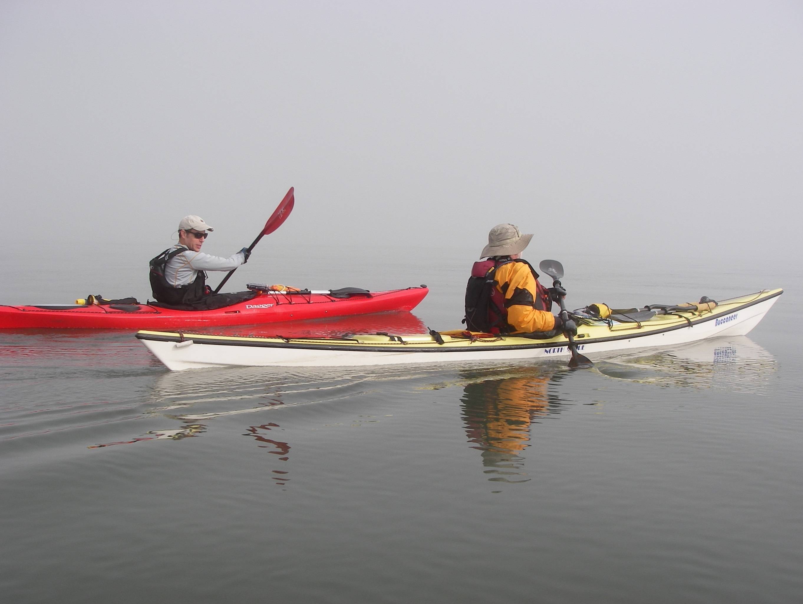
LOL! The compass on Franks kayak is closer to him so he can see it, and therefore not in the photo. I can see mine at the normal distance. You can see it in this photo.
@castoff said:
LOL! The compass on Franks kayak is closer to him so he can see it, and therefore not in the photo. I can see mine at the normal distance. You can see it in this photo.
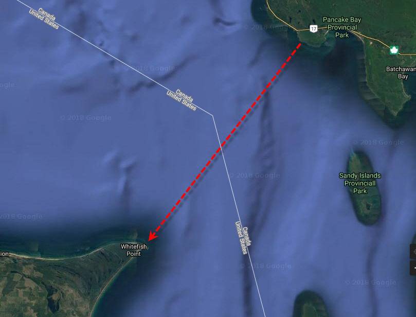
(pre gps days) a little over 15mile crossing from Canada to Michigan (cutting Whitefish Bay), had to be pretty close on the compass heading - or would add a few to several miles if missing, due to the point fingering’ out for quite some distance.
Typically, on crossings using a compass, I would ‘err’ on the side I would heading after crossing. However, on a crossing like this, you don’t want to err, or you may be paddling until the fog lifts and then can see land.
I appreciate the gps technology just about every trip (short or long) I take.