Tony was interested in paddling Sparkleberry Swamp again. I said I would join him and see if some of the folks I enjoy paddling with would like to join us. All had paddled the swamp before. We had 5 total paddling on Wednesday and 4 on Thursday. We camped at Pointset State Park 3 nights and Tony stayed 4 paddling on Tuesday when the rest of us arrived.
Sparkleberry is a shrub that grows in the sand country and high ground surrounding the swamp. It blooms in June and bees make a dark bakery grade honey from it. Water Tupelo makes a superior tasting clear honey in early spring. Water tupelo and bald cypress trees predominate but others are also present on dry land.
Tony wanted to explore areas he hadn’t paddled as did the rest of us. Lisa found a mapping APP and a full version of the hand drawn map from 1973. We have used it to help us orient ourselves in the past. We wanted to over lay our GPS tracks directly to the map for a comparison. What follows are photos and maps of two separate day trips to explore new to us routes in the swamp.
DAY ONE MAP 8.5 mile track.
We failed to find any remnant of Old Sparkleberry Landing. Started to go up mill creek but decided to look for the entrance to Crosscut Creek which we found. However, we seem to have another way up to Moe’s lake where we got into shallow water and had to make several attempts. Our destination was the Santee River which is where we stopped for lunch. We also found a different route than on the map back to the creek connecting Otter’s Flat (the T 2/3 the way up the left edge) back to camp.

An early morning start

Photo by Clint
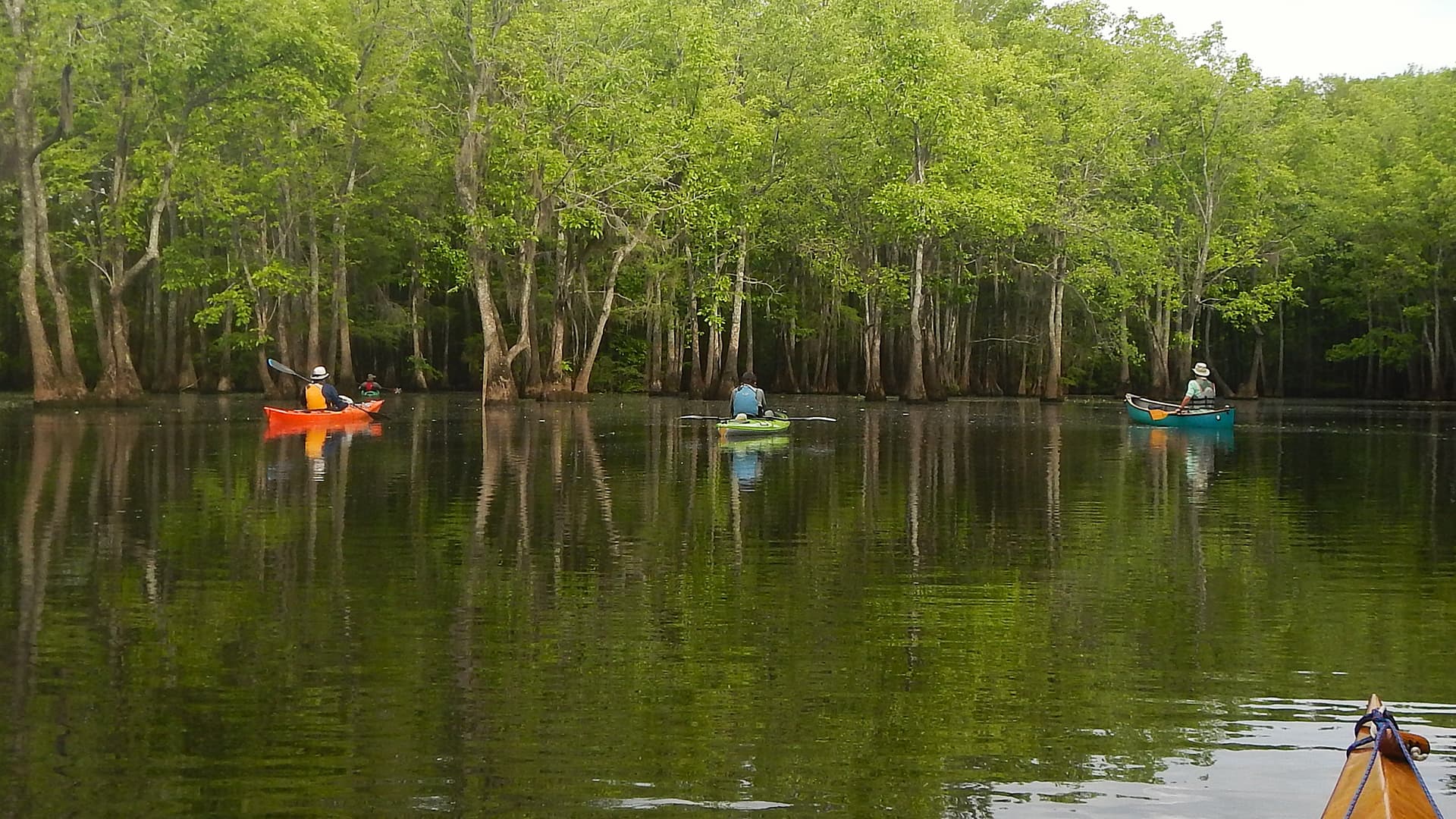
At the kayak landing.

Photo by Clint
Underway
Tony in his traveling kayak that takes apart in 6 pieces.

Four kayaks crossing Sparkleberry Flat

A kettle (not flock) of anhingas. I thought it was a gulp of cormorants until I saw the photos. Clint said it was anhingas.


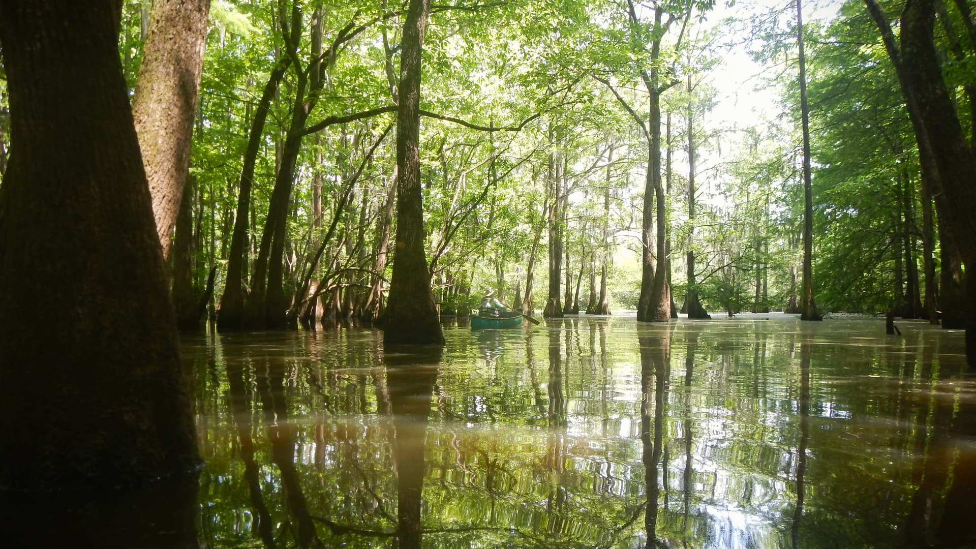
Crosscut Cut Creek.
Bird watchers.

Prothonotary warbler.

Two locals.

A visitor.

DAY TWO MAP 12.5 mile track.
The track from the landing to the top of Jones Flat is well traveled. We initially headed up what proved to be a dead end but found another hunt/fish camp at the red drop pin. We ate lunch and backed tracked to where we picked up a branch that led us up Cypress Gut to Coopers Corner area at the top of the map. This area had no easily indentifiable gut or creek to follow. This situation is common on many of the guts and creeks. However, we did locate Fifty Fools Creek and made our way down to Catfish Gut. We somehow got of this gut and cut through about 100 yards of sawgrass then willow (I highly recommend not doing this.) to get back on track to head back to the landing the way we came. We were on the water by 9AM and off at 6PM.

Hunt/fish Camp

Stretching our legs on an old overgrown road.

A laid back local.

Aqua Silva


I regret not taking a few photos. Never managed to get the white Ibis as they flew by, didn’t think to take a photo of the Santee River, and was too busy bleeding in the sawgrass to think about photography.


