Solo paddled around the island in an Epic 18X kayak. I was guided by a description from a brochure, see page 16: https://www.visitdrummondislan… The trip involved three nights of bush camping on state forest land, dark green on the map.

Basic stats: Ft Drummond Marina to Long Point 17.2 miles. Long Point to Glen Cove 13 miles. Glen Cove to Chippewa Point 14 miles. Chippewa to the marina 14.5. Average speed 4 mph.
Beautiful area. The water is clear and you can easily see boulders and bedrock 20 feet down. I saw loons and bald eagles, and saw and heard loons every day. The shoreline is almost entirely broken limestone rubble, very unfriendly for landing a composite kayak. Turns out most of the protected waters are private land, so when when waves are coming onshore landing options are few. The brochure description covers four of the few possible choices for landing in waves without scraping up your boat. The shoreline has conifers and deciduous, with white cedar and birch predominating, white pine and larger deciduous inland. Parts of the shoreline had cottages, most of them hidden in the trees and none with docks on the rubble shoreline. Most of the time nothing man-made was visible.
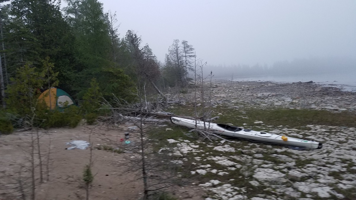
On day one I drove up from the Detroit area and paddled from the Ft Drummond Marina, starting in fog at 12:30. I should have stayed somewhere and started early the next morning, but predicted winds put the island’s south shore in the lee. The marina charged $4 for launching and $5/day for parking. The wind picked up from the SE and made for a wet and tiring paddle later on. I did find an island to pit stop at. Shallows extend well out from the points on this south shore, a must to avoid in waves. The west side of Long Point was calm and I pulled in on rock rubble and a sort of limestone pavement shoreline and made camp.
Day 2 dawned foggy and calm; it soon got sunny and hot. I had a leisurely paddle to Glen Cove and saw a pair of otters frolicking suspiciously near a fishing net. I passed a dozen or so nets during the trip, marked on either end with flagged buoys. I passed Pilot Cove where I saw my first beach, but it featured a pickup truck. Glen cove has a sandy beach where I camped and spent the afternoon. 4-wheeler rentals are a big business and there is a dirt parking lot a hundred yards for the beach. During the afternoon the beach was visited by maybe a dozen families, all quite friendly. Ford also had some kind of PR program going with Broncos - there was a luxury (even had AC) restroom trailer for the reporters. There was a big far-off thunder at noon that turned out to be blasting from a limestone quarry 10 miles away. Also lots of flies at the beach.

A big blow was forecast for day 3 so I was paddling in calm water before sunrise. This close to the solstice sunrise was almost north.

The shoreline was super scenic, including not just rubble but bedrock in places. Still, none of the steep cliffs dropping into the water like the same Niagara limestone that you see on the Bruce and Door Peninsulas in Ontario and Wisconsin. The Fossil Ledges area seemed to be made for getting in and out of a kayak, with flat bedrock six inches up next to deep water.

I reached Chippewa point at 10:30, passing only a handful of houses on the way. The only boat I saw was a couple of fishermen in a runabout at the point. It looked like Grand Marais would be a well protected spot to camp also.

I had lunch and considered continuing to Mare Island but the blow hit and in a period of 5 minutes the lake was covered with white caps. Turned out to be a beautiful place to camp, with entertainment provided by seagulls and deer. I had to pitch the tent in the trees to get out of the wind. Good thing was no bugs.
There was a breeze at dawn day 4; again I departed before sunrise, this time into small waves without whitecaps. The wind died down as the morning progressed and I headed across open water. Looking back I wish I had stopped for another night at Mare Island and spent the morning exploring Harbor Island. De Tour Passage featured dredging, a passenger ship, the ferry and De Tour village, the quarry dock, and a freighter.

By the time I got to De Tour Point, the biggest exposure to Lake Huron, the water was almost glass. I arrived at the marina at 10.
I paddled solo, never a good idea but my paddling partners have dropped out over the decades. The shoreline is unfriendly for landings. There is no cell service outside of the Potaganissing Bay / De Tour area. As with any big lake trip, plan on crack-of-dawn paddling and arriving at your destination early before the wind picks up. Bring extra food in case you get weathered in.