Put-in at Mineral Bottom April 28
Take-out at Spanish Bottom May 3 with jet boat shuttle back to Potash/Moab
52 miles in 4 paddle days. One layover day at Spanish Bottom for hiking The Doll House. Total days on the river - 5, not counting our jet boat pick-up day.
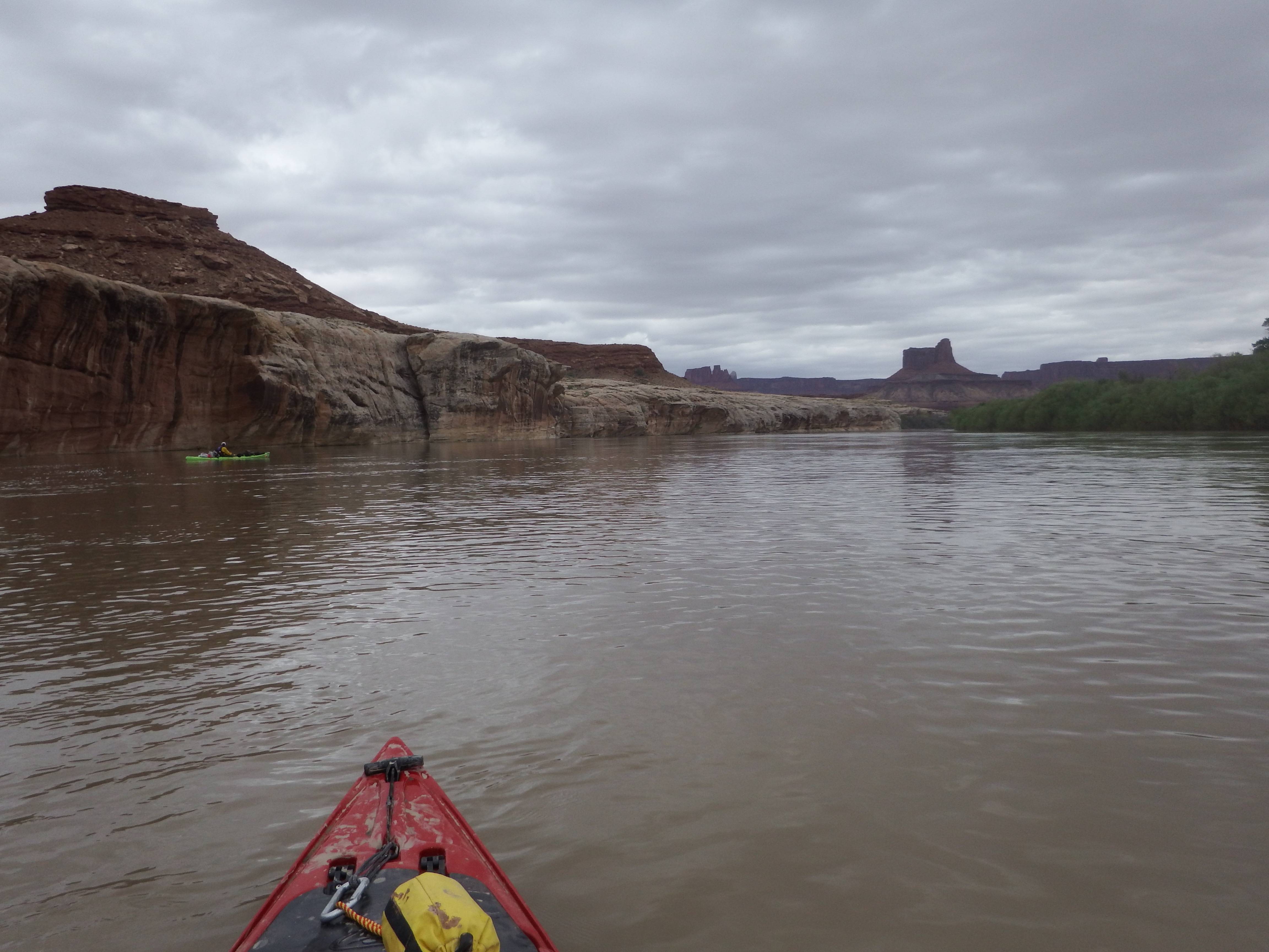
Water level on put-in day - 13,800cfs which is about twice normal for that date, but not peak runoff levels yet. Water temp. - 53 degrees.
Weather was chilly the first 3 days with highs of upper 50s - mid 60s. Last 3 days were gorgeous and in the 70s. No rain at all on the trip, and moderate wind on day 2. Average travel speed on my GPS was around 5 mph with mild paddling effort.
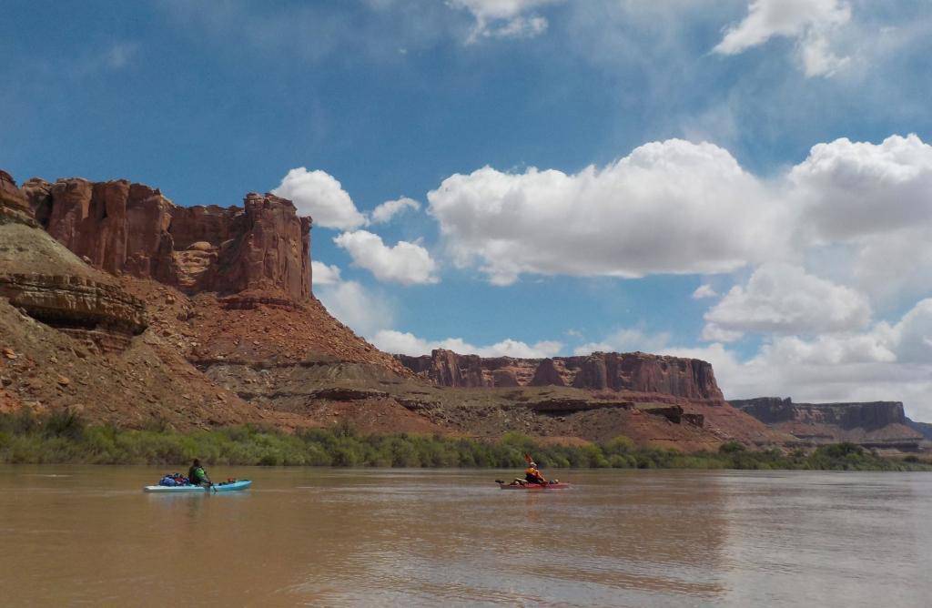
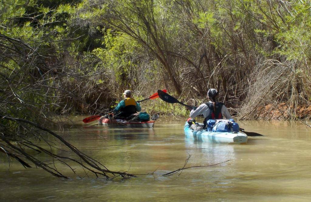
Camps were easy to locate with the aid of a GPS and the River Ways guide by Tom Martin & Duwain Whitis. There is a pretty steady wall of Tamarisk and Russian Olive to deal with along the shore, but with attention to the GPS and the guide, we found the camps with no problem. Because of the higher than normal water level, we were able to paddle up into several of the side canyon/washes to explore & hike. We even camped in an un-named camp in one of the canyons which was fun. We saw only one other group (Canadians in canoes) the entire 5 days on the river.
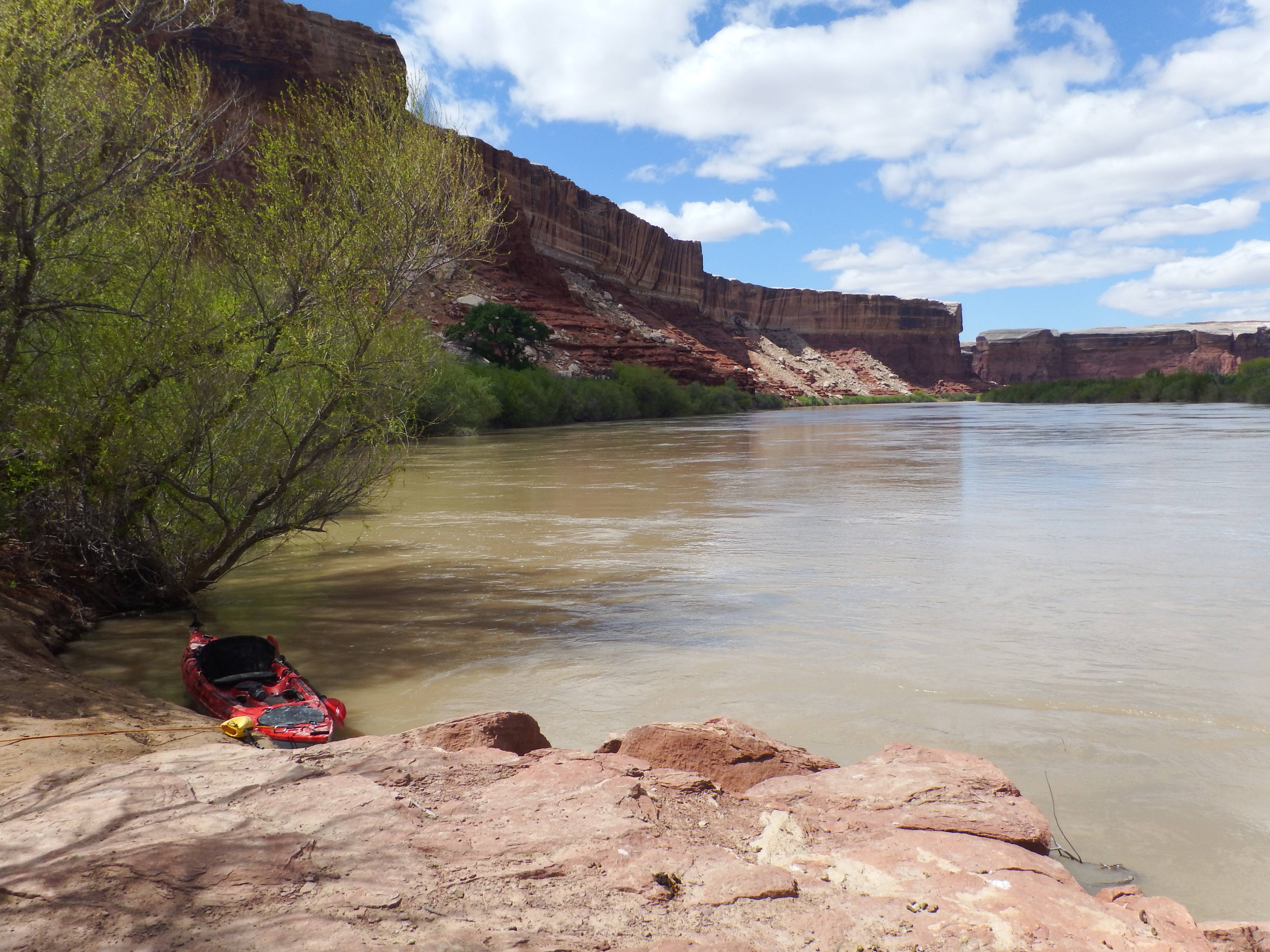
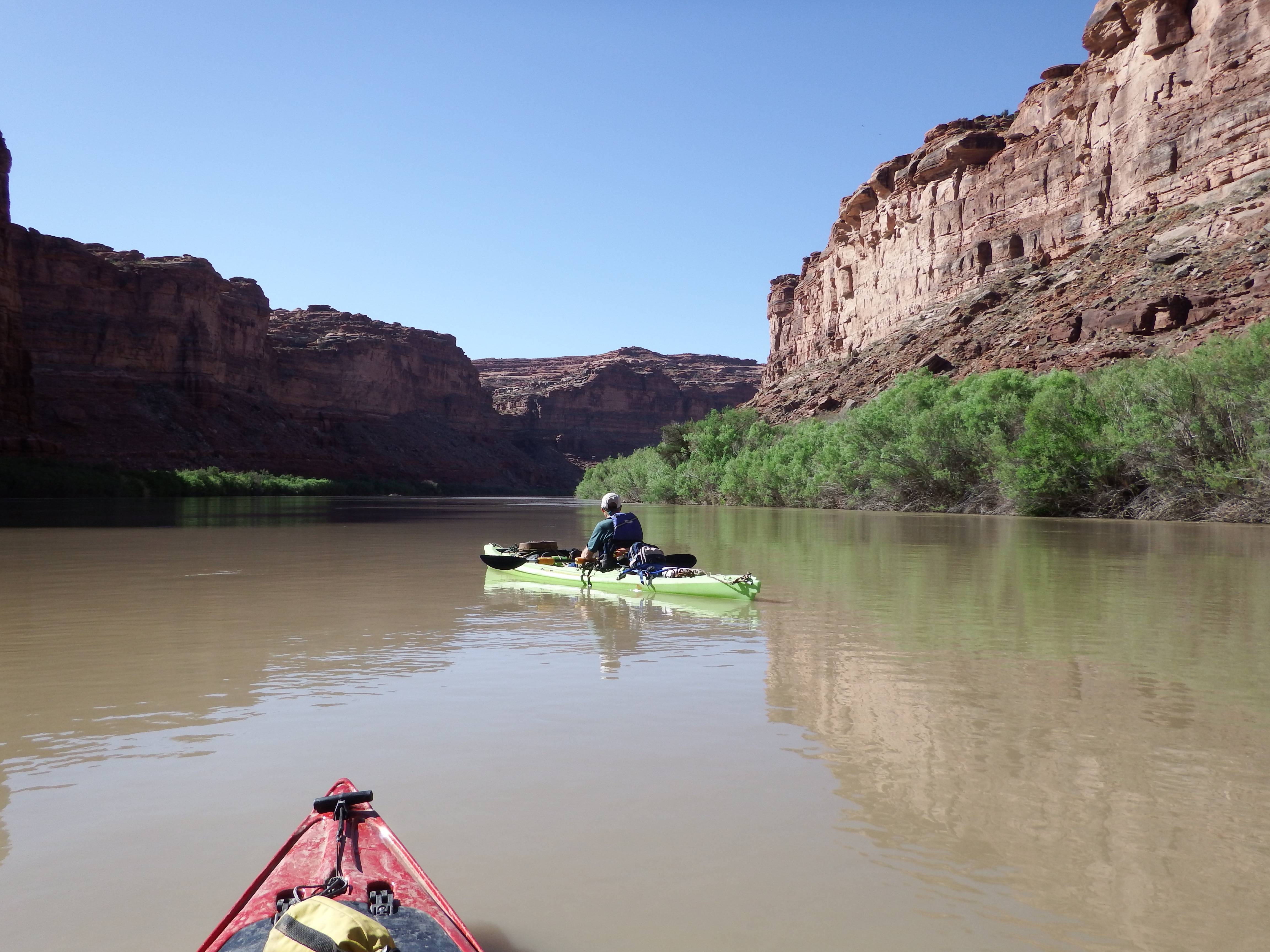
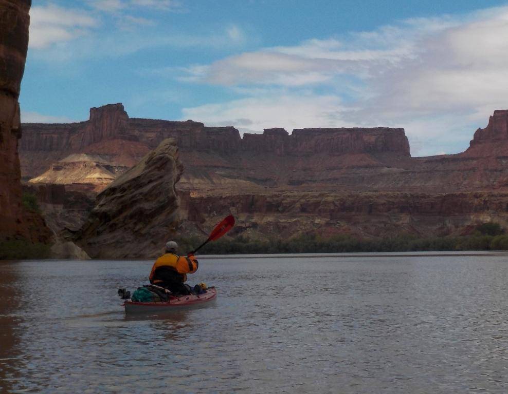
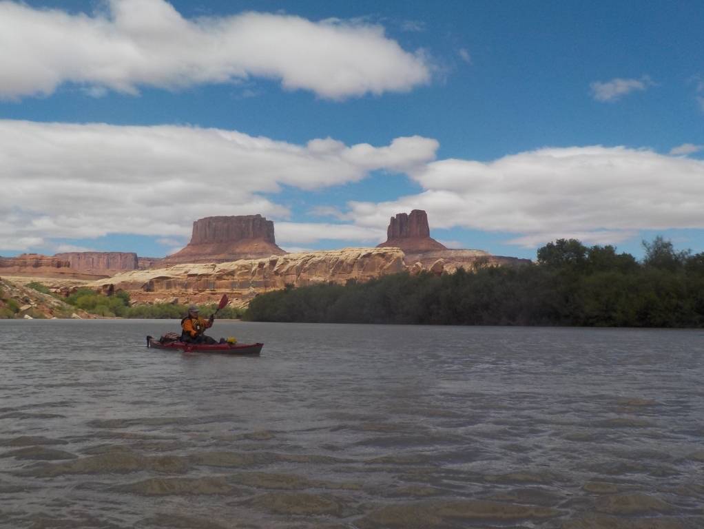
Gear - 3 people in 3 SOT kayaks. I was using my new Eddyline Caribbean 14 for it’s maiden overnight trip. A friend used my Necky Vector 13. The third member of our trio used his trusty OC Scupper Pro 15. Gotta say I love my Eddyline. It handled well, and swallowed gear with no problem. Packing it with gear for 5 days, including all my drinking water was easy. I also used my new Kokatat Super Nova semi-dry suit for the first time on this trip, and it was perfect for the chilly weather & water temps.
Shuttle arranged with Tex’s Riverways in Moab. This was my third trip using them, and they were, as usual, top notch. Very organized, knowledgable, and friendly.
Great trip, with great scenery. I’ll post some pics once I get them all downloaded & get the ones from my friends.
Thanks for posting the pictures… How was the shuttle down to Mineral Bottom? I drove that road once but not with a trailer!
Where is the campsite with the tent? I am trying to go through our pix of the two trips we took… I have not heard of the river guide you mention… I have been using Belknaps with all its quirks not being spiral bound.
@kayamedic said:
Thanks for posting the pictures… How was the shuttle down to Mineral Bottom? I drove that road once but not with a trailer!
Where is the campsite with the tent? I am trying to go through our pix of the two trips we took… I have not heard of the river guide you mention… I have been using Belknaps with all its quirks not being spiral bound.
That is Upper Cabin Bottom camp. It has access to Newspaper Rock, and had a better high water landing than Lower Cabin Bottom. The River Ways guide is newer, large, and spiral bound. It has much more detail and info on camps, hikes, and sites to see. We copied and reduced the size of the pages we needed. We also used the Belnap guide a little.
Here are more pics. Me in my new red Eddyline and my friend in my Necky Vector. One pic shows us exploring a side canyon channel.
Mineral Bottom road was just as exciting as the last time I went down it 30 years ago. It’s a skinny dirt switchback road carved into a cliffside. Always fun. Luckily, the shuttle guys from Tex’s Riverways drive it with a van and trailer almost everyday, so it doesn’t seem to faze them in the least.
The thing I disliked about that road is that I knew someone would be coming up. I saw them on a switchback… several levels down…But then where were they? Who goes first? Who finds a bend and waits first? Is there a rule of the road? We were lucky that on a switchback we saw them and could pull over… We did not have a trailer!
Yep. We watched two trucks meet head to head while we were at the put-in. It took a few seconds for one of them to back up and pull over. I think it was the one going up who backed up. Not much room to do anything on that road. Luckily we didn’t meet anyone on the way down. There were light snow flurries up on the rim before we started down, but once we were below the rim, the sun came out. I can’t imagine that road if it were wet. Yikes.
It was a fun trip. Now that we’ve done both Stillwater and Meander Canyon on the Colorado, we are giving a slight edge to Meander for scenery. A little more dramatic in our opinion, and more sand beaches vs red mud. The Colorado has a lower water level overall, so I think that makes a difference???
thanks for sharing, nice pics and trip report!
And my ever so helpful hubby pointed out the wreck of a vehicle going over the side on the way up…grrr I don’t know how to choose a favorite. Each time I have paddled the Green its been different.
Wow–Whetted my paddle-appetite to get out west again! Really nice, thanks…
Did you see much indication that Tamarisk Beetles are having any impact on the Tamarisks groves along Stillwater Canyon? I just did a 200-mile 10-day kayak and raft trip on the Dolores River from Bradfield Launch Site (below the McPhee Dam) to Moab, and there seemed to be a fairly large number of dead or partly dead Tamarisks in some areas, but pretty healthy looking Tamarisks in other areas. We didn’t spot any Tamarisk Beetles in Tamarisks along the river.
We didn’t see any evidence of beetles on the Green. We did see a lot of downed Tammies on the jet boat ride back to Potash. I don’t know if that was from beetles or from rangers cutting them?
Last year we did Meander Canyon twice and it was the first time in almost 30 years that I’ve been to Spanish Bottom. I did a Cataract Canyon trip right after I moved to Utah from Florida. I didn’t recognize it. The Spanish Bottom of 30 years ago was a wide open sandy beach & bottom. Sad.
Wow! I need to do this some day. Have you ever done the White Cliffs of the Missouri in Montana?
bigskywalker.com/
@Raftergirl said:
We didn’t see any evidence of beetles on the Green. We did see a lot of downed Tammies on the jet boat ride back to Potash. I don’t know if that was from beetles or from rangers cutting them?
We saw a modest amount of cut and burned Tammies on the Dolores, limited to a few areas where the river is accessible by road. I couldn’t tell if the Tammies had been killed by beetles before being cut, or if they had been cut while they were green. Because the McPhee Dam usually releases under 100 cfs, often for years on end, dense stands of willows and other bushes have grown along the sides of and into the stream channel, often making it difficult to stop on shore for miles on end at the 4,000 cfs levels we enjoyed for much of our trip. At lower levels there are probably a lot of sand bars and beaches inside the willow thickets.
@rbenson@helenaschools.org said:
Wow! I need to do this some day. Have you ever done the White Cliffs of the Missouri in Montana?
bigskywalker.com/
The Wild and Scenic section of the Missouri River (both the White Cliffs section and the badlands section between the Judith River and the Fred Robinson Bridge) is similar to the Stillwater Canyon on the Green, in that both are long flatwater river trips with excellent scenery and little development. You need to carry water on both trips.
@rbenson@helenaschools.org said:
Wow! I need to do this some day. Have you ever done the White Cliffs of the Missouri in Montana?
bigskywalker.com/
Not yet, but it’s definitely on my list. Is it doable as a private trip? What sections do you recommend? Shuttle companies?
@Raftergirl said:
@rbenson@helenaschools.org said:
Wow! I need to do this some day. Have you ever done the White Cliffs of the Missouri in Montana?
bigskywalker.com/
Not yet, but it’s definitely on my list. Is it doable as a private trip? What sections do you recommend? Shuttle companies?
I was less than thrilled. It was Canada Goose mating season and the noise from thousands of geese we saw every day and the goose excrement diminished our trip. We did do it in May. It was very hot and I nearly stepped on a rattler… We saw more rattlers on that trip than the Green. Cows are not always friendly either.
We went in 2012 and IIRC there aren’t many shuttle companies. We did it after a flood had washed out some campsites and Kipp Rec area.
I don’t remember the shuttle we used but it was an all day affair to get our car to Kipp and us back to Coal Banks
Here is an outfitter
We did like Hole in the Wall… While we like the Green way better this is a trip everyone should do too. Its a look at history and current ranching.
@Raftergirl said:
Not yet, but it’s definitely on my list. Is it doable as a private trip? What sections do you recommend? Shuttle companies?
The Wild and Scenic Missouri doesn’t require a permit. Just show up and do it. If you only want to spend three or four days, I think the White Cliffs section is nicer than the badlands section between the Judith River and the Joe Robinson Bridge (Kipp), but if you have more time, do the whole thing. The river moves along more quickly in the spring, and the vegetation is greener, but you can do it all spring, summer, and fall. Just be prepared for cold weather and snow, which can happen almost any time in Montana. I can relate some epic tales of trips on the Missouri River, and the Smith River just to the south, which unexpectedly turned into winter camping experiences. Also be aware that there is a lot of gumbo soil in the area, so if it rains, dirt roads can become difficult to negotiate for a couple of days.
It’s a long trip up to Montana, but hopefully someday I’ll get up to the Missouri. I’m still exploring Utah. I have a lot of Lake Powell to explore that will take some time.
I love this part of the Green! I did it solo last year. I actually just finished Labyrinth Canyon on the Green May 15. The CFS had jumped to 17000 when we put in and was at 22,000 at take out at Mineral Bottom. How was the weather? I heard it rained quite a bit the first week of May.