I’m planning trips to the Adirondacks, northern Vermont, and Maine this fall. What do I need to know about water levels given the current drought? Examples: Aziscohos and Richardson in Maine, Green River Reservoir in Vermont. Any recommendations for areas with good water levels?
Avoid Aziscohos. They are taking advantage of the drought to do dam maintenance this fall, so the level will be low until next spring. Richardson is at the minimum level needed to operate the Middle Dam hydro plant. They are going to maintain Richardson near minimum and allow Mooselookmeguntic to fall below the minimum level needed to operate the Upper Dam hydro plant. So they are sacrificing the upper lakes in the chain first.
Sing said Umbagog still looked normal a couple of weeks ago. I see the Errol Dam has been maintaining a minimum flow of 1000 CFS since 15 Aug, which is helping to maintain the level at Umbagog. Given the intent to keep Aziscohos low through the fall and the decision to sacrifice the level of Mooselookmeguntic and hold Richardson, Umbagog might be your best option in northern NH and western ME.
I don’t know the level at the Green River Reservoir, but it has decent depth for its size except in the north end, so even if the level is down, most of the camps sites should still be accessible. The Waterbury Reservoir is not far from there and has remote sites. It is still at normal height. It is normally popular and needs to be booked well in advance.
Central New York has gotten more rainfall this summer than we have, and the northeast region drought map indicates that the western and southern sides of the Adirondacks are not experiencing drought conditions. We were on Lake Champlain over Labor Day and it was very dry in that area. We were going to take the kids to see Ausable Chasm, but didn’t bother due to the conditions. On the drought map, it looks like the Champlain Valley is in the rain shadow of the Adirondack high peaks, so it might be better to stay to the west or south of them.
I would suggest checking out Low’s Lake, Little Tupper Lake, Lake Lila, Raquette Lake, Cranberry Lake, and Stillwater Reservoir.
2 Likes
This was Umbagog from a couple of weeks ago. Looked a couple of feet below high water mark. That is too different for end of August.

My cabin is about 20 minutes from the South Arm launch at Richardson. But, I don’t normally go up that dead end way. So, can’t say much about that lake. Riachardson is huge and deep. Dont think the paddling would be much impacted, except for the boat carry to and from shore.
-sing
Thanks very much for all that information, RedMC. Glad I asked! I will avoid western Maine, then. I was able to talk today with a friend in the foothills of the Adirondacks and he confirms that conditions are good there.
As an alternative to western Maine for a later trip, does anyone know about conditions around Tunk Lake?
I normally launch from the north end. South Arm campground will be closed by the time I get up there. Anyone know if I can camp a few hundred feet just west of the boat launch where there’s a little beach with a nice tent spot? Or on the islands after the South Arm office closes?
In the Adirondacks lake levels are 2-3’ low around the Raquette/Blue Lake area. Locals say the water is at it lowest in 50 years, but most lakes are still navigable. Raquette River is rocky or with shoals in some places. Some beaver dams are 3’ high and very difficult to get over in a kayak. Easier in a canoe. Outflow from many lakes is minimal. Moose River is not navigable nor is the Cedar River Flow. Little Tupper to Rock Pond questionable. Brown’s Tract difficult. Larger boats are bottoming out in the upper lock to Middle Saranac.
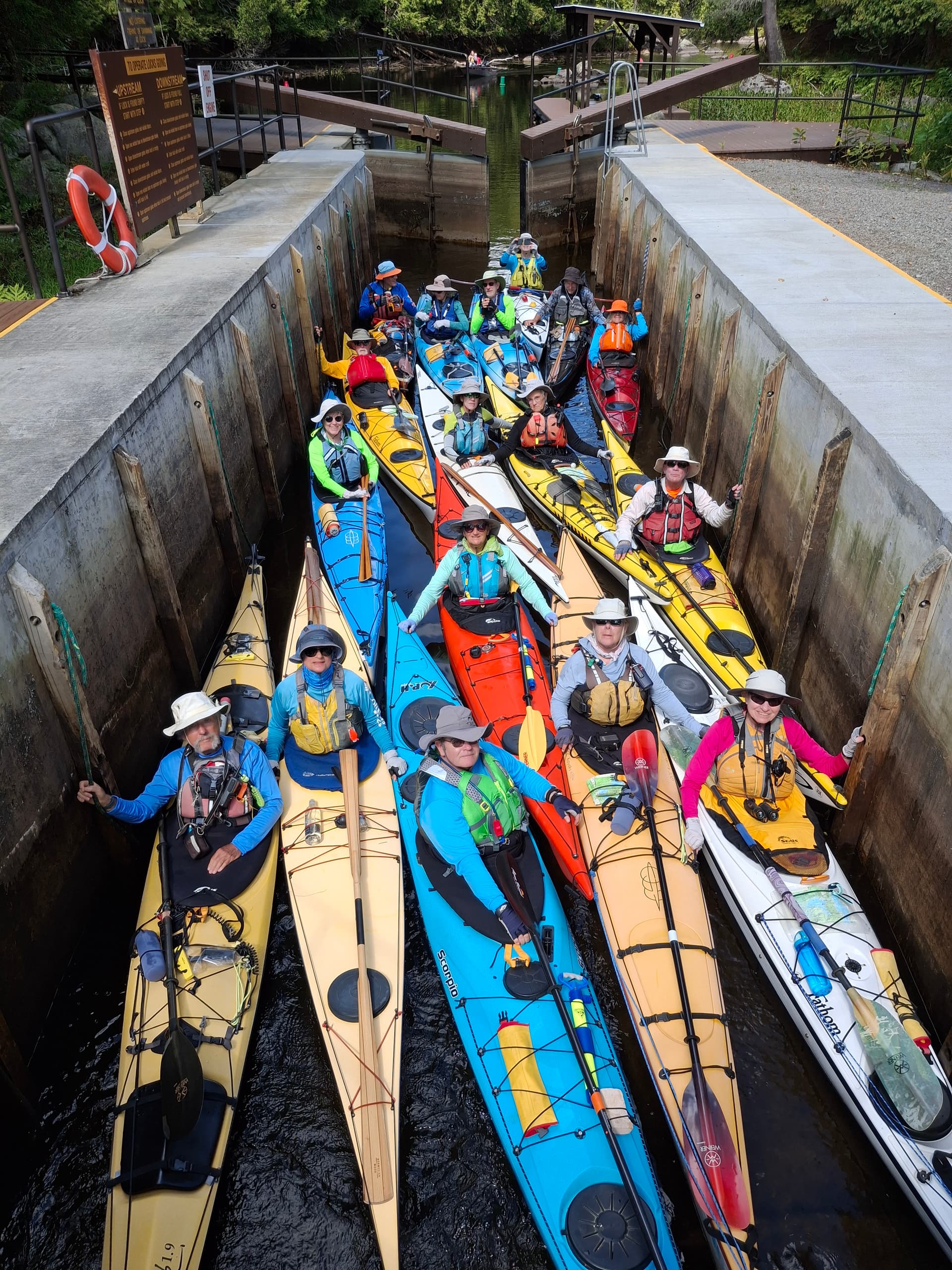
What is this group? Lots of Greenland paddles in there.
Chesapeake Paddlers Association. This is our 21st year leading a group up in the Adirondacks. We stay on Blue Mountain Lake and are where the 90 Milers land on their first day.
Almost all of the Greenland paddles were made by their owners. Were run an occasional workshop in paddle making. No charge other than materials and snacks.
Nice! I would take that workshop if I were in the area.
Droughts affect paddlers all the time.
They can really affect paddlers in the arid West.
A drought is relative. I live near Lake Tahoe but only get an average of 9 inches of rainfall a year. In a drought me might get 4 inches.
It is hard for me to relate to a drought in the Northeast when people only get 25 inches of rain instead of 45.
WB, don’t know what your timetable is for your fall paddling excursion. I am likely headed back up to western ME and NH in the next couple of weeks for more trout fishing before the season ends in October (unless a juicy tropical fish storm materializes for surf). Will report back.
-sing
This is the most recent drought report:
-sing
2 Likes
Just got back from the Adirondacks. Conditions were pretty decent. I paddled 3 smaller lakes (Blue Mountain, Nick’s, and Limekiln) and camped on Raquette. Locals may have a better idea of how low the lakes are, but I had no difficulty paddling there. Everything was green in the foothills and Tug Hill.
2 Likes
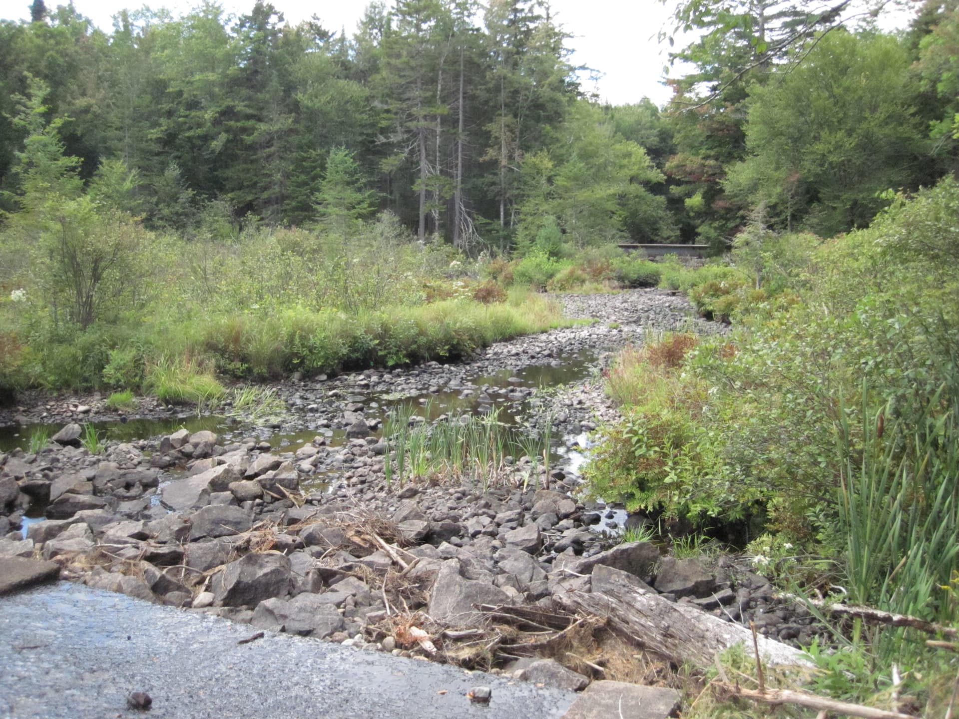
Moose River was the lowest I’ve ever seen it, though.
I’m glad you had a good trip. I’ve found the drought monitor has been a pretty good gauge of where things are driest this summer. Supposedly, if the drier conditions persist we should expect good foliage.
Google AI: “Drought does not reliably produce brighter fall foliage, and its effects can be complex and unpredictable. While moderate drought combined with sunny days and cool nights can increase sugar concentration in leaves and enhance red colors, severe drought will stress trees, leading to duller colors, premature leaf drop, or browning.” The leaf drop in my area is very premature, as is the change in color.
Total outflow from Blue Mountain, Eagle, and Utowana Lakes into the Marion River in the Adirondacks.
Here in Maryland there is essentially no color yet, but a lot of leaves dropping. Just received the first significant rain in weeks, 1.17", but likely too late for many plants and trees this year.
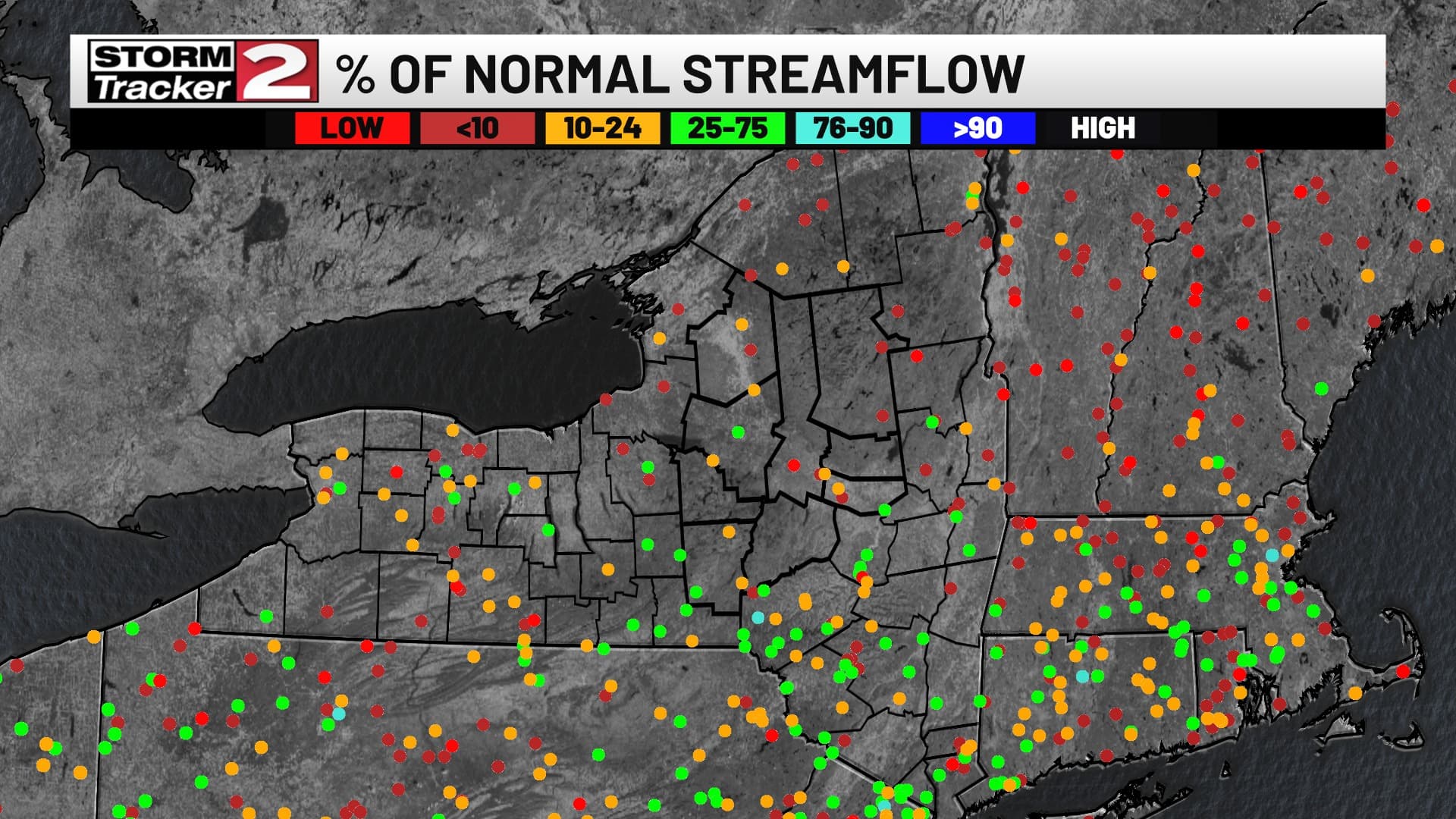
Saw this posted on Facebook. Red dots are locations which have reached their lowest EVER streamflow in it’s recorded history for the day. NH, VT and ME are really low.
Here’s another metric that was included in the 9/11 Northeast drought update that shows how widespread it is:
https://www.drought.gov/sites/default/files/inline-images/northeast-precip-june-aug-2025-acis.png
I’m in that red spot in the SE corner of NH. We’re seeing the first leaves change now. Nothing dropping yet.
Looks about right. I thought I was going to do some “blue line” trout fishing hiking up a long the mountain brooks/streams in the Whites. The blue lines were more like dry bony white lines. The main rivers - the Pemi and the Swift and Saco were running (? walking) low and slow.
When I go back up, will stick with the below dam fisheries at upper Androscoggin.
-sing