Solo out and back from Chickanishing Creek in Killarney Provincial Park to the Bustards in French River Provincial Park, August 2023

I opted to complete this trip before Labor Day weekend after futilely waiting for an ideal weather window. The forecast called for 20 kph winds from the north on day 1, rain all of day 4, and 20 kph winds out of the north on day 5 with gusts up to 50. I stayed at a hotel Friday night in Parry Sound, the closest one available on the way to Killarney Provincial Park’s Chickanishing launch site. I bought a crown land camping permit for six nights online, $47 US, and stopped at park headquarters a few miles from Chickanishing to get a park pass and seven days parking, $63 US. All French River sites and the Killarney sites that are on Georgian Bay are first come, first served.
Day 1, Saturday: With winds from the north, today’s goal was to paddle east along the south shore of twelve mile long Philip Edward Island and make camp short of Point Grondine in preparation for rounding the point tomorrow. There were a dozen canoes and kayaks at the launch ready for put-in that morning and the parking lot was more than half full.
Philip Edward is a certainly a popular paddling destination on nice summer weekends; I passed paddlers and paddling camps every mile or so.

The island is almost all crown land and thus open to camping. The shore is bare glacier-smoothed rock with many inlets and the south shore is surrounded by islands and skerries that provide shelter from waves even when the wind is from the south. Picturesque white pines dominate the larger islands and the mainland. The water is very clear. A look at the area on satellite views shows as much bedrock below the surface as above, and during the trip I scraped a lot of kayak hull off on the bedrock. Some of the more strategically placed shallows had red, blue and yellow scrapes in addition to my white, looking like a child had gone at them with crayons. Early on I hugged the coast but the southwest wind let up a bit in the afternoon and made bay crossing dryer.
I lunched half way down the coast at East Desjardin Bay and after fourteen miles found a good place to take out and bush camp on an island southeast of Philip Edward in the mouth of Beaverstone Bay.

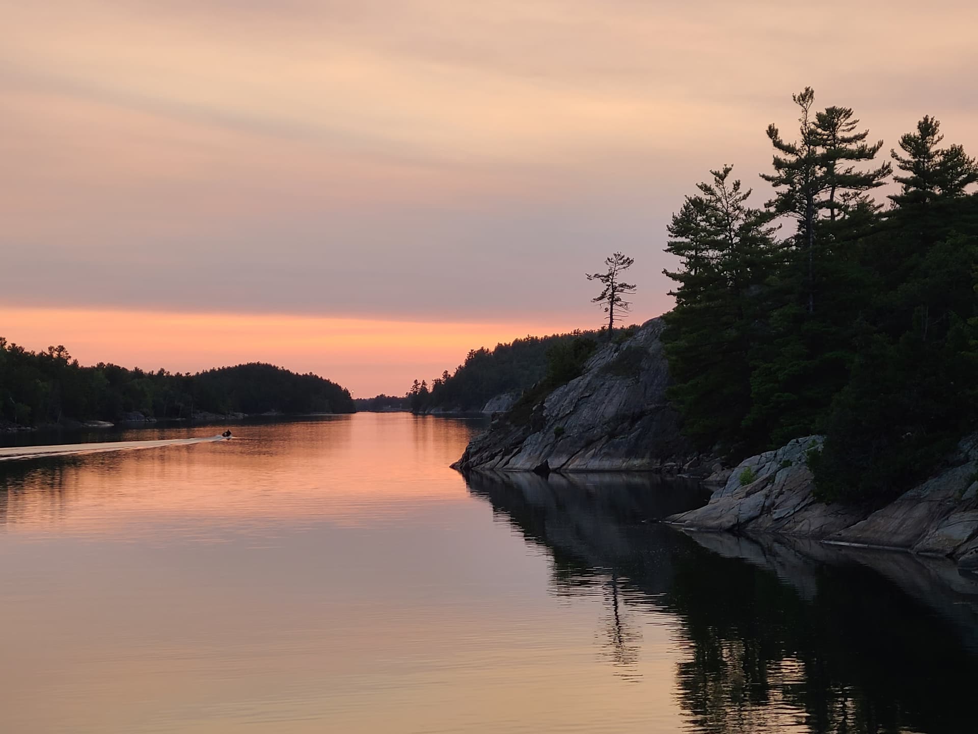
Late that night the moon was down and the milky way stretched to the horizon.
Day 2, Sunday: This warm sunny day without much wind was ideal for reeling out miles to get to the Bustards; I could then explore and meander on the way back. I was out before 7:30 and headed east into sun glare that made shallows even harder to detect as I paddled though the maze of islands protecting Popham Point. The key to paddling here is to get around Point Grondine in good weather, as it is open to big water and surrounded by shallow bedrock reefs that can be deadly in waves. The mainland here is off limits too, a First Nations reserve. The point divides the area physically. West of it you can see Manitoulin Island on the horizon, get a bar or two on the cell phone from the village of Killarney, and I saw paddlers out of Chickanishing all the time. East of it you see wind turbines on the east shore of Georgian Bay, little cell coverage, and I saw maybe two groups of paddlers a day out of Hartley Bay.
The winds were calm enough to filter the day’s drinking water in open water off the point. Past Grondine I paddled north into Chaughis Bay, then picked my way east again around skerries and islands and entered French River Provincial Park. None of my maps were detailed enough to get me through this maze of twisty little passages, all alike. Eyeballs two feet off the water can’t see enough to tell passages from dead-ends, two inch deep straits from two foot ones, or islands from peninsulas.
I crossed the mouth of Voyageur Channel and pit stopped off Green Island.

Composite kayaks are not the best choice here. Smooth bedrock underwater is too slippery to step on. Rotomolded boats can beach on flat bedrock without scraping off too much plastic. Canoeists can touch shore, exit off the bow and lift the canoe halfway up the rock. But my delicate 18 foot composite kayak required a flat area a few inches off the water with a drop to deeper water and no obstructions out to the bow and stern. These were hard to find and beaches were even rarer.
I crossed the open mouth of Fort Channel, threaded my way between islands near Gravel Bay, crossed Bad River Channel, then crossed two miles of open water to Bustard Rocks. The rocks have a unique lighthouse and range marker setup. By this time it was hot. I found a place to have lunch on nearby Gooseberry Island and stowed the spray skirt.

Next I rounded the south end of Tanvat Island, the biggest of the Bustards, and explored the beautiful deep bays on the southeast shore looking for a good campsite. The only good landing spot was at French River site 900. As I was unloading I heard a dog barking; turned out a pair of canoeists on a French River circle route had landed on the opposite side intending to camp there. They let me have the site and used a nearby one instead. Thanks guys, I was tired after a 23 mile day but you must have been tired too! Site 900 is huge with lots places to pitch tents, both on flat rock and on softer ground shaded by trees. The view to the east is open water, the ever-present wind turbines, and (great bars!) a cell tower. Views to the south and north are even prettier.

Day 3, Monday: The goal today was to make camp in the French River delta near Point Grondine in preparation for a rain day. I paddled more of Tanvat’s back bays and then headed into the channel between Strawberry and Tie islands on the north side of the Bustards. The area has quite a few cottages and several yachts were anchored in the channel. After messing around in Coral Channel (blocked) I went around Meaford Island and headed north into the Northeast Passage where I filtered the day’s water. I got an eerie feeling when bedrock appeared below me far from land in the passage. I headed around Graburn Island, crossed Sand Bay (no sand), pit stopped in Whitefish Bay, and then meandered through back channels westward past the Fingerboards and Bad River Channel to lunch near Gravel Bay.
Its amazing how far you can go along the shore of Georgian Bay without actually seeing the bay.
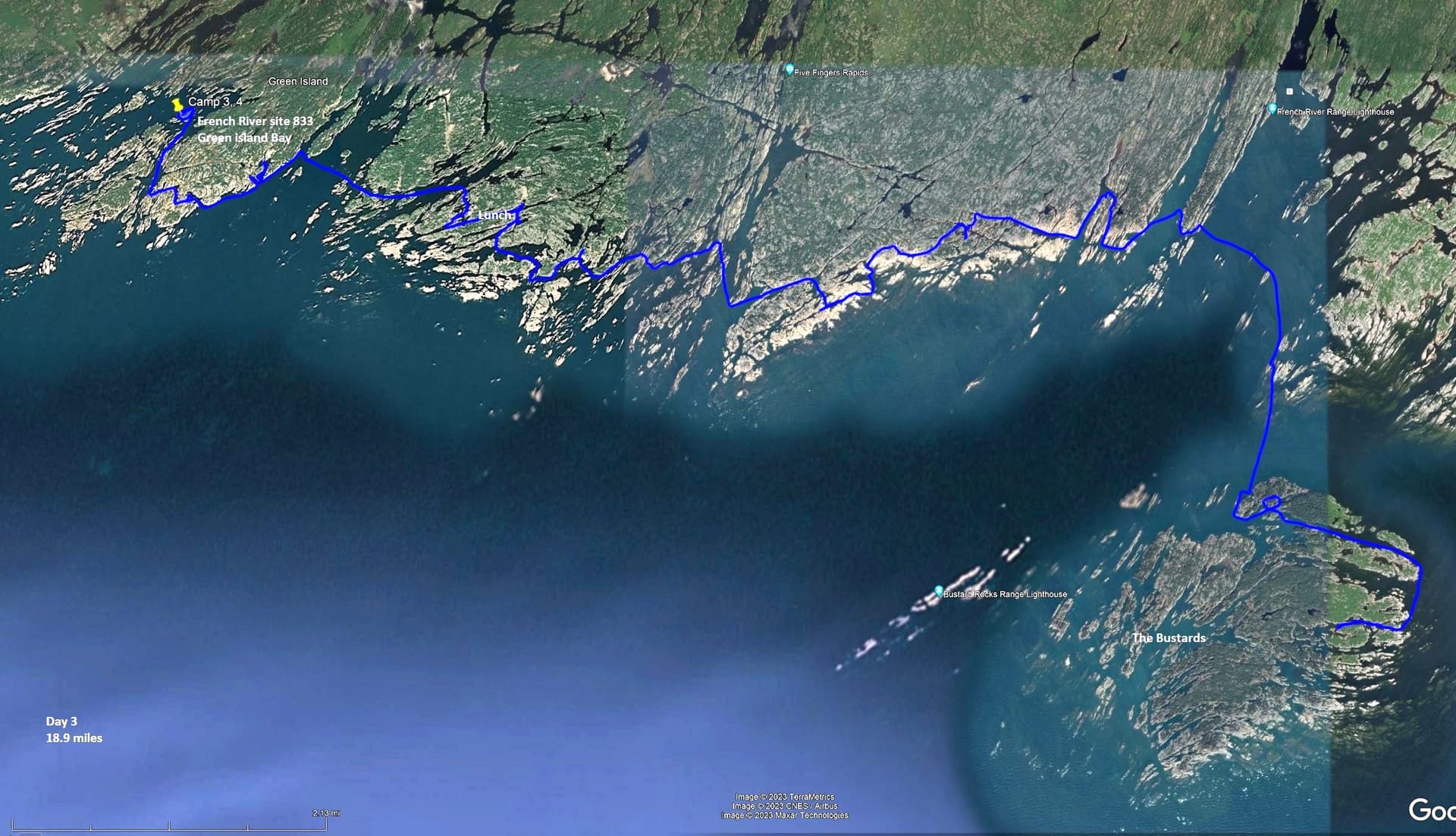
The wind stiffened from the southwest and the half mile passage across Fort Channel was a wet one. After crossing I paddled directly into the wind along the east shore of Green Island, explored Jocko’s Harbor, and found the secret passage that would let me avoid going broadside to the waves around the south end of Green Island. I found French River site 833 before 3 and made camp. The site was trashy and featured toilet paper in the forest near the site. I had pre-treated my tent with permethrin and this was the only place I needed to use mosquitoes spray on the trip. Several runabouts with fishermen passed the site on Green Island Bay, presumably from a nearby outfitter. There was no cell coverage.

Day 4, Tuesday: The weather radio forecast called for showers starting early afternoon (they came early) and winds increasing from the south. The lake level rose 5 inches overnight, the only time I noticed a seiche. The goal today was to explore the French River Delta channels and return to camp before the rain started.
To me a delta is a flat silty buildup at the mouth of a river, but I saw no silt in the French River Delta except in reed beds. Instead the glaciers seem to have bulldozed off anything sticking up more than 20 feet off the water, leaving smooth bedrock and creating channels that follow a pattern of joints in the rock. A number of parallel channels drain the French over short drops into Lake Huron. When Lake Huron is high the drops are submerged and much of the French River becomes an extension of Georgian Bay.
As I headed northeast up Voyageur Channel I turned to see what must have been the Voyageurs’ first sight of a Great Lake. I followed the channel east and then headed up Old Voyageur Channel. The narrows were particularly pretty.

Four people were portaging a pair of canoes at a narrow spot that I was able to navigate in my skinny boat. Further on at Petite Faucille Falls, a drop of about a foot, I watched a young lady do something that I would have broken my neck attempting.

I went back down the channel and paddled east along Cross Channel until I hit a portage, then turned west past Old Voyageur Channel and north up the parallel Western Channel, where I passed the same canoers on their way back down the river. I turned around at Wash Woman Rapids even though it didn’t require a portage and lunched on a mid-channel skerry before returning to camp in the rain after 14 miles. There was no discernible current in any of these channels. I spent most of the afternoon hunkered down in the tent.
Day 5, Wednesday: Strong winds from the north today, morning overcast gave way to clear skies early on. The goal was to round Point Grondine again and camp somewhere around Beaverstone Bay. I started by exploring some of Green Island Bay, then headed to the far shore of Western Channel. As the sky cleared I passed a pair of camped paddlers who asked for help. They had brought their Killarney map instead of French River. We were able to dig mine out of the back hatch and take cell phone pictures of it.
I proceeded west using the shore as a wind break as much as possible into the maze at Chaughis Bay, then south around Point Grondine and west again toward Popham Point. I spotted three kayaks also heading west. They seemed to know where they were going so I followed them, catching up as they were getting out near Popham Point. One of the three was part Ottawa and the group had permission to trespass on the reserve. I joined them and the area looked much prettier than from two feet up. The three had spent the previous day surfing and were headed toward Big Rock on Philip Edward.

I went to the lee of islands at the mouth of Beaverstone Bay and found a rare gravel beach on Toad Island where I stopped for lunch. From there I stuck to the west shore of Beaverstone in a strong headwind and crossed over to an island recommended by the Popham Point kayakers after 16 miles of paddling. It was a beautiful campsite marred once again by toilet paper despite having a makeshift thunderbox. Beaverstone Bay has quite a few cottages and more than its share of loons. The east and north shores are part of the Point Grondine Reserve. A canoe passed by in the evening, making good time as the wind died down.

Day 6, Thursday: Forecast was sunny with west winds increasing during the day. I wanted to paddle Collins Inlet along the north side of Philip Edward Island and camp somewhere close to Chickanishing. I explored more of Beaverstone Bay, then headed west into Collins Inlet just as the wind started to pick up. I found that the headwind was lighter if I hugged the shore. The inlet is a twelve mile long narrow deep channel, interrupted by a wide area called Mill Lake. There are hundred year old logging wharf pilings and houses, motor boats and a lodge where the town of Collins Inlet once stood. This was the most built-up area that I saw on the trip.

I continued west and searched unsuccessfully for the pictographs on the cliff west of the narrows. Then I aimed for a camping spot on a high rock that was recommended by the Popham Pointers. It had a superb view down the inlet but I could not land close enough; getting to the rock was tricky and carrying gear from the boat over the rugged terrain would have been dicey. With 13 miles behind me I spotted a small beach on the mainland opposite the rock and decided to try that. It turned out to be Killarney #185, a beautiful campsite marred once again by toilet paper despite having a thunderbox. I began to wonder if the problem at these three sites was my fellow campers or wild animals. A variety of boats passed by every half hour or so during the evening.
Day 7, Friday: I started early in the morning mist and paddled the five miles back to Chickanishing and my car, passing more cottages along the way. “It would be hard to design a landscape more suited to sea-kayaking than Georgian Bay.” Reynolds and Smith, Kayaking Georgian Bay. I couldn’t agree more.
Resources:
- Ontario Parks maps for French River and Killarney are well done, especially the waterproof version of French River. Note that campsites have been renumbered from those on older maps to make life difficult.
- Topo maps are available for free download at GeoGratis spatial product index I used raster 1:50,000 maps 041H14 Collins Inlet, 041H15 Key Harbor, and 041I03 Lake Panache.
- https://www.unlostify.com/ has free downloads and maps for sale with good detail. Nautical charts have more detail than any of the above.
- Crown land camping permits are required for non-Ontario residents except in parks that charge for campsites. See Non-resident Crown land camping and green zones | ontario.ca